TopoQuest Logo
Do you find TopoQuest useful?
Help keep TopoQuest running and adding new maps/features by donating!
Bitcoin:  19c7KJd3qBynnjoSw5npx9KScwjBe4ifkT
Litecoin:  LXs6TkuXGGXo1vDsWCkWVdjQX94eUKd6ui
Home View Maps Find Maps Find Places Resources & Links


Pollock NW, Missouri Topographic Map

USGS Map Title: Pollock NW, MO
USGS Map MRC: 40093D2
DRG (GeoTIFF) Download: o40093d2.tif


Neighboring USGS Topographic Map Quads:


  Powersville, MO  
40093E3
 

  Saint John, MO  
40093E2
 

  Lake Thunderhead, MO  
40093E1
 

  Lucerne, MO  
40093D3
 

  Pollock NW, MO  
40093D2
 

  Unionville West, MO  
40093D1
 

  Harris, MO  
40093C3
 

  Pollock SW, MO  
40093C2
 

  Pollock, MO  
40093C1


Map MRC Location:

N41°
W94°
N41°
W93°
H8 H7 H6 H5 H4 H3 H2 H1
G8 G7 G6 G5 G4 G3 G2 G1
F8 F7 F6 F5 F4 F3 F2 F1
E8 E7 E6 E5 E4 E3 E2 E1
D8 D7 D6 D5 D4 D3 D2 D1
C8 C7 C6 C5 C4 C3 C2 C1
B8 B7 B6 B5 B4 B3 B2 B1
A8 A7 A6 A5 A4 A3 A2 A1
N40°
W94°
N40°
W93°

Pollock NW, MO USGS 1:24K Topographic Map Preview:
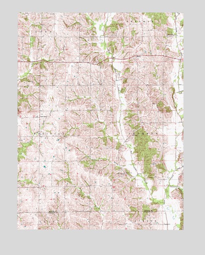
Pollock NW, MO USGS Topographic Map
Click on map above to begin viewing in our Map Viewer.

This topographic map contains these locations and features:
Feature Name Type Latitude Longitude GNIS ID View Map
Badger BranchStreamN40.4131°W93.1638°713526View Map
Brush CreekStreamN40.4274°W93.1312°714832View Map
Cullor Lake DamDamN40.4683°W93.1352°761760View Map
Elm Branch School (historical)SchoolN40.4931°W93.2233°733771View Map
Hackett BranchStreamN40.4095°W93.1313°718956View Map
Hill School (historical)SchoolN40.4070°W93.1683°733779View Map
Hylan BranchStreamN40.4703°W93.2388°720065View Map
Johnson BranchStreamN40.4003°W93.1366°720352View Map
Jones School (historical)SchoolN40.4067°W93.2238°733773View Map
MidwayPopulated PlaceN40.4753°W93.1622°741065View Map
Mount Vernon School (historical)SchoolN40.4542°W93.1597°733777View Map
Parsons CemeteryCemeteryN40.4081°W93.1688°724061View Map
Pearson School (historical)SchoolN40.4870°W93.1797°733774View Map
Plainview ChurchChurchN40.3781°W93.1691°724460View Map
QuinnPopulated PlaceN40.4072°W93.1688°733778View Map
Sprigg CemeteryCemeteryN40.4603°W93.2433°726881View Map
Terre HautePopulated PlaceN40.4395°W93.2341°741317View Map
Terre Haute School (historical)SchoolN40.4447°W93.2338°733772View Map
Township of JacksonCivilN40.4361°W93.1409°767240View Map
Union Grove ChurchChurchN40.4289°W93.1605°728014View Map
Watkins CreekStreamN40.4542°W93.1299°728418View Map
West Concord ChurchChurchN40.4072°W93.1697°728542View Map
West Liberty (historical)Populated PlaceN40.4870°W93.1310°733775View Map
West Liberty ChurchChurchN40.4872°W93.1374°728594View Map
West Liberty School (historical)SchoolN40.4864°W93.1372°733776View Map
West Locust CreekStreamN40.3906°W93.1402°728599View Map

Note: Coordinates in the location and feature list above are referenced to NAD83 datum.


Copyright (C) 2008-2024 Ryan Niemi / Sunset Dynamics ... All Rights Reserved