TopoQuest Logo
Do you find TopoQuest useful?
Help keep TopoQuest running and adding new maps/features by donating!
Bitcoin:  19c7KJd3qBynnjoSw5npx9KScwjBe4ifkT
Litecoin:  LXs6TkuXGGXo1vDsWCkWVdjQX94eUKd6ui
Home View Maps Find Maps Find Places Resources & Links


Pomeroy, Iowa Topographic Map

USGS Map Title: Pomeroy, IA
USGS Map MRC: 42094E6
DRG (GeoTIFF) Download: o42094e6.tif


Neighboring USGS Topographic Map Quads:


  Fonda NE, IA  
42094F7
 

  Pocahontas, IA  
42094F6
 

  Palmer, IA  
42094F5
 

  Fonda, IA  
42094E7
 

  Pomeroy, IA  
42094E6
 

  Manson, IA  
42094E5
 

  Lytton, IA  
42094D7
 

  Rockwell City, IA  
42094D6
 

  Richard, IA  
42094D5


Map MRC Location:

N43°
W95°
N43°
W94°
H8 H7 H6 H5 H4 H3 H2 H1
G8 G7 G6 G5 G4 G3 G2 G1
F8 F7 F6 F5 F4 F3 F2 F1
E8 E7 E6 E5 E4 E3 E2 E1
D8 D7 D6 D5 D4 D3 D2 D1
C8 C7 C6 C5 C4 C3 C2 C1
B8 B7 B6 B5 B4 B3 B2 B1
A8 A7 A6 A5 A4 A3 A2 A1
N42°
W95°
N42°
W94°

Pomeroy, IA USGS 1:24K Topographic Map Preview:
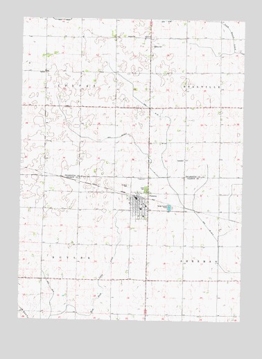
Pomeroy, IA USGS Topographic Map
Click on map above to begin viewing in our Map Viewer.

This topographic map contains these locations and features:
Feature Name Type Latitude Longitude GNIS ID View Map
City of PomeroyCivilN42.5519°W94.6778°2396248View Map
Colfax Township HallLocaleN42.6025°W94.7372°455532View Map
Drainage Ditch 157CanalN42.5889°W94.6794°455987View Map
Drainage Ditch 66CanalN42.6244°W94.7286°456000View Map
Drainage Ditch 79CanalN42.5100°W94.7303°456005View Map
Elfsborg CemeteryCemeteryN42.6167°W94.6869°456272View Map
Elfsborg ChurchChurchN42.6180°W94.6878°456273View Map
Elfsborg Lutheran CemeteryCemeteryN42.6169°W94.6872°1925414View Map
Evangelical Covenant ChurchChurchN42.6169°W94.6814°456406View Map
First United Church of ChristChurchN42.5500°W94.6836°1995800View Map
Immanuel Lutheran ChurchChurchN42.5486°W94.6883°1995803View Map
Joint Drainage Ditch 9-13CanalN42.5747°W94.7033°457981View Map
KTLB-FM (Twin Lakes)TowerN42.5358°W94.6803°463743View Map
PomeroyPopulated PlaceN42.5511°W94.6839°460354View Map
PomeroyLocaleN42.5514°W94.6839°1995807View Map
Pomeroy Care CenterHospitalN42.5433°W94.6805°1995805View Map
Pomeroy City HallBuildingN42.5505°W94.6850°1995796View Map
Pomeroy Elementary SchoolSchoolN42.5461°W94.6819°1995806View Map
Pomeroy Fire and Ambulance ServiceBuildingN42.5512°W94.6858°2577484View Map
Pomeroy Post OfficePost OfficeN42.5506°W94.6855°1995798View Map
Pomeroy Public LibraryBuildingN42.5522°W94.6844°1995797View Map
Rhodes ClinicHospitalN42.5528°W94.6836°1995804View Map
Saint John Lutheran ChurchChurchN42.5475°W94.7144°1995802View Map
Saint Mary's Catholic ChurchChurchN42.5486°W94.6805°1995801View Map
Saint Marys CemeteryCemeteryN42.5559°W94.6890°461176View Map
Swedish Mission Bethany CemeteryCemeteryN42.6137°W94.6772°462148View Map
Township of ButlerCivilN42.5167°W94.7374°467514View Map
Township of ColfaxCivilN42.6023°W94.7372°467636View Map
Union CemeteryCemeteryN42.5549°W94.6794°462431View Map
Wesley United Methodist ChurchChurchN42.5491°W94.6841°1995799View Map

Note: Coordinates in the location and feature list above are referenced to NAD83 datum.


Copyright (C) 2008-2025 Ryan Niemi / Sunset Dynamics ... All Rights Reserved