TopoQuest Logo
Do you find TopoQuest useful?
Help keep TopoQuest running and adding new maps/features by donating!
Bitcoin:  19c7KJd3qBynnjoSw5npx9KScwjBe4ifkT
Litecoin:  LXs6TkuXGGXo1vDsWCkWVdjQX94eUKd6ui
Home View Maps Find Maps Find Places Resources & Links


Rockwell City, Iowa Topographic Map

USGS Map Title: Rockwell City, IA
USGS Map MRC: 42094D6
DRG (GeoTIFF) Download: o42094d6.tif


Neighboring USGS Topographic Map Quads:


  Fonda, IA  
42094E7
 

  Pomeroy, IA  
42094E6
 

  Manson, IA  
42094E5
 

  Lytton, IA  
42094D7
 

  Rockwell City, IA  
42094D6
 

  Richard, IA  
42094D5
 

  Yetter, IA  
42094C7
 

  Lake City, IA  
42094C6
 

  Lohrville, IA  
42094C5


Map MRC Location:

N43°
W95°
N43°
W94°
H8 H7 H6 H5 H4 H3 H2 H1
G8 G7 G6 G5 G4 G3 G2 G1
F8 F7 F6 F5 F4 F3 F2 F1
E8 E7 E6 E5 E4 E3 E2 E1
D8 D7 D6 D5 D4 D3 D2 D1
C8 C7 C6 C5 C4 C3 C2 C1
B8 B7 B6 B5 B4 B3 B2 B1
A8 A7 A6 A5 A4 A3 A2 A1
N42°
W95°
N42°
W94°

Rockwell City, IA USGS 1:24K Topographic Map Preview:
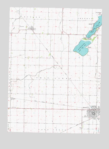
Rockwell City, IA USGS Topographic Map
Click on map above to begin viewing in our Map Viewer.

This topographic map contains these locations and features:
Feature Name Type Latitude Longitude GNIS ID View Map
Calhoun CountyCivilN42.3852°W94.6404°465202View Map
Calhoun County CourthouseBuildingN42.3953°W94.6341°1995771View Map
Calhoun County Historical LibraryBuildingN42.3994°W94.6316°1995775View Map
Calhoun County MuseumBuildingN42.3994°W94.6316°1995773View Map
Calhoun County Sheriff's OfficeBuildingN42.3952°W94.6341°1995772View Map
Church of ChristChurchN42.3916°W94.6430°1995780View Map
City of JolleyCivilN42.4794°W94.7183°2395478View Map
City of Rockwell CityCivilN42.3981°W94.6289°2396412View Map
Crown Hill CemeteryCemeteryN42.4807°W94.7362°455741View Map
Drainage Ditch 6CanalN42.4505°W94.7403°455997View Map
Evangelical Free ChurchChurchN42.3897°W94.6322°1995781View Map
Farmers Co-op ElevatorLocaleN42.3939°W94.6316°1995770View Map
Featherstone Memorial County ParkParkN42.4953°W94.6258°1823189View Map
Highway Number Four Recreation AreaParkN42.3805°W94.6489°1995735View Map
Home Valley MallLocaleN42.3991°W94.6394°1995765View Map
Joint Drainage Ditch 16CanalN42.4172°W94.7205°457980View Map
JolleyPopulated PlaceN42.4789°W94.7189°457983View Map
Jolley (historical)LocaleN42.4783°W94.7208°1995877View Map
Jolley Community Fire DepartmentBuildingN42.4790°W94.7202°2577258View Map
Jolley Post OfficePost OfficeN42.4789°W94.7184°1995878View Map
LaviniaPopulated PlaceN42.4078°W94.7466°458246View Map
Lavinia (historical)LocaleN42.4078°W94.7466°1995747View Map
Lavinia Post Office (historical)Post OfficeN42.4078°W94.7466°1995746View Map
North Twin LakeReservoirN42.4854°W94.6299°459637View Map
North Twin Lake Wildlife Management AreaParkN42.4805°W94.6308°1995737View Map
Presbyterian ChurchChurchN42.3961°W94.6364°1995779View Map
Roby CemeteryCemeteryN42.3752°W94.6293°1995887View Map
Rockwell CityLocaleN42.3916°W94.6322°1995776View Map
Rockwell CityPopulated PlaceN42.3953°W94.6339°460754View Map
Rockwell City Emergency Medical ServicesBuildingN42.3966°W94.6339°2599725View Map
Rockwell City Fire DepartmentBuildingN42.3966°W94.6339°1995769View Map
Rockwell City HallBuildingN42.3953°W94.6330°1995766View Map
Rockwell City LibraryBuildingN42.3950°W94.6353°1995767View Map
Rockwell City ParkParkN42.3994°W94.6350°463887View Map
Rockwell City Post OfficePost OfficeN42.3938°W94.6338°1995768View Map
Rockwell City United Methodist ChurchChurchN42.3964°W94.6261°1995782View Map
Saint Francis Catholic ChurchChurchN42.3961°W94.6394°1995778View Map
Saint James CemeteryCemeteryN42.3847°W94.6272°1995880View Map
Saint Paul American Lutheran ChurchChurchN42.3955°W94.6361°1995777View Map
Site of Pioneer Children's Grave Historical MarkerParkN42.3994°W94.6316°1995774View Map
South Central Calhoun Middle SchoolSchoolN42.3922°W94.6453°1995787View Map
South Twin LakeReservoirN42.4606°W94.6509°461817View Map
South Twin Lake Wildlife Management AreaParkN42.4611°W94.6503°1995736View Map
Township of Twin LakesCivilN42.4291°W94.6886°468802View Map
Twin LakesPopulated PlaceN42.4847°W94.6359°2631657View Map
Twin Lakes Bible CampLocaleN42.4847°W94.6372°1823188View Map
Twin Lakes CemeteryCemeteryN42.4427°W94.6893°462401View Map
Twin Lakes Census Designated PlaceCensusN42.4774°W94.6355°2629974View Map
Twin Lakes Golf ClubLocaleN42.4621°W94.6411°1823187View Map
Twin Lakes Post Office (historical)Post OfficeN42.4805°W94.6669°1995745View Map
Twin Lakes State Park WestParkN42.4833°W94.6441°462403View Map
Twin Lakes Trailer CourtPopulated PlaceN42.4694°W94.6441°1995788View Map

Note: Coordinates in the location and feature list above are referenced to NAD83 datum.


Copyright (C) 2008-2024 Ryan Niemi / Sunset Dynamics ... All Rights Reserved