TopoQuest Logo
Do you find TopoQuest useful?
Help keep TopoQuest running and adding new maps/features by donating!
Bitcoin:  19c7KJd3qBynnjoSw5npx9KScwjBe4ifkT
Litecoin:  LXs6TkuXGGXo1vDsWCkWVdjQX94eUKd6ui
Home View Maps Find Maps Find Places Resources & Links


Bickmore Canyon, California Topographic Map

USGS Map Title: Bickmore Canyon, CA
USGS Map MRC: 36121E2
DRG (GeoTIFF) Download: o36121e2.tif


Neighboring USGS Topographic Map Quads:


  Paicines, CA  
36121F3
 

  Cherry Peak, CA  
36121F2
 

  Panoche Pass, CA  
36121F1
 

  Mount Johnson, CA  
36121E3
 

  Bickmore Canyon, CA  
36121E2
 

  San Benito, CA  
36121E1
 

  Soledad, CA  
36121D3
 

  North Chalone Peak, CA  
36121D2
 

  Topo Valley, CA  
36121D1


Map MRC Location:

N37°
W122°
N37°
W121°
H8 H7 H6 H5 H4 H3 H2 H1
G8 G7 G6 G5 G4 G3 G2 G1
F8 F7 F6 F5 F4 F3 F2 F1
E8 E7 E6 E5 E4 E3 E2 E1
D8 D7 D6 D5 D4 D3 D2 D1
C8 C7 C6 C5 C4 C3 C2 C1
B8 B7 B6 B5 B4 B3 B2 B1
A8 A7 A6 A5 A4 A3 A2 A1
N36°
W122°
N36°
W121°

Bickmore Canyon, CA USGS 1:24K Topographic Map Preview:
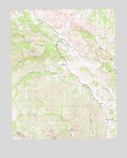
Bickmore Canyon, CA USGS Topographic Map
Click on map above to begin viewing in our Map Viewer.

This topographic map contains these locations and features:
Feature Name Type Latitude Longitude GNIS ID View Map
BalconiesSummitN36.5056°W121.2064°1657974View Map
Bear Valley Fire Control StationLocaleN36.5714°W121.1852°218894View Map
Bear Valley RanchLocaleN36.5177°W121.1294°218895View Map
Bickmore CanyonValleyN36.5528°W121.1652°219105View Map
Department of Forestry and Fire Protection Bear Valley Fire StationBuildingN36.5716°W121.1844°2624581View Map
Melendy RanchLocaleN36.5902°W121.1835°228482View Map
North Fork Chalone CreekStreamN36.5019°W121.1813°1891158View Map
North Wilderness TrailTrailN36.5316°W121.2383°1817421View Map
Parks ValleyValleyN36.5516°W121.2465°230363View Map
Pine RockSummitN36.5644°W121.1352°1659395View Map
PinnaclesPopulated PlaceN36.5308°W121.1452°252765View Map
Pinnacles Ranch Airport (historical)AirportN36.5100°W121.1360°1653795View Map
Pionne PeakSummitN36.5863°W121.1456°230767View Map
Schmidt RanchLocaleN36.5519°W121.1660°232656View Map
South Fork Willow CreekStreamN36.5919°W121.2102°235067View Map
Sulphur CreekStreamN36.5736°W121.1327°235707View Map
West Fork Chalone CreekStreamN36.5019°W121.1813°1817428View Map
Willow CreekStreamN36.5969°W121.1921°237886View Map
Willow Creek CemeteryCemeteryN36.5958°W121.1913°237904View Map
Willow Creek PeakSummitN36.5858°W121.2223°237906View Map
Willow Creek School (historical)SchoolN36.5950°W121.1924°1670173View Map
Willow SpringSpringN36.5093°W121.1814°237934View Map

Note: Coordinates in the location and feature list above are referenced to NAD83 datum.


Copyright (C) 2008-2024 Ryan Niemi / Sunset Dynamics ... All Rights Reserved