TopoQuest Logo
Do you find TopoQuest useful?
Help keep TopoQuest running and adding new maps/features by donating!
Bitcoin:  19c7KJd3qBynnjoSw5npx9KScwjBe4ifkT
Litecoin:  LXs6TkuXGGXo1vDsWCkWVdjQX94eUKd6ui
Home View Maps Find Maps Find Places Resources & Links


Port Arthur South, Texas Topographic Map

USGS Map Title: Port Arthur South, TX
USGS Map MRC: 29093G8
DRG (GeoTIFF) Download: o29093g8.tif


Neighboring USGS Topographic Map Quads:


  Port Acres, TX  
29094H1
 

  Port Arthur North, TX  
29093H8
 

  West of Greens Bayou, TX  
29093H7
 

  Big Hill Bayou, TX  
29094G1
 

  Port Arthur South, TX  
29093G8
 

  West of Johnson Bayou, LA  
29093G7
 

  Clam Lake, TX  
29094F1
 

  Sabine Pass, TX  
29093F8
 

  Texas Point, TX  
29093F7


Map MRC Location:

N30°
W94°
N30°
W93°
H8 H7 H6 H5 H4 H3 H2 H1
G8 G7 G6 G5 G4 G3 G2 G1
F8 F7 F6 F5 F4 F3 F2 F1
E8 E7 E6 E5 E4 E3 E2 E1
D8 D7 D6 D5 D4 D3 D2 D1
C8 C7 C6 C5 C4 C3 C2 C1
B8 B7 B6 B5 B4 B3 B2 B1
A8 A7 A6 A5 A4 A3 A2 A1
N29°
W94°
N29°
W93°

Port Arthur South, TX USGS 1:24K Topographic Map Preview:
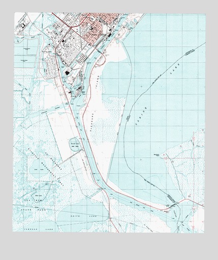
Port Arthur South, TX USGS Topographic Map
Click on map above to begin viewing in our Map Viewer.

This topographic map contains these locations and features:
Feature Name Type Latitude Longitude GNIS ID View Map
Alligator BayouStreamN29.8619°W93.9827°1384084View Map
Barnes Memorial Methodist ChurchChurchN29.8722°W93.9552°2022787View Map
Bethel Temple Church of God in ChristChurchN29.8641°W93.9471°2020626View Map
Big Forge BayouBayN29.8032°W93.8847°546354View Map
Blue Buck PointCapeN29.7947°W93.9029°533233View Map
Blue Buck Pont Gas FieldOilfieldN29.7930°W93.8877°550912View Map
Carter Chapel ChurchChurchN29.8672°W93.9454°2022816View Map
Carver SchoolSchoolN29.8572°W93.9507°1332248View Map
East BasinBasinN29.8333°W93.9588°1334878View Map
First Christian Faith Missionary Baptist ChurchChurchN29.8738°W93.9418°2020694View Map
Greater Macedonia Baptist ChurchChurchN29.8735°W93.9454°2020703View Map
Holiness Pentecostal Sanctified ChurchChurchN29.8669°W93.9441°2022801View Map
Israel Chapel African Methodist Episcopal ChurchChurchN29.8685°W93.9460°2020779View Map
Jefferson County Constable's Office Precinct 2BuildingN29.8706°W93.9327°2751328View Map
Jefferson County Constable's Office Precinct 8BuildingN29.8706°W93.9327°2751330View Map
Jefferson County Sheriff's OfficeBuildingN29.8680°W93.9346°2375979View Map
Johnson LakeLakeN29.7546°W93.9879°1377850View Map
Keith LakeLakeN29.7586°W93.9529°1384178View Map
Lamar SchoolSchoolN29.8735°W93.9541°1339576View Map
Lincoln High SchoolSchoolN29.8660°W93.9491°1339939View Map
Logan ParkParkN29.8635°W93.9307°1384080View Map
Lost LakeLakeN29.7863°W93.9833°1340641View Map
Mesquite PointCliffN29.7652°W93.8982°1341417View Map
Mud LakeLakeN29.7724°W93.9820°1342202View Map
Museum of the Gulf CoastBuildingN29.8733°W93.9335°2014633View Map
Pleasure Island MarinaLocaleN29.8685°W93.9268°2030478View Map
Port Arthur City HallBuildingN29.8709°W93.9344°2753885View Map
Port Arthur Fire Department Central StationBuildingN29.8720°W93.9335°2334790View Map
Port Arthur Fire Department Station Number 2BuildingN29.8686°W93.9502°2655442View Map
Port Arthur Pleasure Pier (historical)LocaleN29.8655°W93.9235°1384138View Map
Port Arthur Police DepartmentBuildingN29.8721°W93.9330°2375982View Map
Port Arthur Post OfficePost OfficeN29.8691°W93.9342°2032514View Map
Riverfront ParkParkN29.8480°W93.9441°1384081View Map
Rock Island Baptist ChurchChurchN29.8691°W93.9477°2020686View Map
Round LakeLakeN29.7997°W93.9601°1345664View Map
Sacred Heart Catholic ChurchChurchN29.8660°W93.9479°2020655View Map
Saint John Baptist ChurchChurchN29.8660°W93.9463°2020688View Map
Saint Luke Baptist ChurchChurchN29.8685°W93.9457°2020637View Map
Saint Paul United Methodist ChurchChurchN29.8677°W93.9449°2022792View Map
Salt BayouLakeN29.8440°W93.9803°1346192View Map
Taylor BayouStreamN29.8258°W93.9610°1376398View Map
Taylor Bayou Outfall CanalChannelN29.8385°W93.9871°1384082View Map
Texaco IslandIslandN29.8302°W93.9577°1384083View Map
Texaco Lease ParkParkN29.8688°W93.9513°1384078View Map
Washington Elementary SchoolSchoolN29.8719°W93.9488°2007144View Map
Washington ParkParkN29.8710°W93.9479°1384079View Map
West BasinBasinN29.8308°W93.9610°1349675View Map
West Port ArthurPopulated PlaceN29.8510°W93.9771°1349783View Map
Westside ParkParkN29.8716°W93.9491°2029952View Map
White Rose Church of God in ChristChurchN29.8710°W93.9477°2022775View Map

Note: Coordinates in the location and feature list above are referenced to NAD83 datum.


Copyright (C) 2008-2025 Ryan Niemi / Sunset Dynamics ... All Rights Reserved