TopoQuest Logo
Do you find TopoQuest useful?
Help keep TopoQuest running and adding new maps/features by donating!
Bitcoin:  19c7KJd3qBynnjoSw5npx9KScwjBe4ifkT
Litecoin:  LXs6TkuXGGXo1vDsWCkWVdjQX94eUKd6ui
Home View Maps Find Maps Find Places Resources & Links


Bad Axe SE, Michigan Topographic Map

USGS Map Title: Bad Axe SE, MI
USGS Map MRC: 43082G7
DRG (GeoTIFF) Download: o43082g7.tif


Neighboring USGS Topographic Map Quads:


  Kinde East, MI  
43082H8
 

  Redman, MI  
43082H7
 

  Port Hope, MI  
43082H6
 

  Bad Axe East, MI  
43082G8
 

  Bad Axe SE, MI  
43082G7
 

  Harbor Beach, MI  
43082G6
 

  Ubly, MI  
43082F8
 

  Minden City, MI  
43082F7
 

  Ruth, MI  
43082F6


Map MRC Location:

N44°
W83°
N44°
W82°
H8 H7 H6 H5 H4 H3 H2 H1
G8 G7 G6 G5 G4 G3 G2 G1
F8 F7 F6 F5 F4 F3 F2 F1
E8 E7 E6 E5 E4 E3 E2 E1
D8 D7 D6 D5 D4 D3 D2 D1
C8 C7 C6 C5 C4 C3 C2 C1
B8 B7 B6 B5 B4 B3 B2 B1
A8 A7 A6 A5 A4 A3 A2 A1
N43°
W83°
N43°
W82°

Bad Axe SE, MI USGS 1:24K Topographic Map Preview:
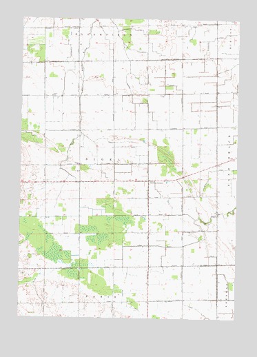
Bad Axe SE, MI USGS Topographic Map
Click on map above to begin viewing in our Map Viewer.

This topographic map contains these locations and features:
Feature Name Type Latitude Longitude GNIS ID View Map
Adams SchoolSchoolN43.8428°W82.8574°619834View Map
Allen DrainCanalN43.7806°W82.7963°619969View Map
Check DrainCanalN43.8183°W82.8019°623139View Map
Eccles SchoolSchoolN43.8436°W82.7927°625324View Map
Essenmacher DrainCanalN43.8708°W82.8122°625646View Map
Halfway CornersLocaleN43.8078°W82.8010°627633View Map
Jericho SchoolSchoolN43.8717°W82.8436°629263View Map
Kipper SchoolSchoolN43.8142°W82.8413°629752View Map
Lutheran CemeteryCemeteryN43.8003°W82.8028°2548559View Map
Morgan DrainCanalN43.8411°W82.8116°632690View Map
Roggenbuck FarmsLocaleN43.8139°W82.8694°2743401View Map
Savage DrainCanalN43.8675°W82.8199°637284View Map
Schelke DrainCanalN43.8692°W82.7541°637331View Map
Sigel DrainCanalN43.7997°W82.8408°637889View Map
Sigel Township Fire DepartmentBuildingN43.8076°W82.7903°2627002View Map
Swayze SchoolSchoolN43.8725°W82.7830°1614480View Map
Tenbusch FarmLocaleN43.8414°W82.8600°2743409View Map
Township of SigelCivilN43.8143°W82.8215°1627082View Map

Note: Coordinates in the location and feature list above are referenced to NAD83 datum.


Copyright (C) 2008-2024 Ryan Niemi / Sunset Dynamics ... All Rights Reserved