TopoQuest Logo
Do you find TopoQuest useful?
Help keep TopoQuest running and adding new maps/features by donating!
Bitcoin:  19c7KJd3qBynnjoSw5npx9KScwjBe4ifkT
Litecoin:  LXs6TkuXGGXo1vDsWCkWVdjQX94eUKd6ui
Home View Maps Find Maps Find Places Resources & Links


Port Leyden, New York Topographic Map

USGS Map Title: Port Leyden, NY
USGS Map MRC: 43075E3
DRG (GeoTIFF) Download: o43075e3.tif


Neighboring USGS Topographic Map Quads:


  Glenfield, NY  
43075F4
 

  Brantingham, NY  
43075F3


  Constableville, NY  
43075E4
 

  Port Leyden, NY  
43075E3


  West Leyden, NY  
43075D4
 

  Boonville, NY  
43075D3
 

  Forestport, NY  
43075D2


Map MRC Location:

N44°
W76°
N44°
W75°
H8 H7 H6 H5 H4 H3 H2 H1
G8 G7 G6 G5 G4 G3 G2 G1
F8 F7 F6 F5 F4 F3 F2 F1
E8 E7 E6 E5 E4 E3 E2 E1
D8 D7 D6 D5 D4 D3 D2 D1
C8 C7 C6 C5 C4 C3 C2 C1
B8 B7 B6 B5 B4 B3 B2 B1
A8 A7 A6 A5 A4 A3 A2 A1
N43°
W76°
N43°
W75°

Port Leyden, NY USGS 1:24K Topographic Map Preview:
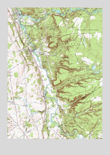
Port Leyden, NY USGS Topographic Map
Click on map above to begin viewing in our Map Viewer.

This topographic map contains these locations and features:
Feature Name Type Latitude Longitude GNIS ID View Map
Agers FallsFallsN43.6216°W75.3124°2786753View Map
Beauty CreekStreamN43.6126°W75.3410°943346View Map
Bible Fellowship ChurchChurchN43.6188°W75.3705°2615612View Map
Calvary CemeteryCemeteryN43.5814°W75.3293°945491View Map
Central SchoolSchoolN43.5840°W75.3427°946312View Map
Cold BrookStreamN43.5859°W75.3391°947029View Map
Fall BrookStreamN43.5484°W75.3221°949874View Map
Fisher Memorial ChapelChurchN43.6081°W75.3455°950160View Map
Forest Presbyterian ChurchChurchN43.6183°W75.3611°2616032View Map
FowlersvillePopulated PlaceN43.6240°W75.2741°972502View Map
Gould Memorial ChapelChurchN43.5806°W75.3338°951418View Map
Goulds MillPopulated PlaceN43.6092°W75.3405°951421View Map
KostervillePopulated PlaceN43.6159°W75.3346°972695View Map
Leyden Hill CemeteryCemeteryN43.5600°W75.3722°955267View Map
Locust GrovePopulated PlaceN43.5634°W75.3743°970313View Map
Lyons FallsFallsN43.6183°W75.3581°2786915View Map
Lyons Falls LibraryBuildingN43.6174°W75.3602°2617339View Map
LyonsdalePopulated PlaceN43.6187°W75.3063°956209View Map
Maple Lane Mobile Home ParkPopulated PlaceN43.5250°W75.3100°2485855View Map
Mile CreekStreamN43.5320°W75.3077°957176View Map
Mill CreekStreamN43.5173°W75.3174°957241View Map
Miller BrookStreamN43.5762°W75.3352°957297View Map
Moose CreekStreamN43.5248°W75.3380°957615View Map
Moose RiverStreamN43.6167°W75.3571°957636View Map
New Covenant ChurchChurchN43.5815°W75.3327°958404View Map
North Branch Cummings CreekStreamN43.5017°W75.2677°958700View Map
Pine CreekStreamN43.6203°W75.2630°960434View Map
Port LeydenPopulated PlaceN43.5831°W75.3452°960975View Map
Port Leyden Community LibraryBuildingN43.5824°W75.3452°2617389View Map
Port Leydon Fire DepartmentBuildingN43.5856°W75.3481°2718629View Map
Saint Johns Catholic ChurchChurchN43.6193°W75.3672°2616934View Map
Saint Marks ChurchChurchN43.5812°W75.3493°963853View Map
ShuetownPopulated PlaceN43.6203°W75.3285°973066View Map
Styshs Brown Barn CampgroundLocaleN43.5061°W75.3087°2615241View Map
Sugar RiverStreamN43.5181°W75.3179°966718View Map
TalcottvillePopulated PlaceN43.5334°W75.3652°967005View Map
Village of Lyons FallsCivilN43.6171°W75.3618°2390954View Map
Village of Port LeydenCivilN43.5838°W75.3412°2391079View Map
WBRV-AM (Boonville)TowerN43.5131°W75.3624°978420View Map
Wildwood CemeteryCemeteryN43.6079°W75.3452°971265View Map

Note: Coordinates in the location and feature list above are referenced to NAD83 datum.


Copyright (C) 2008-2025 Ryan Niemi / Sunset Dynamics ... All Rights Reserved