TopoQuest Logo
Do you find TopoQuest useful?
Help keep TopoQuest running and adding new maps/features by donating!
Bitcoin:  19c7KJd3qBynnjoSw5npx9KScwjBe4ifkT
Litecoin:  LXs6TkuXGGXo1vDsWCkWVdjQX94eUKd6ui
Home View Maps Find Maps Find Places Resources & Links


Port Washington East, Wisconsin Topographic Map

USGS Map Title: Port Washington East, WI
USGS Map MRC: 43087D7
DRG (GeoTIFF) Download: o43087d7.tif


Neighboring USGS Topographic Map Quads:


  Random Lake, WI  
43087E8
 

  Cedar Grove, WI  
43087E7


  Port Washington West, WI  
43087D8
 

  Port Washington East, WI  
43087D7


  Cedarburg, WI  
43087C8


Map MRC Location:

N44°
W88°
N44°
W87°
H8 H7 H6 H5 H4 H3 H2 H1
G8 G7 G6 G5 G4 G3 G2 G1
F8 F7 F6 F5 F4 F3 F2 F1
E8 E7 E6 E5 E4 E3 E2 E1
D8 D7 D6 D5 D4 D3 D2 D1
C8 C7 C6 C5 C4 C3 C2 C1
B8 B7 B6 B5 B4 B3 B2 B1
A8 A7 A6 A5 A4 A3 A2 A1
N43°
W88°
N43°
W87°

Port Washington East, WI USGS 1:24K Topographic Map Preview:
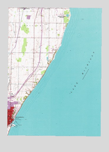
Port Washington East, WI USGS Topographic Map
Click on map above to begin viewing in our Map Viewer.

This topographic map contains these locations and features:
Feature Name Type Latitude Longitude GNIS ID View Map
BelgiumPopulated PlaceN43.4997°W87.8504°1561517View Map
Belgium Post OfficePost OfficeN43.4993°W87.8470°2768308View Map
DeckerPopulated PlaceN43.4706°W87.8626°1577567View Map
DrueckerPopulated PlaceN43.4400°W87.8712°1577577View Map
Friedens Evangelical ChurchChurchN43.3922°W87.8720°1833588View Map
Interchange 100CrossingN43.4117°W87.8714°2351430View Map
Interchange 107CrossingN43.4994°W87.8303°2351431View Map
KnellsvillePopulated PlaceN43.4142°W87.8709°1567569View Map
Lake ChurchPopulated PlaceN43.4997°W87.8206°1567726View Map
Lake ParkParkN43.3958°W87.8648°1567747View Map
Ozaukee County CourthouseBuildingN43.3883°W87.8712°1833600View Map
Port Washington Catholic SchoolSchoolN43.4090°W87.8692°2716654View Map
Port Washington Fire DepartmentBuildingN43.3897°W87.8714°2698040View Map
Port Washington Police DepartmentBuildingN43.3900°W87.8716°2759457View Map
Port Washington Post OfficePost OfficeN43.3888°W87.8707°1833604View Map
Port Washington Wastewater Treatment PlantLocaleN43.3928°W87.8644°2723886View Map
Port Washington Yacht ClubLocaleN43.3914°W87.8659°1578033View Map
Public School Number 1 (historical)SchoolN43.3900°W87.8718°1833605View Map
Saint Mary Parish SchoolSchoolN43.4996°W87.8187°2716766View Map
Saint Marys Roman Catholic ChurchChurchN43.3919°W87.8695°1833608View Map
Saint Marys SchoolSchoolN43.3922°W87.8687°1833609View Map
Sauk CreekStreamN43.3867°W87.8690°1573733View Map
South Jetty LightBuildingN43.3833°W87.8643°1577444View Map
South Pier LightBuildingN43.3850°W87.8640°1577443View Map
Sucker CreekStreamN43.4225°W87.8381°1575004View Map

Note: Coordinates in the location and feature list above are referenced to NAD83 datum.


Copyright (C) 2008-2025 Ryan Niemi / Sunset Dynamics ... All Rights Reserved