TopoQuest Logo
Do you find TopoQuest useful?
Help keep TopoQuest running and adding new maps/features by donating!
Bitcoin:  19c7KJd3qBynnjoSw5npx9KScwjBe4ifkT
Litecoin:  LXs6TkuXGGXo1vDsWCkWVdjQX94eUKd6ui
Home View Maps Find Maps Find Places Resources & Links


Random Lake, Wisconsin Topographic Map

USGS Map Title: Random Lake, WI
USGS Map MRC: 43087E8
DRG (GeoTIFF) Download: o43087e8.tif


Neighboring USGS Topographic Map Quads:


  Cascade, WI  
43088F1
 

  Plymouth South, WI  
43087F8
 

  Sheboygan Falls, WI  
43087F7
 

  Batavia, WI  
43088E1
 

  Random Lake, WI  
43087E8
 

  Cedar Grove, WI  
43087E7
 

  Newburg, WI  
43088D1
 

  Port Washington West, WI  
43087D8
 

  Port Washington East, WI  
43087D7


Map MRC Location:

N44°
W88°
N44°
W87°
H8 H7 H6 H5 H4 H3 H2 H1
G8 G7 G6 G5 G4 G3 G2 G1
F8 F7 F6 F5 F4 F3 F2 F1
E8 E7 E6 E5 E4 E3 E2 E1
D8 D7 D6 D5 D4 D3 D2 D1
C8 C7 C6 C5 C4 C3 C2 C1
B8 B7 B6 B5 B4 B3 B2 B1
A8 A7 A6 A5 A4 A3 A2 A1
N43°
W88°
N43°
W87°

Random Lake, WI USGS 1:24K Topographic Map Preview:
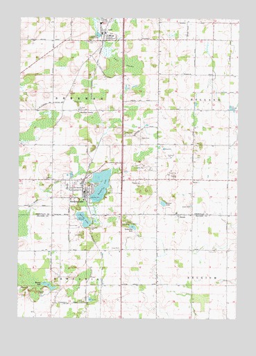
Random Lake, WI USGS Topographic Map
Click on map above to begin viewing in our Map Viewer.

This topographic map contains these locations and features:
Feature Name Type Latitude Longitude GNIS ID View Map
AdellPopulated PlaceN43.6192°W87.9520°1560695View Map
Adell Fire DepartmentBuildingN43.6191°W87.9505°2698134View Map
Adell SwampSwampN43.6061°W87.9415°1560696View Map
Camp J C CLocaleN43.5100°W87.9876°1562619View Map
DacadaPopulated PlaceN43.5433°W87.9087°1563654View Map
Emmanuel CemeteryCemeteryN43.6160°W87.9589°1564625View Map
Grasser LakeLakeN43.5479°W87.9174°1565773View Map
Greene School (historical)SchoolN43.6167°W87.9009°1834577View Map
Hoard School (historical)SchoolN43.5944°W87.8898°1834581View Map
Huiras LakeLakeN43.5134°W87.9825°1566792View Map
Huiras Lake State Natural AreaParkN43.5194°W87.9833°2093525View Map
Lake View ParkParkN43.5494°W87.9604°1567760View Map
Liberty School (historical)SchoolN43.5869°W87.9212°1834607View Map
Ludowissi LakeLakeN43.5380°W87.9347°1568794View Map
Our Lady of the Lakes SchoolSchoolN43.5525°W87.9606°1834675View Map
Ozaukee County Waterfowl Production AreaParkN43.5172°W87.8807°2765440View Map
Random LakeLakeN43.5554°W87.9533°1572068View Map
Random LakePopulated PlaceN43.5522°W87.9618°1572069View Map
Random Lake Elementary SchoolSchoolN43.5545°W87.9723°2716367View Map
Random Lake Fire DepartmentBuildingN43.5560°W87.9689°2697745View Map
Random Lake High SchoolSchoolN43.5545°W87.9723°1834652View Map
Random Lake Middle SchoolSchoolN43.5545°W87.9723°2716465View Map
Saint John Lutheran SchoolSchoolN43.5861°W87.9662°1834669View Map
Saint Johns CemeteryCemeteryN43.5875°W87.9665°1573041View Map
Saint Marys CemeteryCemeteryN43.5578°W87.9851°1573282View Map
Saint Patrick Catholic CemeteryCemeteryN43.6177°W87.9305°1833479View Map
Saint Patrick ChurchChurchN43.6167°W87.9309°1573396View Map
Saint Paul CemeteryCemeteryN43.5764°W87.9395°1573430View Map
Saint Paul Church (historical)ChurchN43.5758°W87.9404°1834679View Map
Sherman CenterLocaleN43.5864°W87.9631°1574023View Map
Spring LakeLakeN43.5410°W87.9628°1574660View Map
Spring Lake PitMineN43.5350°W87.9661°2711479View Map
Still Point Zen CenterChurchN43.6056°W87.9560°2504687View Map
Town of FredoniaCivilN43.5005°W87.9827°1583240View Map
Town of ShermanCivilN43.5878°W87.9826°1584148View Map
Union CemeteryCemeteryN43.5383°W87.9706°1575878View Map
Village of AdellCivilN43.6213°W87.9482°1582658View Map
Village of Random LakeCivilN43.5544°W87.9549°1583997View Map

Note: Coordinates in the location and feature list above are referenced to NAD83 datum.


Copyright (C) 2008-2024 Ryan Niemi / Sunset Dynamics ... All Rights Reserved