TopoQuest Logo
Do you find TopoQuest useful?
Help keep TopoQuest running and adding new maps/features by donating!
Bitcoin:  19c7KJd3qBynnjoSw5npx9KScwjBe4ifkT
Litecoin:  LXs6TkuXGGXo1vDsWCkWVdjQX94eUKd6ui
Home View Maps Find Maps Find Places Resources & Links


Port Washington West, Wisconsin Topographic Map

USGS Map Title: Port Washington West, WI
USGS Map MRC: 43087D8
DRG (GeoTIFF) Download: o43087d8.tif


Neighboring USGS Topographic Map Quads:


  Batavia, WI  
43088E1
 

  Random Lake, WI  
43087E8
 

  Cedar Grove, WI  
43087E7
 

  Newburg, WI  
43088D1
 

  Port Washington West, WI  
43087D8
 

  Port Washington East, WI  
43087D7
 

  Five Corners, WI  
43088C1
 

  Cedarburg, WI  
43087C8


Map MRC Location:

N44°
W88°
N44°
W87°
H8 H7 H6 H5 H4 H3 H2 H1
G8 G7 G6 G5 G4 G3 G2 G1
F8 F7 F6 F5 F4 F3 F2 F1
E8 E7 E6 E5 E4 E3 E2 E1
D8 D7 D6 D5 D4 D3 D2 D1
C8 C7 C6 C5 C4 C3 C2 C1
B8 B7 B6 B5 B4 B3 B2 B1
A8 A7 A6 A5 A4 A3 A2 A1
N43°
W88°
N43°
W87°

Port Washington West, WI USGS 1:24K Topographic Map Preview:
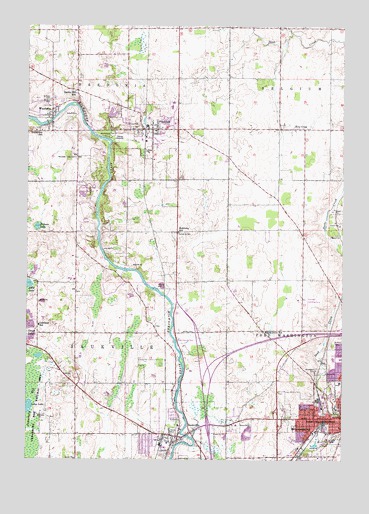
Port Washington West, WI USGS Topographic Map
Click on map above to begin viewing in our Map Viewer.

This topographic map contains these locations and features:
Feature Name Type Latitude Longitude GNIS ID View Map
City of Port WashingtonCivilN43.3845°W87.8850°1583960View Map
Daly LakeLakeN43.4257°W87.9995°1563682View Map
Dunwiddie Elementary SchoolSchoolN43.3841°W87.8939°1564190View Map
Ehler County ParkParkN43.4100°W87.9373°1564463View Map
First Congregational ChurchChurchN43.3886°W87.8759°1833587View Map
FredoniaPopulated PlaceN43.4706°W87.9506°1565286View Map
Fredonia Fire DepartmentBuildingN43.4686°W87.9511°2697487View Map
Fredonia Police DepartmentBuildingN43.4708°W87.9470°2759873View Map
Fredonia Wastewater Treatment PlantLocaleN43.4678°W87.9628°2723884View Map
Grady ParkParkN43.3833°W87.9412°1565701View Map
Grand Avenue Evangelical United Brethren Church (historical)ChurchN43.3869°W87.8795°1833591View Map
Grandview SchoolSchoolN43.4697°W87.9945°1565728View Map
Hawthorne Hills County ParkParkN43.4528°W87.9765°1566167View Map
Hawthorne Hills PondLakeN43.4513°W87.9783°2761322View Map
Hill Public School (historical)SchoolN43.3875°W87.8854°1833592View Map
Holden CemeteryCemeteryN43.4117°W87.9381°1566541View Map
Holy CrossPopulated PlaceN43.4703°W87.8956°1566584View Map
Honors High Online SchoolSchoolN43.4765°W87.9432°2716903View Map
Interchange 96CrossingN43.3850°W87.9281°2351428View Map
Interchange 97CrossingN43.4014°W87.9281°2351429View Map
Katarina CemeteryCemeteryN43.4405°W87.9404°1567359View Map
Lakeland SchoolSchoolN43.4139°W87.9951°1567770View Map
Lincoln Elementary SchoolSchoolN43.4041°W87.8760°1833598View Map
Maple Grove SchoolSchoolN43.4122°W87.9059°1568980View Map
McKinley SchoolSchoolN43.4406°W87.9404°1569252View Map
Northern Ozaukee AmbulanceBuildingN43.4686°W87.9511°2698340View Map
Norwegian CemeteryCemeteryN43.4009°W87.8856°1570553View Map
Ohana Ambulance and Emergency Medical ServicesBuildingN43.3782°W87.8920°2698342View Map
Ozaukee Airport (historical)AirportN43.4214°W87.8890°1582153View Map
Ozaukee Christian SchoolSchoolN43.3799°W87.9441°2716154View Map
Ozaukee Elementary SchoolSchoolN43.4778°W87.9424°2716278View Map
Ozaukee High SchoolSchoolN43.4766°W87.9429°1833602View Map
Ozaukee Middle SchoolSchoolN43.4772°W87.9427°2716799View Map
Port WashingtonPopulated PlaceN43.3872°W87.8756°1571797View Map
Port Washington High SchoolSchoolN43.3902°W87.8778°1833603View Map
Rosemary SchoolSchoolN43.4698°W87.9492°2716330View Map
Saint Alphonsus HospitalHospitalN43.3975°W87.8762°1833606View Map
Saint Johns Lutheran ChurchChurchN43.3844°W87.8759°1833607View Map
Saint Mary's CemeteryCemeteryN43.4082°W87.8792°1573281View Map
Saint Marys Hospital Ozaukee HeliportAirportN43.3964°W87.8765°1582154View Map
Saint Paul CemeteryCemeteryN43.4783°W87.9909°1573428View Map
Saint Rose CemeteryCemeteryN43.4792°W87.9909°1573558View Map
Sandhill LakeLakeN43.4420°W87.9960°1566046View Map
SaukvillePopulated PlaceN43.3817°W87.9406°1573739View Map
Saukville Elementary SchoolSchoolN43.3848°W87.9400°1833613View Map
Saukville Fire Department and Rescue SquadBuildingN43.3832°W87.9497°2697494View Map
Saukville Police DepartmentBuildingN43.3832°W87.9315°2759763View Map
Saukville Wastewater Treatment PlantLocaleN43.3761°W87.9400°2723887View Map
Smoky Hill SchoolSchoolN43.4806°W87.9809°1574327View Map
Thomas Jefferson Middle SchoolSchoolN43.4040°W87.8789°1833615View Map
Town of BelgiumCivilN43.4996°W87.8863°1582782View Map
Town of Port WashingtonCivilN43.4246°W87.8761°1583961View Map
Town of SaukvilleCivilN43.4140°W87.9843°1584104View Map
Union CemeteryCemeteryN43.3842°W87.8806°1833617View Map
Village of FredoniaCivilN43.4716°W87.9487°1583239View Map
Village of SaukvilleCivilN43.3846°W87.9439°1584103View Map
W J Niederkorn Public LibraryBuildingN43.3878°W87.8754°1833618View Map
Waubedonia ParkParkN43.4683°W87.9679°1576300View Map
WaubekaPopulated PlaceN43.4750°W87.9904°1576304View Map
Waubeka Census Designated PlaceCensusN43.4703°W87.9921°2585078View Map
Waubeka DamDamN43.4717°W87.9918°1792202View Map
Waubeka Fire DepartmentBuildingN43.4734°W87.9913°2697859View Map
Waubeka Millpond 412ReservoirN43.4717°W87.9918°1792203View Map
Waubeka Union CemeteryCemeteryN43.4622°W87.9809°1576305View Map
WGLB-AM (Port Washington)TowerN43.3864°W87.9195°1582340View Map
WGLB-FM (Port Washington)TowerN43.3861°W87.9195°1582442View Map
Wisconsin Virtual AcademySchoolN43.4764°W87.9431°2716408View Map

Note: Coordinates in the location and feature list above are referenced to NAD83 datum.


Copyright (C) 2008-2025 Ryan Niemi / Sunset Dynamics ... All Rights Reserved