TopoQuest Logo
Do you find TopoQuest useful?
Help keep TopoQuest running and adding new maps/features by donating!
Bitcoin:  19c7KJd3qBynnjoSw5npx9KScwjBe4ifkT
Litecoin:  LXs6TkuXGGXo1vDsWCkWVdjQX94eUKd6ui
Home View Maps Find Maps Find Places Resources & Links


Devils Slide, Utah Topographic Map

USGS Map Title: Devils Slide, UT
USGS Map MRC: 41111A5
DRG (GeoTIFF) Download: o41111a5.tif


Neighboring USGS Topographic Map Quads:


  Durst Mountain, UT  
41111B6
 

  Bybee Knoll, UT  
41111B5
 

  Lost Creek Dam, UT  
41111B4
 

  Morgan, UT  
41111A6
 

  Devils Slide, UT  
41111A5
 

  Henefer, UT  
41111A4
 

  Porterville, UT  
40111H6
 

  East Canyon Reservoir, UT  
40111H5
 

  Coalville, UT  
40111H4


Map MRC Location:

N42°
W112°
N42°
W111°
H8 H7 H6 H5 H4 H3 H2 H1
G8 G7 G6 G5 G4 G3 G2 G1
F8 F7 F6 F5 F4 F3 F2 F1
E8 E7 E6 E5 E4 E3 E2 E1
D8 D7 D6 D5 D4 D3 D2 D1
C8 C7 C6 C5 C4 C3 C2 C1
B8 B7 B6 B5 B4 B3 B2 B1
A8 A7 A6 A5 A4 A3 A2 A1
N41°
W112°
N41°
W111°

Devils Slide, UT USGS 1:24K Topographic Map Preview:
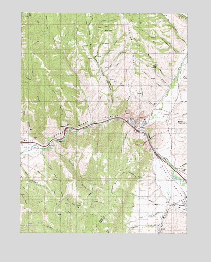
Devils Slide, UT USGS Topographic Map
Click on map above to begin viewing in our Map Viewer.

This topographic map contains these locations and features:
Feature Name Type Latitude Longitude GNIS ID View Map
Big Cottonwood CreekStreamN41.1063°W111.5010°1438646View Map
Big ForkStreamN41.0802°W111.5571°1425491View Map
Bolly KnobSummitN41.1141°W111.5608°1425863View Map
Branch CanyonValleyN41.0949°W111.5666°1425943View Map
Cabin HollowValleyN41.0913°W111.5630°1426253View Map
Chokecherry HollowValleyN41.0716°W111.5260°1426610View Map
Coal HollowValleyN41.0838°W111.5144°1426760View Map
Cooper GulchValleyN41.0533°W111.6055°1426844View Map
Coyote CanyonValleyN41.1194°W111.5677°1427036View Map
Coyote HollowValleyN41.1172°W111.5758°1440118View Map
CroydonPopulated PlaceN41.0686°W111.5138°1427128View Map
Croydon CemeteryCemeteryN41.0622°W111.5135°1435375View Map
Devils SlideSlopeN41.0619°W111.5485°1427378View Map
Devils SlidePopulated PlaceN41.0636°W111.5433°1427379View Map
Dry CreekStreamN41.0624°W111.5733°1440605View Map
Dry ForkStreamN41.1063°W111.5744°1440625View Map
Dry HollowValleyN41.0888°W111.5616°1427554View Map
First CanyonValleyN41.0122°W111.5180°1427945View Map
Folley CanyonValleyN41.0874°W111.5119°1428026View Map
Folley RidgeRidgeN41.1041°W111.5430°1441153View Map
Folley SpringSpringN41.0949°W111.5243°1428027View Map
Frank HollowValleyN41.1138°W111.6066°1441211View Map
Harris CanyonValleyN41.0388°W111.5035°1428545View Map
Hay HollowValleyN41.0749°W111.5058°1428596View Map
Henefer ValleyValleyN41.0449°W111.5244°1428659View Map
Little Cottonwood CreekStreamN41.1016°W111.5058°1429695View Map
Little HollowValleyN41.0683°W111.5110°1429741View Map
Lost CreekStreamN41.0602°W111.5394°1442968View Map
Lost ValleyValleyN41.0602°W111.5396°1448624View Map
Main CanyonValleyN41.0169°W111.5133°1430060View Map
Main Canyon CreekStreamN41.0333°W111.5174°1430061View Map
Mine HollowValleyN41.0205°W111.5916°1430355View Map
Morgan CountyCivilN41.0893°W111.5732°1448028View Map
Oak SpringSpringN41.1081°W111.5646°1430926View Map
Oak Spring CanyonValleyN41.0991°W111.5699°1430927View Map
Phil Shop HollowValleyN41.0466°W111.6097°1431208View Map
Pipe HollowValleyN41.1155°W111.5699°1431317View Map
Powder HollowValleyN41.0597°W111.5419°1431457View Map
Quarry Cottonwood CanyonValleyN41.0655°W111.5577°1444691View Map
Quarry Cottonwood CreekStreamN41.0655°W111.5577°1444692View Map
Quarry HollowValleyN41.0658°W111.5488°1431517View Map
Right Fork Dry CreekStreamN41.1222°W111.6194°1444917View Map
Roberts HollowValleyN41.0308°W111.5244°1431888View Map
Sharps HollowValleyN41.0611°W111.5902°1432363View Map
Shells HollowValleyN41.0808°W111.5166°1432394View Map
Stephens CanyonValleyN41.0047°W111.5219°1432963View Map
TaggartsPopulated PlaceN41.0597°W111.5919°1437698View Map
Tunnel HollowValleyN41.0511°W111.6016°1433698View Map
Wolf Den CanyonValleyN41.0894°W111.5041°1434430View Map
Yence HollowValleyN41.0544°W111.6219°1434510View Map

Note: Coordinates in the location and feature list above are referenced to NAD83 datum.


Copyright (C) 2008-2024 Ryan Niemi / Sunset Dynamics ... All Rights Reserved