TopoQuest Logo
Do you find TopoQuest useful?
Help keep TopoQuest running and adding new maps/features by donating!
Bitcoin:  19c7KJd3qBynnjoSw5npx9KScwjBe4ifkT
Litecoin:  LXs6TkuXGGXo1vDsWCkWVdjQX94eUKd6ui
Home View Maps Find Maps Find Places Resources & Links


Big A Mountain, Virginia Topographic Map

USGS Map Title: Big A Mountain, VA
USGS Map MRC: 37082A1
DRG (GeoTIFF) Download: o37082a1.tif


Neighboring USGS Topographic Map Quads:


  Prater, VA  
37082B2
 

  Vansant, VA  
37082B1
 

  Keen Mountain, VA  
37081B8
 

  Duty, VA  
37082A2
 

  Big A Mountain, VA  
37082A1
 

  Honaker, VA  
37081A8
 

  Carbo, VA  
36082H2
 

  Lebanon, VA  
36082H1
 

  Elk Garden, VA  
36081H8


Map MRC Location:

N38°
W83°
N38°
W82°
H8 H7 H6 H5 H4 H3 H2 H1
G8 G7 G6 G5 G4 G3 G2 G1
F8 F7 F6 F5 F4 F3 F2 F1
E8 E7 E6 E5 E4 E3 E2 E1
D8 D7 D6 D5 D4 D3 D2 D1
C8 C7 C6 C5 C4 C3 C2 C1
B8 B7 B6 B5 B4 B3 B2 B1
A8 A7 A6 A5 A4 A3 A2 A1
N37°
W83°
N37°
W82°

Big A Mountain, VA USGS 1:24K Topographic Map Preview:
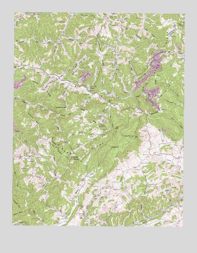
Big A Mountain, VA USGS Topographic Map
Click on map above to begin viewing in our Map Viewer.

This topographic map contains these locations and features:
Feature Name Type Latitude Longitude GNIS ID View Map
Andy BranchStreamN37.0726°W82.0537°1462474View Map
Austin CemeteryCemeteryN37.1009°W82.0521°1462621View Map
Austin ChapelChurchN37.0948°W82.0512°1462622View Map
Baldwin CemeteryCemeteryN37.1043°W82.0185°1462716View Map
Ball CemeteryCemeteryN37.0482°W82.0754°1462725View Map
Ball CemeteryCemeteryN37.0795°W82.1046°1462727View Map
Ball CreekStreamN37.0779°W82.0626°1462731View Map
Barton CemeteryCemeteryN37.0404°W82.1132°1462817View Map
Barton ForkStreamN37.0771°W82.0393°1462819View Map
Bear WallowBasinN37.0579°W82.0474°1462903View Map
Bethany ChurchChurchN37.0418°W82.0260°1463125View Map
Big A MountainSummitN37.0526°W82.0357°1463300View Map
Big A Mountain SchoolSchoolN37.0371°W82.0318°1463301View Map
Big BranchStreamN37.0843°W82.0851°1463314View Map
Bowen CemeteryCemeteryN37.0393°W82.0810°1463704View Map
Bowen GapGapN37.0401°W82.0826°1463705View Map
Bradley GapGapN37.0471°W82.0532°1463745View Map
Clark CemeteryCemeteryN37.0770°W82.0185°1464939View Map
Claypool BranchStreamN37.0037°W82.0274°1464961View Map
Claypool CemeteryCemeteryN37.0245°W82.0310°1464962View Map
Clinchview ChurchChurchN37.0373°W82.1090°1464993View Map
Clinchview School (historical)SchoolN37.0376°W82.1093°1497507View Map
Combs CemeteryCemeteryN37.0154°W82.0793°1465132View Map
Combs CemeteryCemeteryN37.0234°W82.0526°1465133View Map
Combs CemeteryCemeteryN37.0401°W82.0018°1465134View Map
Combs CemeteryCemeteryN37.0626°W82.0771°1465135View Map
Combs RidgeRidgeN37.0676°W82.0724°1465136View Map
Combs Ridge SchoolSchoolN37.0537°W82.0632°1465137View Map
Combs School (historical)SchoolN37.0154°W82.0774°1497509View Map
Compton CemeteryCemeteryN37.0537°W82.0646°1465143View Map
Cook CemeteryCemeteryN37.0023°W82.0687°1465185View Map
Cook CemeteryCemeteryN37.0237°W82.0743°1465186View Map
Cook CemeteryCemeteryN37.0509°W82.1015°1465187View Map
Coon Flat BranchStreamN37.0773°W82.0299°1465212View Map
Copperhead BranchStreamN37.0646°W82.0929°1465237View Map
Copperhead GapGapN37.0687°W82.0868°1465238View Map
Corinth ChurchChurchN37.0796°W82.0701°1465253View Map
CouncilPopulated PlaceN37.0804°W82.0685°1492809View Map
Council Elementary - Middle SchoolSchoolN37.0830°W82.0822°1497443View Map
Council High SchoolSchoolN37.0819°W82.0794°2498483View Map
Council Volunteer Fire DepartmentBuildingN37.0786°W82.0606°2721081View Map
Crabtree CemeteryCemeteryN37.0229°W82.0618°1465378View Map
Crabtree CemeteryCemeteryN37.0248°W82.1021°1465379View Map
Crabtree Chapel Elementary SchoolSchoolN37.0398°W82.1076°1465380View Map
Crackers NeckValleyN37.0123°W82.0784°1465383View Map
Deskin School (historical)SchoolN37.0173°W82.0379°1497515View Map
Dogpen BranchStreamN37.0859°W82.0924°1465873View Map
FlatwoodsPopulated PlaceN37.0243°W82.0265°1497523View Map
Fletcher CemeteryCemeteryN37.1001°W82.0598°1466700View Map
Fletcher CemeteryCemeteryN37.1237°W82.0607°1466701View Map
Fletcher RidgeRidgeN37.1134°W82.0654°1466708View Map
Fletcher Ridge SchoolSchoolN37.1234°W82.0546°1466709View Map
Fuller BranchStreamN37.0707°W82.0546°1466919View Map
Fuller BranchStreamN37.0807°W82.0735°1497446View Map
Fuller CemeteryCemeteryN37.0504°W82.0087°1466923View Map
Fuller CornerPopulated PlaceN37.0429°W82.0249°1497525View Map
Gilbert CemeteryCemeteryN37.0329°W82.1190°1467079View Map
Gilbert ForkStreamN37.1062°W82.0940°1467080View Map
Grissom CreekStreamN37.0787°W82.0390°1467555View Map
Grissom SchoolSchoolN37.0787°W82.0399°1467556View Map
Hale CemeteryCemeteryN37.0829°W82.0865°1467644View Map
Hale HollowValleyN37.0846°W82.0823°1467647View Map
Hale School (historical)SchoolN37.0829°W82.0849°1497448View Map
Hallie Post OfficePost OfficeN37.1013°W82.0227°2336117View Map
Harris CemeteryCemeteryN37.0229°W82.0087°1467772View Map
Harris CemeteryCemeteryN37.0862°W82.0529°1467773View Map
Hart CemeteryCemeteryN37.0070°W82.0873°1467797View Map
Hart CreekStreamN37.0026°W82.0865°1467798View Map
Helton CemeteryCemeteryN37.1179°W82.0390°1467911View Map
Hurricane ChurchChurchN37.1073°W82.0965°1468422View Map
Hurricane DistrictCivilN37.1206°W82.0564°1927346View Map
Independence ChurchChurchN37.0065°W82.0718°1468452View Map
Independence Church CemeteryCemeteryN37.0058°W82.0713°2774755View Map
Indian RidgeRidgeN37.0829°W82.1199°1474238View Map
Ivy LickStreamN37.1204°W82.1229°1462304View Map
Jackson CemeteryCemeteryN37.0173°W82.0021°2774765View Map
Jackson ForkStreamN37.0773°W82.0282°1468601View Map
Jakes ForkStreamN37.1232°W82.1171°1468624View Map
Johnson CemeteryCemeteryN37.0565°W82.0598°1468788View Map
Keen CemeteryCemeteryN37.0768°W82.0690°1468923View Map
Lester CemeteryCemeteryN37.0718°W82.0554°1469311View Map
Little Grassy CreekStreamN37.0721°W82.0010°1469555View Map
Little Indian CreekStreamN37.0484°W82.0846°1469568View Map
Lockhart CemeteryCemeteryN37.1123°W82.0107°1469720View Map
Lockhart ChapelChurchN37.0251°W82.0196°1469721View Map
Lockhart Chapel CemeteryCemeteryN37.0252°W82.0195°2774770View Map
Lockhart Chapel School (historical)SchoolN37.0248°W82.0199°1497551View Map
Logan Wallace Jackson CemeteryCemeteryN37.0684°W82.0168°1468596View Map
Louis Lowe GapGapN37.1026°W82.0162°1469872View Map
Lowe CemeteryCemeteryN37.0948°W82.0068°1469902View Map
Martin CemeteryCemeteryN37.1057°W82.0210°1470124View Map
May CemeteryCemeteryN37.0884°W82.0207°1470206View Map
McFarlane BranchStreamN37.0832°W82.0837°1470253View Map
McGlothin CemeteryCemeteryN37.1170°W82.0482°1470255View Map
McGlothlin CemeteryCemeteryN37.0218°W82.0512°1470256View Map
Mount Zion ChurchChurchN37.1012°W82.0035°1471127View Map
Mount Zion Freewill Baptist ChurchChurchN37.0421°W82.0193°1471126View Map
Mountain View ChurchChurchN37.0584°W82.0618°1471197View Map
Nance White BranchStreamN37.0865°W82.0351°1471316View Map
Nuckles CemeteryCemeteryN37.1240°W82.0532°1471685View Map
Parett Fletcher BranchStreamN37.1246°W82.0801°1472054View Map
Patten Hess BranchStreamN37.1093°W82.0801°1472109View Map
Pealog BranchStreamN37.1240°W82.0824°1472156View Map
Presley BranchStreamN37.0859°W82.0924°1472769View Map
Presley CemeteryCemeteryN37.0868°W82.0951°1472771View Map
Presley CemeteryCemeteryN37.1193°W82.0876°1472773View Map
Presley SchoolSchoolN37.1071°W82.0932°1472775View Map
Puncheon Camp BranchStreamN37.0707°W82.1132°1472863View Map
Quinn BranchStreamN37.0768°W82.0676°1472910View Map
Quinn CemeteryCemeteryN37.0701°W82.0796°1472911View Map
RasnakePopulated PlaceN37.0404°W82.1096°1497565View Map
Rasnake CemeteryCemeteryN37.0284°W82.0690°1472991View Map
Rasnake CemeteryCemeteryN37.0401°W82.1221°1472992View Map
Rockhouse BranchStreamN37.1101°W82.0879°1473409View Map
Rose CemeteryCemeteryN37.0682°W82.0985°1473531View Map
Rose Hill Church (historical)ChurchN37.0293°W82.1104°1497571View Map
Russell Fork ChurchChurchN37.0898°W82.1024°1473649View Map
Shaw Memorial Church (historical)ChurchN37.0234°W82.0276°1497578View Map
Smith CemeteryCemeteryN37.0332°W82.0496°1474733View Map
Smith CemeteryCemeteryN37.0657°W82.0376°1474735View Map
Stevens CemeteryCemeteryN37.0387°W82.1165°1475122View Map
Stevens CemeteryCemeteryN37.0643°W82.0601°1475123View Map
Stinson CemeteryCemeteryN37.1107°W82.0360°1475162View Map
Stinson RidgeRidgeN37.1146°W82.0357°1475163View Map
Street CemeteryCemeteryN37.0040°W82.0857°1475246View Map
Taylor BranchStreamN37.0107°W82.1143°1475499View Map
Thompson CemeteryCemeteryN37.0332°W82.0312°1475655View Map
Tiller CemeteryCemeteryN37.0920°W82.1246°1475713View Map
VeniaPopulated PlaceN37.0912°W82.0499°1493737View Map
Whitt CemeteryCemeteryN37.0212°W82.0135°1476694View Map
Whitt CemeteryCemeteryN37.1204°W82.0121°1476695View Map
Whitt CemeteryCemeteryN37.1220°W82.0321°1476696View Map
Whitt School (historical)SchoolN37.0134°W82.0062°1497588View Map

Note: Coordinates in the location and feature list above are referenced to NAD83 datum.


Copyright (C) 2008-2024 Ryan Niemi / Sunset Dynamics ... All Rights Reserved