TopoQuest Logo
Do you find TopoQuest useful?
Help keep TopoQuest running and adding new maps/features by donating!
Bitcoin:  19c7KJd3qBynnjoSw5npx9KScwjBe4ifkT
Litecoin:  LXs6TkuXGGXo1vDsWCkWVdjQX94eUKd6ui
Home View Maps Find Maps Find Places Resources & Links


Carbo, Virginia Topographic Map

USGS Map Title: Carbo, VA
USGS Map MRC: 36082H2
DRG (GeoTIFF) Download: o36082h2.tif


Neighboring USGS Topographic Map Quads:


  Nora, VA  
37082A3
 

  Duty, VA  
37082A2
 

  Big A Mountain, VA  
37082A1
 

  Saint Paul, VA  
36082H3
 

  Carbo, VA  
36082H2
 

  Lebanon, VA  
36082H1
 

  Moll Creek, VA  
36082G3
 

  Hansonville, VA  
36082G2
 

  Brumley, VA  
36082G1


Map MRC Location:

N37°
W83°
N37°
W82°
H8 H7 H6 H5 H4 H3 H2 H1
G8 G7 G6 G5 G4 G3 G2 G1
F8 F7 F6 F5 F4 F3 F2 F1
E8 E7 E6 E5 E4 E3 E2 E1
D8 D7 D6 D5 D4 D3 D2 D1
C8 C7 C6 C5 C4 C3 C2 C1
B8 B7 B6 B5 B4 B3 B2 B1
A8 A7 A6 A5 A4 A3 A2 A1
N36°
W83°
N36°
W82°

Carbo, VA USGS 1:24K Topographic Map Preview:
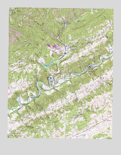
Carbo, VA USGS Topographic Map
Click on map above to begin viewing in our Map Viewer.

This topographic map contains these locations and features:
Feature Name Type Latitude Longitude GNIS ID View Map
Abby Counts IslandIslandN36.9376°W82.1643°1497489View Map
Anderson CreekStreamN36.9807°W82.2351°1497490View Map
Aranco-Kiser CemeteryCemeteryN36.9929°W82.2481°2774756View Map
Artrip CemeteryCemeteryN36.9384°W82.1707°1462567View Map
Artrip CemeteryCemeteryN36.9612°W82.1260°1462568View Map
Ash Pond Area Number OneReservoirN36.9392°W82.1899°1490828View Map
Ash Pond Number TwoReservoirN36.9418°W82.1882°1490826View Map
Ashbrook CemeteryCemeteryN36.9548°W82.1379°1462587View Map
Back ValleyValleyN36.9607°W82.1762°1462660View Map
Bee BranchStreamN36.9484°W82.2115°1462990View Map
Blankenship CemeteryCemeteryN36.9026°W82.1604°1463559View Map
Brushy RidgeRidgeN36.9598°W82.2340°1463953View Map
Burke CemeteryCemeteryN36.9018°W82.2079°1464107View Map
CandlerPopulated PlaceN36.8996°W82.2049°1497502View Map
Candler CemeteryCemeteryN36.9020°W82.2032°1464397View Map
CarboPopulated PlaceN36.9284°W82.1943°1492711View Map
Carter CemeteryCemeteryN36.8787°W82.1632°1464473View Map
Carter CemeteryCemeteryN36.9112°W82.2218°1464474View Map
CartertonPopulated PlaceN36.9134°W82.2210°1464495View Map
Castlewood DistrictCivilN36.9287°W82.2367°1927128View Map
Chafin CemeteryCemeteryN36.8837°W82.2104°1464710View Map
Chafin CemeteryCemeteryN36.8973°W82.1679°1464711View Map
Chaney CreekStreamN36.9496°W82.2112°1464734View Map
Chaney Fork School (historical)SchoolN36.9796°W82.2354°1497504View Map
Chaney HollowValleyN36.9669°W82.2237°1464736View Map
Clark CemeteryCemeteryN36.9365°W82.1407°1464938View Map
ClevelandPopulated PlaceN36.9437°W82.1518°1464978View Map
Cleveland Elementary SchoolSchoolN36.9457°W82.1487°1497506View Map
Cleveland Elementary SchoolSchoolN36.9333°W82.1363°1498382View Map
Cleveland Lifesaving CrewBuildingN36.9306°W82.1346°2721163View Map
Cleveland Post OfficePost OfficeN36.9434°W82.1507°2766447View Map
Cleveland Volunteer Fire DepartmentBuildingN36.9438°W82.1503°2085966View Map
Clinch River Flyash Dike Number One DamDamN36.9418°W82.1882°1490827View Map
Clinch River Flyash Dike Number Two DamDamN36.9418°W82.1882°1490825View Map
Clinch River Steam PlantLocaleN36.9329°W82.1990°1491128View Map
ClinchfieldPopulated PlaceN36.9557°W82.1837°1492783View Map
Couch CemeteryCemeteryN36.9057°W82.2393°1465279View Map
Couch CemeteryCemeteryN36.9432°W82.1832°1465280View Map
CountsPopulated PlaceN36.9284°W82.2262°1497512View Map
CountsLocaleN36.9371°W82.2168°1465289View Map
Counts CemeteryCemeteryN36.9298°W82.2279°1465290View Map
Counts CemeteryCemeteryN36.9440°W82.1568°1465291View Map
Dark HollowValleyN36.9144°W82.2382°1465606View Map
Davis CemeteryCemeteryN36.9073°W82.1346°1465641View Map
Dickenson CemeteryCemeteryN36.8910°W82.2391°1465766View Map
Dickenson CemeteryCemeteryN36.9198°W82.2249°1465770View Map
Dickenson CemeteryCemeteryN36.9229°W82.2418°1465771View Map
Dickenson CornerPopulated PlaceN36.8912°W82.2379°1497516View Map
Dorton HollowValleyN36.9825°W82.2100°1465891View Map
Dry RunStreamN36.9145°W82.2382°1466005View Map
Dry Run BendBendN36.9112°W82.2365°1466012View Map
Dumps CreekStreamN36.9462°W82.1918°1466038View Map
Eagle Nest BranchStreamN36.9290°W82.2137°1466080View Map
Evans CemeteryCemeteryN36.9401°W82.2135°1466354View Map
Glade View Church (historical)ChurchN36.8973°W82.1310°1497529View Map
Gose CemeteryCemeteryN36.8890°W82.2454°1467271View Map
Grassy BranchStreamN36.9990°W82.1501°1467360View Map
Gravel LickPopulated PlaceN36.9509°W82.2307°1493021View Map
Gravel Lick School (historical)SchoolN36.9482°W82.2413°1497531View Map
Grizzle (historical)Populated PlaceN36.9918°W82.1654°1497532View Map
Grizzle CemeteryCemeteryN36.9412°W82.1879°1467559View Map
Grizzle CemeteryCemeteryN36.9551°W82.1340°1467560View Map
Hackney CemeteryCemeteryN36.9326°W82.1801°1467626View Map
Hazel Mountain Lookout TowerTowerN36.9951°W82.2451°1499035View Map
Honey BranchStreamN36.9976°W82.2032°1468208View Map
Hop HollowValleyN36.9062°W82.2118°1468222View Map
Huffman CemeteryCemeteryN36.9004°W82.1610°1468353View Map
Hurricane ForkStreamN36.9709°W82.1915°1468427View Map
Ivy RidgeRidgeN36.9640°W82.1601°1468561View Map
Ivy Ridge ChurchChurchN36.9609°W82.1701°1468562View Map
Jessee CemeteryCemeteryN36.8976°W82.2249°1468725View Map
Jessee CemeteryCemeteryN36.9057°W82.1946°1468726View Map
Jessee CemeteryCemeteryN36.9109°W82.1662°1468727View Map
Jessee HollowValleyN36.8961°W82.2129°1468732View Map
Jessees MillPopulated PlaceN36.9143°W82.1674°1493144View Map
John Counts Memorial BridgeBridgeN36.9432°W82.1551°1497541View Map
Johnson CemeteryCemeteryN36.8823°W82.2082°1468785View Map
Kiser (historical)Populated PlaceN36.9251°W82.1776°1497544View Map
Kiser BendBendN36.9312°W82.1982°1469043View Map
Kiser CemeteryCemeteryN36.9132°W82.1774°1469044View Map
Kiser CemeteryCemeteryN36.9326°W82.1865°1469045View Map
Kiser CemeteryCemeteryN36.9536°W82.1983°1469046View Map
Kiser CemeteryCemeteryN36.9554°W82.2226°1469047View Map
Kiser CemeteryCemeteryN36.9361°W82.1848°2774754View Map
Lake BonaventureReservoirN36.9442°W82.2029°1501956View Map
Lake Bonaventure DamDamN36.9479°W82.1960°1490829View Map
Laurel BranchStreamN36.9896°W82.1737°1469168View Map
McReynolds CemeteryCemeteryN36.9262°W82.1471°1470285View Map
Meade BranchStreamN36.9146°W82.2199°1470291View Map
Meade CemeteryCemeteryN36.8779°W82.1894°1470297View Map
Middle Fork Clinch RiverStreamN36.9348°W82.1965°1474251View Map
Middle Fork Slurry Impoundment DamDamN36.9584°W82.1999°1490833View Map
Mill CreekStreamN36.9307°W82.1818°1470477View Map
Mill Creek ChurchChurchN36.9115°W82.1660°1470519View Map
Mill Creek School (historical)SchoolN36.9121°W82.1660°1497557View Map
Millstone BranchStreamN36.9571°W82.1787°1470584View Map
Monk BranchStreamN36.9746°W82.1349°1470674View Map
Moss Number 2 Mine and Preparation PlantMineN36.9859°W82.1821°1491200View Map
Moss Number 3 Preparation PlantMineN36.9571°W82.1815°1491202View Map
Moss Number Three Preparation Plant Upper SlurryReservoirN36.9584°W82.1999°1490834View Map
Moss Number Two Mine Pond DamDamN36.9884°W82.1832°1490830View Map
Muddy BranchStreamN36.9454°W82.1462°1471219View Map
Muddy BranchStreamN36.9990°W82.1474°1471220View Map
Muddy HollowValleyN36.9076°W82.2165°1471233View Map
Munseys ChapelChurchN36.8782°W82.1715°1471269View Map
Musick CemeteryCemeteryN36.9773°W82.1390°1471287View Map
Musick CemeteryCemeteryN36.9854°W82.1282°1471288View Map
Pennus HollowValleyN36.9031°W82.1576°1472190View Map
Pleasant Hill ChurchChurchN36.9023°W82.2079°1472495View Map
Possum HollowValleyN36.9235°W82.1964°1472691View Map
PurcellPopulated PlaceN36.9307°W82.1351°1493461View Map
Rasnake CemeteryCemeteryN36.9540°W82.1618°1472988View Map
Rasnake CemeteryCemeteryN36.9595°W82.1468°1472989View Map
Rasnake CemeteryCemeteryN36.9654°W82.1529°1472990View Map
Red Oak RidgeRidgeN36.9446°W82.2274°1473062View Map
Reeds Valley Church CemeteryCemeteryN36.8951°W82.2301°1473098View Map
Rocky ForkStreamN36.9715°W82.1307°1473457View Map
Sexton BranchStreamN36.9026°W82.2399°1474184View Map
Sexton HollowValleyN36.8893°W82.2309°1474186View Map
Sinkhole ValleyValleyN36.9726°W82.1351°1474630View Map
Sinking CreekStreamN36.8932°W82.1310°1474631View Map
Skeen CemeteryCemeteryN36.8818°W82.2171°1474640View Map
Skeen CemeteryCemeteryN36.9295°W82.1429°1474641View Map
Smith CemeteryCemeteryN36.9037°W82.1571°1474726View Map
Smith CemeteryCemeteryN36.9554°W82.1715°1474728View Map
South ClinchfieldPopulated PlaceN36.9626°W82.1760°1493629View Map
Springfield ChurchChurchN36.9268°W82.2251°1475017View Map
Spruce Pine HollowValleyN36.9523°W82.2137°1475034View Map
Stillhouse HollowValleyN36.9071°W82.2284°1475146View Map
Stonecoal CreekStreamN36.9668°W82.2235°1475189View Map
Sutherland CemeteryCemeteryN36.9673°W82.1718°1496281View Map
Sutherland CemeteryCemeteryN36.9695°W82.1712°1496282View Map
Sutherland CemeteryCemeteryN36.9329°W82.1865°1475350View Map
Tank HollowValleyN36.9417°W82.1551°1475448View Map
Tank Hollow FallsFallsN36.9401°W82.1543°1475449View Map
Town of ClevelandCivilN36.9434°W82.1526°2390802View Map
Tunnel HillSummitN36.9223°W82.2099°1475925View Map
Turner CemeteryCemeteryN36.9420°W82.2365°1475979View Map
Turner CemeteryCemeteryN36.9479°W82.2329°1475980View Map
Weaver Creek ChurchChurchN36.9829°W82.1299°1476415View Map
Winney HollowValleyN36.9181°W82.1874°1476867View Map
Wolfpen BranchStreamN36.9896°W82.1729°1476909View Map

Note: Coordinates in the location and feature list above are referenced to NAD83 datum.


Copyright (C) 2008-2024 Ryan Niemi / Sunset Dynamics ... All Rights Reserved