TopoQuest Logo
Do you find TopoQuest useful?
Help keep TopoQuest running and adding new maps/features by donating!
Bitcoin:  19c7KJd3qBynnjoSw5npx9KScwjBe4ifkT
Litecoin:  LXs6TkuXGGXo1vDsWCkWVdjQX94eUKd6ui
Home View Maps Find Maps Find Places Resources & Links


Caney Ridge, Virginia Topographic Map

USGS Map Title: Caney Ridge, VA
USGS Map MRC: 37082A4
DRG (GeoTIFF) Download: o37082a4.tif


Neighboring USGS Topographic Map Quads:


  Jenkins East, KY  
37082B5
 

  Clintwood, VA  
37082B4
 

  Haysi, VA  
37082B3
 

  Pound, VA  
37082A5
 

  Caney Ridge, VA  
37082A4
 

  Nora, VA  
37082A3
 

  Wise, VA  
36082H5
 

  Coeburn, VA  
36082H4
 

  Saint Paul, VA  
36082H3


Map MRC Location:

N38°
W83°
N38°
W82°
H8 H7 H6 H5 H4 H3 H2 H1
G8 G7 G6 G5 G4 G3 G2 G1
F8 F7 F6 F5 F4 F3 F2 F1
E8 E7 E6 E5 E4 E3 E2 E1
D8 D7 D6 D5 D4 D3 D2 D1
C8 C7 C6 C5 C4 C3 C2 C1
B8 B7 B6 B5 B4 B3 B2 B1
A8 A7 A6 A5 A4 A3 A2 A1
N37°
W83°
N37°
W82°

Caney Ridge, VA USGS 1:24K Topographic Map Preview:
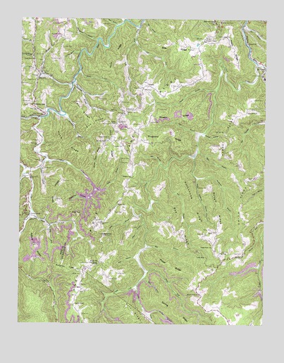
Caney Ridge, VA USGS Topographic Map
Click on map above to begin viewing in our Map Viewer.

This topographic map contains these locations and features:
Feature Name Type Latitude Longitude GNIS ID View Map
Adkins CemeteryCemeteryN37.0562°W82.4043°1462370View Map
Adkins RidgeRidgeN37.0323°W82.4907°1462371View Map
Alka (historical)Populated PlaceN37.0312°W82.4740°1497362View Map
Alleys CreekStreamN37.0668°W82.4871°1462420View Map
Bad BranchStreamN37.0643°W82.4251°1462668View Map
Bad RidgeRidgeN37.0432°W82.4213°1462670View Map
Bad Ridge School (historical)SchoolN37.0407°W82.4210°1497364View Map
Bear BranchStreamN37.0712°W82.4093°1462870View Map
Bear ForkStreamN37.0404°W82.4840°1462889View Map
Bearpen GapGapN37.1234°W82.4007°1481547View Map
Big BranchStreamN37.0320°W82.4338°1463313View Map
Big BranchStreamN37.1243°W82.4371°1463316View Map
Big BranchStreamN37.1229°W82.3860°1463328View Map
Big BranchStreamN37.0270°W82.4402°1497365View Map
Big HollowValleyN37.0272°W82.4406°1463358View Map
Big Oak SchoolSchoolN37.0787°W82.3957°1463390View Map
Big Oak School (historical)SchoolN37.0857°W82.3874°1497366View Map
Bill RidgeRidgeN37.0879°W82.4693°1463434View Map
Birchfield CreekStreamN37.0634°W82.4965°1481809View Map
Bise CemeteryCemeteryN37.1126°W82.4115°1463457View Map
Bise RidgeRidgeN37.1148°W82.4240°1463458View Map
Bise SchoolSchoolN37.1171°W82.4071°1463459View Map
Brushy RidgeRidgeN37.0868°W82.4190°1463954View Map
Buchanan CemeteryCemeteryN37.1182°W82.4796°1463968View Map
Buchanan CemeteryCemeteryN37.1137°W82.4790°1495321View Map
Buchanan CemeteryCemeteryN37.1084°W82.4796°1495322View Map
Buchanan RidgeRidgeN37.0223°W82.4746°1463970View Map
Buck BranchStreamN37.1034°W82.4699°1463976View Map
Caney CreekStreamN37.1068°W82.3793°1482306View Map
Caney Fork ChurchChurchN37.0315°W82.4010°1464407View Map
Caney Fork ChurchChurchN37.0873°W82.3843°1464408View Map
Caney RidgeRidgeN37.0420°W82.4574°1482307View Map
Caney Ridge AirportAirportN37.0638°W82.4444°2770636View Map
Caney TunnelTunnelN37.1026°W82.3779°1464412View Map
Cantrell HollowValleyN37.0603°W82.4979°1482315View Map
Cherrytree HollowValleyN37.1243°W82.4375°1497371View Map
Childress CemeteryCemeteryN37.0732°W82.3974°1464844View Map
Clintwood Volunteer Fire Department Station 2BuildingN37.0281°W82.3976°2721190View Map
Crabtree ForkStreamN37.1234°W82.4932°1482795View Map
DarwinPopulated PlaceN37.1004°W82.4910°1477249View Map
Davis CemeteryCemeteryN37.0504°W82.4813°1465643View Map
Davis ChapelChurchN37.0448°W82.4940°1465647View Map
Davis RidgeRidgeN37.0545°W82.4807°1465659View Map
Deadman HollowValleyN37.0511°W82.4655°1465679View Map
Dingus CemeteryCemeteryN37.0362°W82.4574°1465809View Map
Dingus GapGapN37.0368°W82.4585°1465810View Map
Dotson CemeteryCemeteryN37.0907°W82.4699°1465894View Map
Flat TopPopulated PlaceN37.0290°W82.3974°1492942View Map
ForakerPopulated PlaceN37.0762°W82.4888°1497380View Map
Freeman CemeteryCemeteryN37.0251°W82.4640°1466878View Map
Fremont ChurchChurchN37.1151°W82.3846°1466883View Map
Frogpond RidgeRidgeN37.0782°W82.4238°1466902View Map
Funk CemeteryCemeteryN37.0043°W82.4671°1466925View Map
Gouge CemeteryCemeteryN37.0204°W82.4676°1467289View Map
Hale CemeteryCemeteryN37.0582°W82.4776°1467643View Map
Hamilton CemeteryCemeteryN37.0187°W82.4538°1467680View Map
Harm RidgeRidgeN37.0704°W82.4763°1467752View Map
Hibbitts CemeteryCemeteryN37.0907°W82.4949°1467967View Map
Hibbitts GapGapN37.0901°W82.4927°1467968View Map
Honeycamp BranchStreamN37.1162°W82.4604°1484193View Map
Horseshoe BranchStreamN37.0859°W82.4768°1468309View Map
House BranchStreamN37.0240°W82.3771°1497384View Map
Hutchinson School (historical)SchoolN37.0143°W82.4679°1496622View Map
Ibex (historical)Populated PlaceN37.0512°W82.4818°1497387View Map
John RidgeRidgeN37.0759°W82.4529°1468761View Map
Keel BranchStreamN37.1223°W82.4504°1484527View Map
Kenady DistrictCivilN37.0496°W82.4142°1927365View Map
Kenady SchoolSchoolN37.0607°W82.4424°1468944View Map
Kennedy CemeteryCemeteryN37.0732°W82.4518°1468952View Map
Kiser CemeteryCemeteryN37.0301°W82.3968°1469052View Map
Lambert CemeteryCemeteryN37.1229°W82.4590°1469109View Map
Large CemeteryCemeteryN37.0829°W82.4496°1469135View Map
Lebanon ChurchChurchN37.0876°W82.4452°1469243View Map
LeckPopulated PlaceN37.0382°W82.4007°1493187View Map
Left Fork Rush CreekStreamN37.1154°W82.4415°1469298View Map
Lick BranchStreamN37.0776°W82.4085°1469380View Map
Lick BranchStreamN37.1018°W82.4893°1469381View Map
Lick ForkStreamN37.0840°W82.4896°1484821View Map
Lick Fork ChurchChurchN37.0859°W82.4885°1469400View Map
Little Caney CreekStreamN37.0162°W82.4390°1484879View Map
Little Rockhouse BranchStreamN37.0598°W82.4093°1469639View Map
Long BranchStreamN37.0445°W82.4410°1469766View Map
Long ForkStreamN37.0982°W82.4696°1485052View Map
Long Fork ChurchChurchN37.1082°W82.4929°1469810View Map
LongforkPopulated PlaceN37.1232°W82.4932°1497394View Map
Low GapGapN37.0279°W82.4046°1469888View Map
Low Gap BranchStreamN37.0140°W82.3763°1497395View Map
LyonsPopulated PlaceN37.0137°W82.4677°1493241View Map
Lyons ForkStreamN37.0465°W82.4935°1469962View Map
Mack RidgeRidgeN37.1096°W82.4499°1469993View Map
Maple Grove ChurchChurchN37.0123°W82.4074°1470071View Map
McClurePopulated PlaceN37.1026°W82.3763°1493267View Map
McCoy CemeteryCemeteryN37.0384°W82.4021°1470242View Map
McCoy CemeteryCemeteryN37.0751°W82.4379°1470243View Map
Meadow BranchStreamN37.0040°W82.4329°1485331View Map
Mill BranchStreamN37.0659°W82.4279°1470463View Map
Millard Peuther ChapelChurchN37.1162°W82.4060°1470551View Map
Mink GapGapN37.0454°W82.4677°1470607View Map
Mullins CemeteryCemeteryN37.0868°W82.4454°1495983View Map
Mullins CemeteryCemeteryN37.0909°W82.4482°1495984View Map
Mullins CemeteryCemeteryN37.0676°W82.4438°1471259View Map
OmahaPopulated PlaceN37.0976°W82.4346°1493375View Map
Pine Grove ChurchChurchN37.0245°W82.4593°1472345View Map
Pippin ChapelChurchN37.0079°W82.4713°1472436View Map
Porter RidgeRidgeN37.0245°W82.4226°1472681View Map
Pound BranchStreamN37.0968°W82.3993°1472722View Map
Powers BranchStreamN37.1146°W82.4938°1486412View Map
Powers CemeteryCemeteryN37.0748°W82.4896°1472750View Map
Rachel ChapelChurchN37.0823°W82.4504°1472925View Map
Rachel Chapel SchoolSchoolN37.0754°W82.4540°1472926View Map
Ramsey (historical)Populated PlaceN37.0918°W82.3821°1497409View Map
Ramsey RidgeRidgeN37.0771°W82.3926°1472956View Map
Ratliff CemeteryCemeteryN37.0826°W82.4568°1473005View Map
Reedy RidgeRidgeN37.1126°W82.3918°1473123View Map
Right Fork Rush CreekStreamN37.1154°W82.4415°1473225View Map
Ring CemeteryCemeteryN37.0159°W82.4688°1473232View Map
Rob RidgeRidgeN37.0820°W82.4621°1473310View Map
Roberson CemeteryCemeteryN37.0607°W82.4974°1473312View Map
Rockhouse BranchStreamN37.0690°W82.4110°1473407View Map
Rockhouse BranchStreamN37.0993°W82.4724°1473408View Map
Rockhouse RidgeRidgeN37.0509°W82.4121°1473412View Map
Rose CemeteryCemeteryN37.0920°W82.4593°1473532View Map
Rose CemeteryCemeteryN37.0293°W82.3865°1473558View Map
Rose CemeteryCemeteryN37.0373°W82.4051°1473559View Map
Rose Hill School (historical)SchoolN37.0284°W82.3971°1497411View Map
Rough RidgeRidgeN37.0487°W82.3999°1473571View Map
Rugby CemeteryCemeteryN37.0462°W82.4507°1473623View Map
Rugby ChurchChurchN37.0484°W82.4496°1473624View Map
Rugby SchoolSchoolN37.0254°W82.4588°1473625View Map
Rush CreekStreamN37.1215°W82.4393°1473639View Map
Sally BranchStreamN37.0551°W82.4610°1473970View Map
Salyers CemeteryCemeteryN37.0426°W82.4574°1473979View Map
Salyers CemeteryCemeteryN37.0818°W82.4426°1473980View Map
Sheep Rock RidgeRidgeN37.0693°W82.4599°1474461View Map
Short BranchStreamN37.0412°W82.4354°1474551View Map
Short BranchStreamN37.1246°W82.4460°1487215View Map
Slemp CemeteryCemeteryN37.0637°W82.4876°1474690View Map
Smith CemeteryCemeteryN37.0212°W82.4493°1474732View Map
Smith CemeteryCemeteryN37.0601°W82.3835°1474734View Map
Smith CornersPopulated PlaceN37.0590°W82.3840°1497413View Map
Smith RidgeRidgeN37.0598°W82.3796°1474772View Map
Spring BranchStreamN37.0195°W82.4360°1474973View Map
Spring RidgeRidgeN37.0026°W82.4160°1487457View Map
Stanley CemeteryCemeteryN37.1034°W82.4899°1496251View Map
Stanley CemeteryCemeteryN37.1107°W82.4904°1496252View Map
Stanley CemeteryCemeteryN37.0829°W82.4335°1475067View Map
Stanley CemeteryCemeteryN37.0854°W82.3901°1475068View Map
Stanley CemeteryCemeteryN37.0923°W82.3807°1475069View Map
Sweet Home ChurchChurchN37.0759°W82.4540°1475383View Map
Tempest BranchStreamN37.0643°W82.4890°1475532View Map
Trace ForkStreamN37.0215°W82.4351°1487974View Map
Trace Fork SchoolSchoolN37.0437°W82.4946°1475827View Map
Trivitt CemeteryCemeteryN37.0995°W82.4926°1475889View Map
Turkey BranchStreamN37.1107°W82.4688°1475937View Map
Wolfpen BranchStreamN37.1095°W82.4935°1488464View Map
Yates CemeteryCemeteryN37.0973°W82.4213°1474324View Map
Yates ChapelChurchN37.0965°W82.4368°1474325View Map
Yates SchoolSchoolN37.0965°W82.4382°1474327View Map

Note: Coordinates in the location and feature list above are referenced to NAD83 datum.


Copyright (C) 2008-2024 Ryan Niemi / Sunset Dynamics ... All Rights Reserved