TopoQuest Logo
Do you find TopoQuest useful?
Help keep TopoQuest running and adding new maps/features by donating!
Bitcoin:  19c7KJd3qBynnjoSw5npx9KScwjBe4ifkT
Litecoin:  LXs6TkuXGGXo1vDsWCkWVdjQX94eUKd6ui
Home View Maps Find Maps Find Places Resources & Links


Hopkinton West, Iowa Topographic Map

USGS Map Title: Hopkinton West, IA
USGS Map MRC: 42091C3
DRG (GeoTIFF) Download: o42091c3.tif


Neighboring USGS Topographic Map Quads:


  Manchester, IA  
42091D4
 

  Earlville, IA  
42091D3
 

  Dyersville West, IA  
42091D2
 

  Ryan, IA  
42091C4
 

  Hopkinton West, IA  
42091C3
 

  Hopkinton East, IA  
42091C2
 

  Prairieburg, IA  
42091B4
 

  Anamosa NE, IA  
42091B3
 

  Monticello, IA  
42091B2


Map MRC Location:

N43°
W92°
N43°
W91°
H8 H7 H6 H5 H4 H3 H2 H1
G8 G7 G6 G5 G4 G3 G2 G1
F8 F7 F6 F5 F4 F3 F2 F1
E8 E7 E6 E5 E4 E3 E2 E1
D8 D7 D6 D5 D4 D3 D2 D1
C8 C7 C6 C5 C4 C3 C2 C1
B8 B7 B6 B5 B4 B3 B2 B1
A8 A7 A6 A5 A4 A3 A2 A1
N42°
W92°
N42°
W91°

Hopkinton West, IA USGS 1:24K Topographic Map Preview:
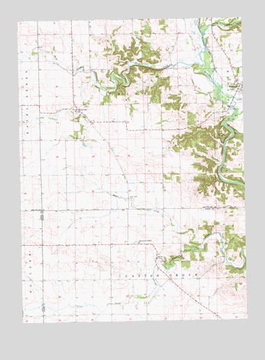
Hopkinton West, IA USGS Topographic Map
Click on map above to begin viewing in our Map Viewer.

This topographic map contains these locations and features:
Feature Name Type Latitude Longitude GNIS ID View Map
ArgandPopulated PlaceN42.2817°W91.3454°464189View Map
Argand Post Office (historical)Post OfficeN42.2817°W91.3113°2001802View Map
Argland (historical)LocaleN42.2828°W91.2752°466164View Map
Bell CreekStreamN42.3350°W91.2551°454491View Map
Boulder Post Office (historical)Post OfficeN42.2528°W91.3696°2046624View Map
Buck CreekPopulated PlaceN42.3372°W91.3421°454914View Map
Buck CreekStreamN42.3567°W91.2713°454922View Map
Buck Creek CemeteryCemeteryN42.3364°W91.3425°2000004View Map
Castle GrovePopulated PlaceN42.2606°W91.3168°464190View Map
Castle Grove Baptist CemeteryCemeteryN42.2668°W91.2927°2001884View Map
Castle Grove Catholic CemeteryCemeteryN42.2826°W91.3103°2001885View Map
Downersville Post Office (historical)Post OfficeN42.2611°W91.2849°2001801View Map
Grove CreekStreamN42.2819°W91.2743°457163View Map
Grove Creek CemeteryCemeteryN42.3013°W91.3147°457164View Map
Grove Creek Post Office (historical)Post OfficeN42.3000°W91.3154°1999875View Map
Hard Scrabble County ParkParkN42.3242°W91.2618°457243View Map
Hopkinton Wastewater PlantLocaleN42.3403°W91.2508°2728358View Map
Immaculate Conception ChurchChurchN42.2822°W91.3099°457755View Map
Lime CreekStreamN42.3489°W91.3318°458347View Map
Plum CreekStreamN42.3675°W91.2721°460330View Map
Sand CreekStreamN42.3461°W91.2621°461396View Map
Township of Castle GroveCivilN42.2527°W91.3053°467547View Map
Township of UnionCivilN42.3397°W91.3150°468818View Map
UniontownLocaleN42.3622°W91.3549°466227View Map
Uniontown Post Office (historical)Post OfficeN42.3500°W91.3043°1999885View Map

Note: Coordinates in the location and feature list above are referenced to NAD83 datum.


Copyright (C) 2008-2024 Ryan Niemi / Sunset Dynamics ... All Rights Reserved