TopoQuest Logo
Do you find TopoQuest useful?
Help keep TopoQuest running and adding new maps/features by donating!
Bitcoin:  19c7KJd3qBynnjoSw5npx9KScwjBe4ifkT
Litecoin:  LXs6TkuXGGXo1vDsWCkWVdjQX94eUKd6ui
Home View Maps Find Maps Find Places Resources & Links


Big Bend, Michigan Topographic Map

USGS Map Title: Big Bend, MI
USGS Map MRC: 43085E5
DRG (GeoTIFF) Download: o43085e5.tif


Neighboring USGS Topographic Map Quads:


  Woodville, MI  
43085F6
 

  Woodville NE, MI  
43085F5
 

  Big Rapids, MI  
43085F4
 

  Big Prairie, MI  
43085E6
 

  Big Bend, MI  
43085E5
 

  Stanwood, MI  
43085E4
 

  Croton, MI  
43085D6
 

  Tift Corner, MI  
43085D5
 

  Howard City, MI  
43085D4


Map MRC Location:

N44°
W86°
N44°
W85°
H8 H7 H6 H5 H4 H3 H2 H1
G8 G7 G6 G5 G4 G3 G2 G1
F8 F7 F6 F5 F4 F3 F2 F1
E8 E7 E6 E5 E4 E3 E2 E1
D8 D7 D6 D5 D4 D3 D2 D1
C8 C7 C6 C5 C4 C3 C2 C1
B8 B7 B6 B5 B4 B3 B2 B1
A8 A7 A6 A5 A4 A3 A2 A1
N43°
W86°
N43°
W85°

Big Bend, MI USGS 1:24K Topographic Map Preview:
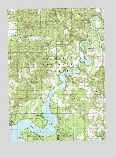
Big Bend, MI USGS Topographic Map
Click on map above to begin viewing in our Map Viewer.

This topographic map contains these locations and features:
Feature Name Type Latitude Longitude GNIS ID View Map
Bennett CreekStreamN43.5656°W85.5409°1619163View Map
Betts CreekStreamN43.5947°W85.5259°1619178View Map
Big BendPopulated PlaceN43.5236°W85.5828°1619185View Map
Big Bend Township ParkParkN43.5217°W85.5806°2542011View Map
Big Prairie Township ParkParkN43.5217°W85.5798°1622469View Map
Brady LakeLakeN43.5017°W85.5107°1619301View Map
Breezy Knoll ParkParkN43.5167°W85.6220°1622470View Map
Brower ParkParkN43.5569°W85.5494°2106680View Map
Carey LakeLakeN43.5728°W85.5975°1619423View Map
Davis Park BridgeParkN43.5889°W85.5264°2518978View Map
Fairview CemeteryCemeteryN43.5892°W85.5337°1619885View Map
Goodwell CemeteryCemeteryN43.5992°W85.6237°626954View Map
Hardy Dam PondReservoirN43.5106°W85.5889°1620127View Map
Hartman LakeLakeN43.5376°W85.5048°627887View Map
Hodgers CreekStreamN43.5653°W85.5317°1622802View Map
Laverne CreekStreamN43.5578°W85.5512°1622474View Map
Lee LakeLakeN43.5882°W85.5755°1622473View Map
Linn CreekStreamN43.5209°W85.6084°1617069View Map
Little Bear CreekStreamN43.5747°W85.5511°2375089View Map
Mast LakeLakeN43.5663°W85.6095°631724View Map
Mud LakeLakeN43.5979°W85.6066°1622472View Map
Nelson LakeLakeN43.5455°W85.5129°1622475View Map
Newaygo State ParkParkN43.5025°W85.5917°1622803View Map
Newaygo State Park Rustic CampgroundLocaleN43.5050°W85.5894°2542013View Map
Oxbow ParkPopulated PlaceN43.5072°W85.6020°634264View Map
Pearson LakeLakeN43.6001°W85.6173°1621179View Map
Pickerel LakeLakeN43.5985°W85.5972°634788View Map
Rosy RunStreamN43.5097°W85.5642°1621441View Map
Round LakeLakeN43.5719°W85.5938°636296View Map
Saint Peters CemeteryCemeteryN43.5697°W85.5100°1621491View Map
South Mitchell CreekStreamN43.5314°W85.5728°638390View Map
Thumser CreekStreamN43.5370°W85.5798°1622471View Map
Township of AetnaCivilN43.5115°W85.5028°1625805View Map
Township of Big PrairieCivilN43.5118°W85.6225°1625933View Map
Township of GoodwellCivilN43.5987°W85.6220°1626364View Map
Township of MecostaCivilN43.5985°W85.5030°1626716View Map
West Aetna CemeteryCemeteryN43.5358°W85.5620°1622087View Map

Note: Coordinates in the location and feature list above are referenced to NAD83 datum.


Copyright (C) 2008-2024 Ryan Niemi / Sunset Dynamics ... All Rights Reserved