TopoQuest Logo
Do you find TopoQuest useful?
Help keep TopoQuest running and adding new maps/features by donating!
Bitcoin:  19c7KJd3qBynnjoSw5npx9KScwjBe4ifkT
Litecoin:  LXs6TkuXGGXo1vDsWCkWVdjQX94eUKd6ui
Home View Maps Find Maps Find Places Resources & Links


Stanwood, Michigan Topographic Map

USGS Map Title: Stanwood, MI
USGS Map MRC: 43085E4
DRG (GeoTIFF) Download: o43085e4.tif


Neighboring USGS Topographic Map Quads:


  Woodville NE, MI  
43085F5
 

  Big Rapids, MI  
43085F4
 

  Chippewa Lake South, MI  
43085F3
 

  Big Bend, MI  
43085E5
 

  Stanwood, MI  
43085E4
 

  Altona, MI  
43085E3
 

  Tift Corner, MI  
43085D5
 

  Howard City, MI  
43085D4
 

  Lakeview, MI  
43085D3


Map MRC Location:

N44°
W86°
N44°
W85°
H8 H7 H6 H5 H4 H3 H2 H1
G8 G7 G6 G5 G4 G3 G2 G1
F8 F7 F6 F5 F4 F3 F2 F1
E8 E7 E6 E5 E4 E3 E2 E1
D8 D7 D6 D5 D4 D3 D2 D1
C8 C7 C6 C5 C4 C3 C2 C1
B8 B7 B6 B5 B4 B3 B2 B1
A8 A7 A6 A5 A4 A3 A2 A1
N43°
W86°
N43°
W85°

Stanwood, MI USGS 1:24K Topographic Map Preview:
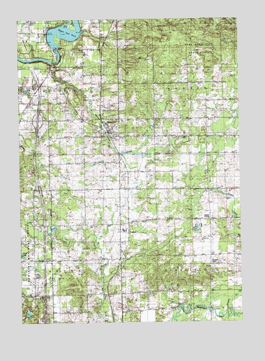
Stanwood, MI USGS Topographic Map
Click on map above to begin viewing in our Map Viewer.

This topographic map contains these locations and features:
Feature Name Type Latitude Longitude GNIS ID View Map
BorlandPopulated PlaceN43.5370°W85.4392°1619286View Map
Borland Post Office (historical)Post OfficeN43.5369°W85.4392°2518859View Map
Borland Station (historical)LocaleN43.5383°W85.4383°2518833View Map
Cain FieldAirportN43.5961°W85.4934°1624171View Map
Cold Spring CreekStreamN43.6231°W85.4714°1619549View Map
Doyle LakeLakeN43.5279°W85.4999°1619758View Map
Green SchoolSchoolN43.5259°W85.4928°1620078View Map
Higbee CemeteryCemeteryN43.5394°W85.3931°2519050View Map
Higbee CornerPopulated PlaceN43.5422°W85.3925°1620197View Map
Holt CemeteryCemeteryN43.5131°W85.4334°1620230View Map
Interchange 131CrossingN43.5836°W85.4889°2541727View Map
Ladner CemeteryCemeteryN43.6206°W85.4920°1620468View Map
Ladner CreekStreamN43.6092°W85.4920°1620469View Map
Macks CreekStreamN43.5697°W85.4425°1620663View Map
Macks CreekStreamN43.6067°W85.4798°1620664View Map
Mecosta - Austin Fire DepartmentBuildingN43.5836°W85.4670°2518865View Map
Mecosta Lookout TowerTowerN43.6228°W85.3959°1623511View Map
Morley Stanwood High SchoolSchoolN43.5383°W85.4417°2519016View Map
Morley Stanwood Middle SchoolSchoolN43.5394°W85.4417°2519015View Map
Northland United Methodist ChurchChurchN43.5822°W85.4597°2518867View Map
Quigley CemeteryCemeteryN43.5536°W85.3931°1621327View Map
Quigley CreekStreamN43.5034°W85.3845°1621328View Map
Rogers DamDamN43.6136°W85.4792°1621424View Map
Rogers Dam PondReservoirN43.6192°W85.4719°1621425View Map
Rogers Heights Christian ChurchChurchN43.6231°W85.4819°2518886View Map
Saint Thomas Lutheran ChurchChurchN43.5889°W85.4683°2518866View Map
StanwoodPopulated PlaceN43.5786°W85.4492°1621761View Map
Stanwood Elementary SchoolSchoolN43.5819°W85.4506°2518863View Map
Stanwood Free Methodist ChurchChurchN43.5764°W85.4475°2518868View Map
Stanwood Post OfficePost OfficeN43.5944°W85.4736°2518864View Map
Stanwood Station (historical)LocaleN43.5783°W85.4500°2518862View Map
Township of AustinCivilN43.5979°W85.3837°1625867View Map
Township of DeerfieldCivilN43.5115°W85.3835°1626172View Map
Village of StanwoodCivilN43.5805°W85.4481°2399887View Map
Walton Erickson Public LibrarySchoolN43.5394°W85.4417°2519014View Map
WWTG-AM (Stanwood)TowerN43.6220°W85.4598°1625313View Map

Note: Coordinates in the location and feature list above are referenced to NAD83 datum.


Copyright (C) 2008-2024 Ryan Niemi / Sunset Dynamics ... All Rights Reserved