TopoQuest Logo
Do you find TopoQuest useful?
Help keep TopoQuest running and adding new maps/features by donating!
Bitcoin:  19c7KJd3qBynnjoSw5npx9KScwjBe4ifkT
Litecoin:  LXs6TkuXGGXo1vDsWCkWVdjQX94eUKd6ui
Home View Maps Find Maps Find Places Resources & Links


Preston, Missouri Topographic Map

USGS Map Title: Preston, MO
USGS Map MRC: 37093H2
DRG (GeoTIFF) Download: o37093h2.tif


Neighboring USGS Topographic Map Quads:


  Fristoe, MO  
38093A3
 

  Cross Timbers, MO  
38093A2
 

  Climax Springs, MO  
38093A1
 

  Hermitage, MO  
37093H3
 

  Preston, MO  
37093H2
 

  Branch, MO  
37093H1
 

  Sentinel, MO  
37093G3
 

  Urbana, MO  
37093G2
 

  Tunas, MO  
37093G1


Map MRC Location:

N38°
W94°
N38°
W93°
H8 H7 H6 H5 H4 H3 H2 H1
G8 G7 G6 G5 G4 G3 G2 G1
F8 F7 F6 F5 F4 F3 F2 F1
E8 E7 E6 E5 E4 E3 E2 E1
D8 D7 D6 D5 D4 D3 D2 D1
C8 C7 C6 C5 C4 C3 C2 C1
B8 B7 B6 B5 B4 B3 B2 B1
A8 A7 A6 A5 A4 A3 A2 A1
N37°
W94°
N37°
W93°

Preston, MO USGS 1:24K Topographic Map Preview:
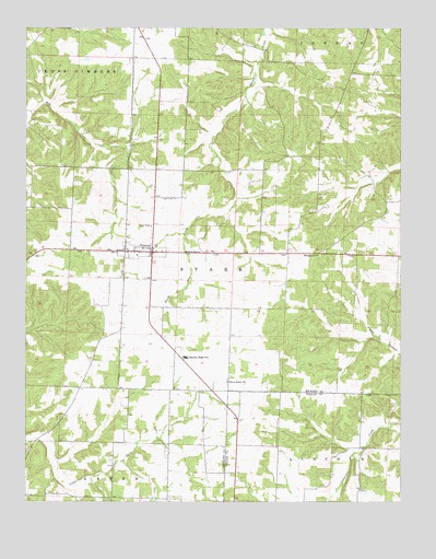
Preston, MO USGS Topographic Map
Click on map above to begin viewing in our Map Viewer.

This topographic map contains these locations and features:
Feature Name Type Latitude Longitude GNIS ID View Map
Browder School (historical)SchoolN37.9173°W93.2260°745337View Map
Cahoochie AirportAirportN37.8879°W93.1313°758972View Map
Fisher CemeteryCemeteryN37.9550°W93.1999°717952View Map
Lakes Country Planning RegionCivilN37.8753°W93.1253°754107View Map
Lone Spring (historical)LocaleN37.9067°W93.1844°744863View Map
Morgan SchoolSchoolN37.9400°W93.1527°722620View Map
New Haven School (historical)SchoolN37.9717°W93.2058°745336View Map
Olive Point CemeteryCemeteryN37.9071°W93.1830°2702288View Map
Olive Point ChurchChurchN37.9067°W93.1827°723809View Map
Olive Point School (historical)SchoolN37.9223°W93.1421°745335View Map
Pleasant Valley School (historical)SchoolN37.8792°W93.1919°745334View Map
PrestonPopulated PlaceN37.9409°W93.2077°729805View Map
Preston Area Volunteer Fire DepartmentBuildingN37.9408°W93.2095°2620941View Map
Preston Post OfficePost OfficeN37.9410°W93.2161°2782764View Map
Skyline High SchoolSchoolN37.9131°W93.1969°726520View Map
Township of StarkCivilN37.9421°W93.1615°766757View Map
Village of PrestonCivilN37.9410°W93.2127°2396866View Map

Note: Coordinates in the location and feature list above are referenced to NAD83 datum.


Copyright (C) 2008-2025 Ryan Niemi / Sunset Dynamics ... All Rights Reserved