TopoQuest Logo
Do you find TopoQuest useful?
Help keep TopoQuest running and adding new maps/features by donating!
Bitcoin:  19c7KJd3qBynnjoSw5npx9KScwjBe4ifkT
Litecoin:  LXs6TkuXGGXo1vDsWCkWVdjQX94eUKd6ui
Home View Maps Find Maps Find Places Resources & Links


Cross Timbers, Missouri Topographic Map

USGS Map Title: Cross Timbers, MO
USGS Map MRC: 38093A2
DRG (GeoTIFF) Download: o38093a2.tif


Neighboring USGS Topographic Map Quads:


  Warsaw East, MO  
38093B3
 

  Edwards, MO  
38093B2
 

  Knobby, MO  
38093B1
 

  Fristoe, MO  
38093A3
 

  Cross Timbers, MO  
38093A2
 

  Climax Springs, MO  
38093A1
 

  Hermitage, MO  
37093H3
 

  Preston, MO  
37093H2
 

  Branch, MO  
37093H1


Map MRC Location:

N39°
W94°
N39°
W93°
H8 H7 H6 H5 H4 H3 H2 H1
G8 G7 G6 G5 G4 G3 G2 G1
F8 F7 F6 F5 F4 F3 F2 F1
E8 E7 E6 E5 E4 E3 E2 E1
D8 D7 D6 D5 D4 D3 D2 D1
C8 C7 C6 C5 C4 C3 C2 C1
B8 B7 B6 B5 B4 B3 B2 B1
A8 A7 A6 A5 A4 A3 A2 A1
N38°
W94°
N38°
W93°

Cross Timbers, MO USGS 1:24K Topographic Map Preview:
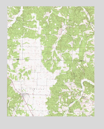
Cross Timbers, MO USGS Topographic Map
Click on map above to begin viewing in our Map Viewer.

This topographic map contains these locations and features:
Feature Name Type Latitude Longitude GNIS ID View Map
Antioch School (historical)SchoolN38.0873°W93.1463°745401View Map
Bethel Campground CemeteryCemeteryN38.1083°W93.1621°2681301View Map
Bethel ChurchChurchN38.1089°W93.1621°714053View Map
City of Cross TimbersCivilN38.0243°W93.2294°2393680View Map
Cross TimbersPopulated PlaceN38.0248°W93.2269°716530View Map
Cross Timbers Area Rural Fire DepartmentBuildingN38.0247°W93.2298°2620982View Map
Cross Timbers Post OfficePost OfficeN38.0242°W93.2278°2782997View Map
Davis CemeteryCemeteryN38.0725°W93.2010°716718View Map
Davis School (historical)SchoolN38.0900°W93.2038°745400View Map
Fairview CemeteryCemeteryN38.0010°W93.1326°2702287View Map
Fairview ChurchChurchN38.0014°W93.1330°717782View Map
Fristoe BranchStreamN38.1109°W93.2377°718255View Map
Guier CemeteryCemeteryN38.0309°W93.1896°1946381View Map
Hazel Valley School (historical)SchoolN38.0223°W93.1421°745329View Map
Indian CreekStreamN38.1061°W93.1308°720120View Map
JordanPopulated PlaceN38.0214°W93.1413°740974View Map
Kugler Lake DamDamN38.0417°W93.2169°765432View Map
Lake Glenwood in Hidden ValleyReservoirN38.0600°W93.1485°765431View Map
North Star School (historical)SchoolN38.1228°W93.1946°745399View Map
Owsley School (historical)SchoolN38.0384°W93.1655°745330View Map
Sugar CreekStreamN38.0978°W93.1696°727220View Map
Talbot DamDamN38.0600°W93.1485°765430View Map
Township of Cross TimbersCivilN38.0206°W93.2500°766753View Map

Note: Coordinates in the location and feature list above are referenced to NAD83 datum.


Copyright (C) 2008-2025 Ryan Niemi / Sunset Dynamics ... All Rights Reserved