TopoQuest Logo
Do you find TopoQuest useful?
Help keep TopoQuest running and adding new maps/features by donating!
Bitcoin:  19c7KJd3qBynnjoSw5npx9KScwjBe4ifkT
Litecoin:  LXs6TkuXGGXo1vDsWCkWVdjQX94eUKd6ui
Home View Maps Find Maps Find Places Resources & Links


Prichard, Idaho Topographic Map

USGS Map Title: Prichard, ID
USGS Map MRC: 47115F8
DRG (GeoTIFF) Download: o47115f8.tif


Neighboring USGS Topographic Map Quads:


  Pond Peak, ID  
47116G1
 

  Taylor Peak, ID  
47115G8
 

  Bloom Peak, MT  
47115G7
 

  Grizzly Mountain, ID  
47116F1
 

  Prichard, ID  
47115F8
 

  Murray, ID  
47115F7
 

  Kellogg East, ID  
47116E1
 

  Osburn, ID  
47115E8
 

  Burke, ID  
47115E7


Map MRC Location:

N48°
W116°
N48°
W115°
H8 H7 H6 H5 H4 H3 H2 H1
G8 G7 G6 G5 G4 G3 G2 G1
F8 F7 F6 F5 F4 F3 F2 F1
E8 E7 E6 E5 E4 E3 E2 E1
D8 D7 D6 D5 D4 D3 D2 D1
C8 C7 C6 C5 C4 C3 C2 C1
B8 B7 B6 B5 B4 B3 B2 B1
A8 A7 A6 A5 A4 A3 A2 A1
N47°
W116°
N47°
W115°

Prichard, ID USGS 1:24K Topographic Map Preview:
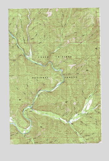
Prichard, ID USGS Topographic Map
Click on map above to begin viewing in our Map Viewer.

This topographic map contains these locations and features:
Feature Name Type Latitude Longitude GNIS ID View Map
Accident GulchValleyN47.6280°W115.8982°376461View Map
Avery CreekStreamN47.6874°W115.9282°376782View Map
Avery Creek Nocelly Gulch SaddleGapN47.6830°W115.9071°394178View Map
Avery Creek Picnic AreaLocaleN47.6877°W115.9268°394177View Map
Avery SaddleGapN47.6896°W115.8946°395064View Map
Babins JunctionLocaleN47.6399°W115.9793°393860View Map
Beaver CreekStreamN47.6341°W115.9818°377256View Map
Bedrock GulchValleyN47.6546°W115.8843°377305View Map
Bobtail PeakSummitN47.7124°W115.8791°377983View Map
Bridge CreekStreamN47.7219°W115.9727°378221View Map
Carpenter GulchValleyN47.6355°W115.9879°378948View Map
Clee CreekStreamN47.6921°W115.9318°379408View Map
Creaky CreekStreamN47.6680°W115.9652°380055View Map
Daisy GulchValleyN47.6463°W115.9049°380218View Map
Dam CreekStreamN47.7380°W115.9702°380226View Map
EaglePopulated PlaceN47.6435°W115.9179°396428View Map
Eagle CreekStreamN47.6441°W115.9216°380978View Map
East Fork Eagle CreekStreamN47.6521°W115.9041°381087View Map
East Fork Lost CreekStreamN47.7130°W115.9316°381128View Map
Fancy GulchValleyN47.6502°W115.8985°381591View Map
George GulchValleyN47.6491°W115.9288°382244View Map
Hat CreekStreamN47.7202°W115.9282°382804View Map
Hutchins GulchValleyN47.6260°W115.9652°383579View Map
Jack CreekStreamN47.7252°W115.9977°383804View Map
Jupiter CreekStreamN47.7230°W115.9918°384082View Map
Keller CreekStreamN47.7180°W115.9888°400191View Map
Kings PointSummitN47.6405°W115.9516°395556View Map
Loading CreekStreamN47.7166°W115.9713°385018View Map
Lost CreekStreamN47.7002°W115.9446°399966View Map
Lost Creek RidgeRidgeN47.7296°W115.8888°395652View Map
McComber GulchValleyN47.6302°W115.9038°386345View Map
Nocelly GulchValleyN47.6655°W115.8963°387602View Map
North Fork Avery CreekStreamN47.6899°W115.9104°393865View Map
Perry GulchValleyN47.6327°W115.9032°388351View Map
Plover CreekStreamN47.7283°W115.9746°388609View Map
PrichardPopulated PlaceN47.6563°W115.9763°374535View Map
Prichard / Murray Volunteer Fire DepartmentBuildingN47.6397°W115.9813°2619294View Map
Prichard CreekStreamN47.6577°W115.9754°388874View Map
Prichard PeakSummitN47.6635°W115.9277°388876View Map
Ratail GulchValleyN47.6452°W115.8832°389120View Map
Rock GulchValleyN47.6280°W115.9718°389513View Map
Ruby GulchValleyN47.6441°W115.8774°389706View Map
Shehee GulchValleyN47.6296°W115.9666°390275View Map
Short CreekStreamN47.6738°W115.9499°390355View Map
Shoshone Camp Work CenterLocaleN47.7074°W115.9710°394176View Map
Shoshone CreekStreamN47.7024°W115.9718°390376View Map
Shoshone Creek Guard StationLocaleN47.7058°W115.9702°399196View Map
Shoshone Forest CampLocaleN47.7063°W115.9732°390378View Map
Sparta PeakSummitN47.6635°W115.9838°395975View Map
Stack CreekStreamN47.7291°W115.9277°391327View Map
Trouble CreekStreamN47.6652°W115.9671°392407View Map
Ucelly GulchValleyN47.6521°W115.9099°392593View Map
Uranus CreekStreamN47.7077°W115.9793°392666View Map
West Fork Eagle CreekStreamN47.6519°W115.9041°393091View Map

Note: Coordinates in the location and feature list above are referenced to NAD83 datum.


Copyright (C) 2008-2025 Ryan Niemi / Sunset Dynamics ... All Rights Reserved