TopoQuest Logo
Do you find TopoQuest useful?
Help keep TopoQuest running and adding new maps/features by donating!
Bitcoin:  19c7KJd3qBynnjoSw5npx9KScwjBe4ifkT
Litecoin:  LXs6TkuXGGXo1vDsWCkWVdjQX94eUKd6ui
Home View Maps Find Maps Find Places Resources & Links


Burke, Idaho Topographic Map

USGS Map Title: Burke, ID
USGS Map MRC: 47115E7
DRG (GeoTIFF) Download: o47115e7.tif


Neighboring USGS Topographic Map Quads:


  Prichard, ID  
47115F8
 

  Murray, ID  
47115F7
 

  Black Peak, MT  
47115F6
 

  Osburn, ID  
47115E8
 

  Burke, ID  
47115E7
 

  Thompson Pass, MT  
47115E6
 

  Wallace, ID  
47115D8
 

  Mullan, ID  
47115D7
 

  Lookout Pass, MT  
47115D6


Map MRC Location:

N48°
W116°
N48°
W115°
H8 H7 H6 H5 H4 H3 H2 H1
G8 G7 G6 G5 G4 G3 G2 G1
F8 F7 F6 F5 F4 F3 F2 F1
E8 E7 E6 E5 E4 E3 E2 E1
D8 D7 D6 D5 D4 D3 D2 D1
C8 C7 C6 C5 C4 C3 C2 C1
B8 B7 B6 B5 B4 B3 B2 B1
A8 A7 A6 A5 A4 A3 A2 A1
N47°
W116°
N47°
W115°

Burke, ID USGS 1:24K Topographic Map Preview:
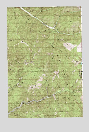
Burke, ID USGS Topographic Map
Click on map above to begin viewing in our Map Viewer.

This topographic map contains these locations and features:
Feature Name Type Latitude Longitude GNIS ID View Map
Barton GulchValleyN47.5949°W115.7924°376992View Map
Bear GulchValleyN47.6013°W115.7968°377155View Map
Bell GulchValleyN47.5069°W115.8665°377323View Map
Black BearPopulated PlaceN47.5160°W115.8524°396130View Map
BurkePopulated PlaceN47.5202°W115.8202°396196View Map
Butte GulchValleyN47.6135°W115.8263°378606View Map
Cement GulchValleyN47.5933°W115.7679°379122View Map
CornwallPopulated PlaceN47.5185°W115.8377°394151View Map
Cougar GulchValleyN47.6235°W115.8477°379900View Map
Custer MineMineN47.5355°W115.8460°380191View Map
Custer PeakSummitN47.5338°W115.8371°380193View Map
Dry Butte GulchValleyN47.6208°W115.8168°380780View Map
East Grouse PeakSummitN47.5063°W115.7818°396434View Map
French GulchValleyN47.5302°W115.7874°382066View Map
FriscoPopulated PlaceN47.5122°W115.8593°396518View Map
Frisco MineMineN47.5102°W115.8543°382088View Map
Fulkerson PeakSummitN47.5958°W115.8599°393900View Map
GemPopulated PlaceN47.5083°W115.8679°396538View Map
Gold RunStreamN47.6244°W115.8521°382397View Map
Golden Chest MineMineN47.6169°W115.8346°382409View Map
Goose PeakSummitN47.5627°W115.8438°394155View Map
Gorge GulchValleyN47.5244°W115.8093°382457View Map
Granite GulchValleyN47.5944°W115.7963°382537View Map
Granite MineMineN47.5247°W115.8743°382540View Map
Granite PeakSummitN47.5627°W115.7604°382551View Map
Grouse PeakSummitN47.5055°W115.8096°394152View Map
Hecla MineMineN47.5197°W115.8146°396640View Map
Hercules MineMineN47.5424°W115.8099°383112View Map
Humboldt GulchValleyN47.5319°W115.7777°383533View Map
Idaho GulchValleyN47.6094°W115.8238°383604View Map
Interstate MineMineN47.5472°W115.8504°394150View Map
LittlefieldLocaleN47.6122°W115.8268°385001View Map
MacePopulated PlaceN47.5183°W115.8221°396831View Map
Military GulchValleyN47.5272°W115.7663°386902View Map
Monarch GulchValleyN47.5933°W115.7571°400002View Map
Monarch MineMineN47.5847°W115.7749°387081View Map
Moonshine GulchValleyN47.5805°W115.7985°387144View Map
Murray CemeteryCemeteryN47.6235°W115.8643°400527View Map
O'Neill GulchValleyN47.5219°W115.8077°387906View Map
Ophir GulchValleyN47.6130°W115.8332°387979View Map
Paragon GulchValleyN47.5972°W115.7504°374316View Map
Pony PeakSummitN47.5863°W115.8513°388734View Map
Rabbit GulchValleyN47.5305°W115.7707°389008View Map
RavenLocaleN47.5997°W115.7943°389168View Map
Raven GulchValleyN47.5977°W115.7924°394149View Map
Reeder GulchValleyN47.6183°W115.8354°389267View Map
Revett LakeLakeN47.5609°W115.7510°389319View Map
Round TopSummitN47.6074°W115.7704°397117View Map
Sawmill GulchValleyN47.5263°W115.7935°389976View Map
Silvertip MineMineN47.5647°W115.8393°394148View Map
Sixteen-to-One MineMineN47.5377°W115.8729°390503View Map
Sonora GulchValleyN47.5263°W115.7874°390834View Map
Standard Mammoth MineMineN47.5194°W115.8490°391334View Map
SullivanLocaleN47.5947°W115.7585°391593View Map
Sunset (historical)Populated PlaceN47.5624°W115.8354°399202View Map
Sunset MineMineN47.5591°W115.8366°391666View Map
Sunset PeakSummitN47.5633°W115.8346°391670View Map
Tamarack SaddleGapN47.5566°W115.8257°394156View Map
Tiger GulchValleyN47.6233°W115.8632°392131View Map
Tiger PeakSummitN47.5363°W115.8316°392132View Map
Tiger-Poorman MineMineN47.5241°W115.8343°392133View Map
Vendetta GulchValleyN47.5969°W115.7988°392717View Map
Wesp GulchValleyN47.6210°W115.8402°393008View Map
West Fork Prichard CreekStreamN47.5983°W115.7938°393174View Map
Wilson CreekStreamN47.5399°W115.8571°399659View Map

Note: Coordinates in the location and feature list above are referenced to NAD83 datum.


Copyright (C) 2008-2024 Ryan Niemi / Sunset Dynamics ... All Rights Reserved