TopoQuest Logo
Do you find TopoQuest useful?
Help keep TopoQuest running and adding new maps/features by donating!
Bitcoin:  19c7KJd3qBynnjoSw5npx9KScwjBe4ifkT
Litecoin:  LXs6TkuXGGXo1vDsWCkWVdjQX94eUKd6ui
Home View Maps Find Maps Find Places Resources & Links


Priday Reservoir, Oregon Topographic Map

USGS Map Title: Priday Reservoir, OR
USGS Map MRC: 42119C8
DRG (GeoTIFF) Download: o42119c8.tif


Neighboring USGS Topographic Map Quads:


  Drake Peak NE, OR  
42120D1
 

  Plush, OR  
42119D8
 

  Hart Lake, OR  
42119D7
 

  Drake Peak, OR  
42120C1
 

  Priday Reservoir, OR  
42119C8
 

  Crump Lake, OR  
42119C7
 

  Sage Hen Butte, OR  
42120B1
 

  Adel, OR  
42119B8
 

  Calderwood Reservoir, OR  
42119B7


Map MRC Location:

N43°
W120°
N43°
W119°
H8 H7 H6 H5 H4 H3 H2 H1
G8 G7 G6 G5 G4 G3 G2 G1
F8 F7 F6 F5 F4 F3 F2 F1
E8 E7 E6 E5 E4 E3 E2 E1
D8 D7 D6 D5 D4 D3 D2 D1
C8 C7 C6 C5 C4 C3 C2 C1
B8 B7 B6 B5 B4 B3 B2 B1
A8 A7 A6 A5 A4 A3 A2 A1
N42°
W120°
N42°
W119°

Priday Reservoir, OR USGS 1:24K Topographic Map Preview:
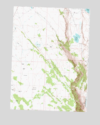
Priday Reservoir, OR USGS Topographic Map
Click on map above to begin viewing in our Map Viewer.

This topographic map contains these locations and features:
Feature Name Type Latitude Longitude GNIS ID View Map
Antelope SpringSpringN42.2994°W119.9819°1116992View Map
Anthony SpringsSpringN42.2748°W119.9662°1117010View Map
Ballet SpringSpringN42.2769°W119.9642°1117207View Map
Ballew LakeFlatN42.2741°W119.9944°1117208View Map
Ballew Lake SpringSpringN42.2722°W119.9876°1117209View Map
Ballew ReservoirReservoirN42.2888°W119.9941°1158714View Map
Barry RanchLocaleN42.3693°W119.9005°1117269View Map
Boulder WaterholeReservoirN42.3047°W119.9649°1131203View Map
Bull LakeReservoirN42.3294°W119.9580°1118285View Map
Cleland SpringSpringN42.2922°W119.9152°1119011View Map
Cox SpringSpringN42.3023°W119.9313°1119447View Map
Crump Lake LandingLocaleN42.2680°W119.8768°2700207View Map
Elmers WaterholeLakeN42.3318°W119.9525°1131099View Map
Fang SpringSpringN42.3027°W119.9219°1131101View Map
Finucane SpringSpringN42.3054°W119.9797°1120724View Map
Fish CreekStreamN42.3354°W119.8977°1120753View Map
Fish LakeLakeN42.3738°W119.9707°1120765View Map
Good Seep WaterholeReservoirN42.3042°W119.9343°1131100View Map
Horn SpringSpringN42.2919°W119.9801°1121984View Map
Lassie WaterholeReservoirN42.2552°W119.9195°1131201View Map
Lynch SpringSpringN42.3273°W119.9390°1123631View Map
Monument FlatFlatN42.2888°W119.9288°1158722View Map
Noonan SpringsSpringN42.2604°W119.9914°1124708View Map
Priday ReservoirReservoirN42.3391°W119.8953°1125665View Map
Sidewinder WaterholeReservoirN42.2671°W119.9144°1131202View Map
Wickiup ReservoirReservoirN42.2721°W119.9566°1131102View Map

Note: Coordinates in the location and feature list above are referenced to NAD83 datum.


Copyright (C) 2008-2025 Ryan Niemi / Sunset Dynamics ... All Rights Reserved