TopoQuest Logo
Do you find TopoQuest useful?
Help keep TopoQuest running and adding new maps/features by donating!
Bitcoin:  19c7KJd3qBynnjoSw5npx9KScwjBe4ifkT
Litecoin:  LXs6TkuXGGXo1vDsWCkWVdjQX94eUKd6ui
Home View Maps Find Maps Find Places Resources & Links


Drake Peak, Oregon Topographic Map

USGS Map Title: Drake Peak, OR
USGS Map MRC: 42120C1
DRG (GeoTIFF) Download: o42120c1.tif


Neighboring USGS Topographic Map Quads:


  Little Honey Creek, OR  
42120D2
 

  Drake Peak NE, OR  
42120D1
 

  Plush, OR  
42119D8
 

  Crook Peak, OR  
42120C2
 

  Drake Peak, OR  
42120C1
 

  Priday Reservoir, OR  
42119C8
 

  Horse Prairie, OR  
42120B2
 

  Sage Hen Butte, OR  
42120B1
 

  Adel, OR  
42119B8


Map MRC Location:

N43°
W121°
N43°
W120°
H8 H7 H6 H5 H4 H3 H2 H1
G8 G7 G6 G5 G4 G3 G2 G1
F8 F7 F6 F5 F4 F3 F2 F1
E8 E7 E6 E5 E4 E3 E2 E1
D8 D7 D6 D5 D4 D3 D2 D1
C8 C7 C6 C5 C4 C3 C2 C1
B8 B7 B6 B5 B4 B3 B2 B1
A8 A7 A6 A5 A4 A3 A2 A1
N42°
W121°
N42°
W120°

Drake Peak, OR USGS 1:24K Topographic Map Preview:
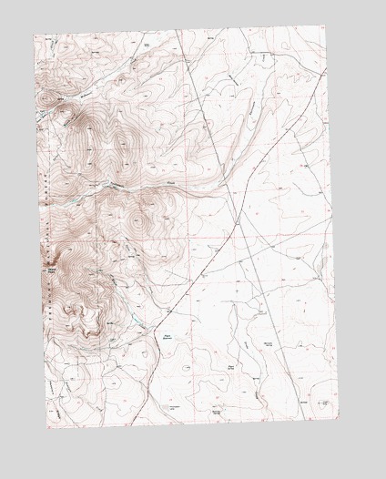
Drake Peak, OR USGS Topographic Map
Click on map above to begin viewing in our Map Viewer.

This topographic map contains these locations and features:
Feature Name Type Latitude Longitude GNIS ID View Map
Deboy RanchLocaleN42.3702°W120.0755°1140771View Map
Deboy ReservoirReservoirN42.3303°W120.0102°1153757View Map
Drake PeakSummitN42.3002°W120.1236°1141230View Map
Flynn DamDamN42.2779°W120.0699°1155568View Map
Flynn ReservoirReservoirN42.2777°W120.0733°1142281View Map
Flynn SpringSpringN42.2674°W120.0449°1142282View Map
Game ReservoirReservoirN42.2893°W120.0359°1153756View Map
Irish HillSummitN42.2552°W120.0080°1144106View Map
Mapes CreekStreamN42.2807°W120.0572°1145789View Map
North Fork McDowell CreekStreamN42.3502°W120.1219°1146977View Map
Obernolte SpringSpringN42.2744°W120.0280°1147131View Map
Peddlers RidgeRidgeN42.2557°W120.1225°1147557View Map
Road SpringsSpringN42.3599°W120.0412°1148511View Map
Roaring SpringSpringN42.2532°W120.0516°1148524View Map
Snipe CreekStreamN42.3552°W120.1063°1150568View Map
South Fork McDowell CreekStreamN42.3502°W120.1219°1149989View Map
State Game Reservoir Number TwoReservoirN42.3206°W120.0095°1158694View Map
Thompson LakeFlatN42.2552°W120.0744°1151109View Map
Vinyard CabinLocaleN42.2774°W120.0977°1151778View Map

Note: Coordinates in the location and feature list above are referenced to NAD83 datum.


Copyright (C) 2008-2025 Ryan Niemi / Sunset Dynamics ... All Rights Reserved