TopoQuest Logo
Do you find TopoQuest useful?
Help keep TopoQuest running and adding new maps/features by donating!
Bitcoin:  19c7KJd3qBynnjoSw5npx9KScwjBe4ifkT
Litecoin:  LXs6TkuXGGXo1vDsWCkWVdjQX94eUKd6ui
Home View Maps Find Maps Find Places Resources & Links


Pride, Louisiana Topographic Map

USGS Map Title: Pride, LA
USGS Map MRC: 30090F8
DRG (GeoTIFF) Download: o30090f8.tif


Neighboring USGS Topographic Map Quads:


  Clinton, LA  
30091G1
 

  Bluff Creek, LA  
30090G8
 

  Hatchersville, LA  
30090G7
 

  Fred, LA  
30091F1
 

  Pride, LA  
30090F8
 

  Pine Grove, LA  
30090F7
 

  Comite, LA  
30091E1
 

  Watson, LA  
30090E8
 

  Satsuma, LA  
30090E7


Map MRC Location:

N31°
W91°
N31°
W90°
H8 H7 H6 H5 H4 H3 H2 H1
G8 G7 G6 G5 G4 G3 G2 G1
F8 F7 F6 F5 F4 F3 F2 F1
E8 E7 E6 E5 E4 E3 E2 E1
D8 D7 D6 D5 D4 D3 D2 D1
C8 C7 C6 C5 C4 C3 C2 C1
B8 B7 B6 B5 B4 B3 B2 B1
A8 A7 A6 A5 A4 A3 A2 A1
N30°
W91°
N30°
W90°

Pride, LA USGS 1:24K Topographic Map Preview:
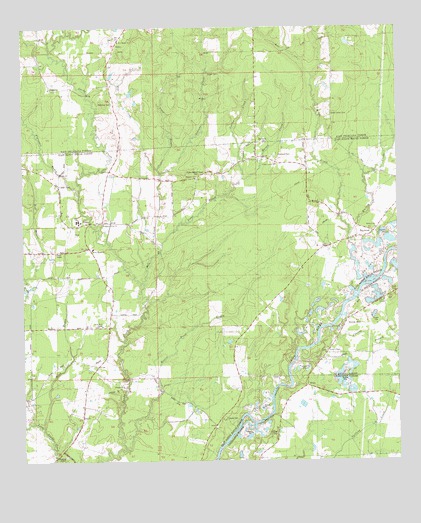
Pride, LA USGS Topographic Map
Click on map above to begin viewing in our Map Viewer.

This topographic map contains these locations and features:
Feature Name Type Latitude Longitude GNIS ID View Map
Andrew ChapelChurchN30.6713°W90.8798°1628713View Map
BaywoodPopulated PlaceN30.6910°W90.8832°542966View Map
Baywood ChurchChurchN30.7074°W90.9420°532815View Map
Baywood ParkParkN30.7130°W90.9154°542136View Map
Beaver Pond BayouStreamN30.6285°W90.9665°532862View Map
Bell CreekStreamN30.7366°W90.9034°532915View Map
Bethany ChurchChurchN30.6921°W90.8820°542137View Map
Cedar Grove ChurchChurchN30.7107°W90.9157°542138View Map
Chaney BranchStreamN30.6582°W90.9029°560399View Map
Cooper CemeteryCemeteryN30.7374°W90.9332°534120View Map
Cotton CreekStreamN30.7069°W90.9265°534161View Map
Craft CemeteryCemeteryN30.6741°W90.8754°560523View Map
Dennis MillsLocaleN30.6657°W90.8920°560621View Map
Drehr CemeteryCemeteryN30.7052°W90.9859°542139View Map
Duff BayouStreamN30.6782°W90.9993°534642View Map
Fairchild CemeteryCemeteryN30.7171°W90.9182°542127View Map
Flanagan BayouStreamN30.7035°W90.9809°534975View Map
Hanna CreekStreamN30.7066°W90.9265°535520View Map
Kidds CreekStreamN30.6894°W90.8909°554924View Map
Little Sandy CreekStreamN30.7482°W90.9845°555096View Map
Mahoney CemeteryCemeteryN30.7288°W90.9720°536850View Map
McCray CemeteryCemeteryN30.6330°W90.9159°542144View Map
McKnight CrossingPopulated PlaceN30.7474°W90.8965°541141View Map
Mill CreekStreamN30.6769°W90.9609°537108View Map
New Hope ChurchChurchN30.7463°W90.9676°542128View Map
New Zion ChurchChurchN30.7124°W90.9215°542140View Map
OaknoliaPopulated PlaceN30.7330°W90.9907°541157View Map
Oaknolia Post Office (historical)Post OfficeN30.7430°W90.9954°1631427View Map
Odom SchoolSchoolN30.6713°W90.8790°1627815View Map
Perkins CemeteryCemeteryN30.6907°W90.8782°538070View Map
PridePopulated PlaceN30.6938°W90.9782°543602View Map
Pride Lookout TowerTowerN30.7085°W90.9393°542141View Map
Pride Post OfficePost OfficeN30.6932°W90.9784°1632168View Map
Pride Volunteer Fire Department Station 10BuildingN30.6673°W90.9707°2332429View Map
Pride Volunteer Fire Department Station 12BuildingN30.6919°W90.8816°2332642View Map
Pride Ward ChapelChurchN30.6641°W90.9740°555726View Map
ReileyPopulated PlaceN30.7438°W90.9693°541172View Map
Reimer CrossingPopulated PlaceN30.7432°W90.9218°555790View Map
Salters ChapelChurchN30.6569°W90.8990°1628714View Map
Sandy Creek Baptist ChurchChurchN30.6863°W90.9768°555976View Map
Saulteis ChapelChurchN30.6569°W90.8987°1628177View Map
Scalous CreekStreamN30.7080°W90.9540°539204View Map
South Union CemeteryCemeteryN30.7252°W90.8976°542126View Map
South Union ChurchChurchN30.7246°W90.8973°539517View Map
Steep BayouStreamN30.7096°W90.9548°539648View Map
Stoner CemeteryCemeteryN30.6374°W90.9334°556149View Map
Stonypoint (historical)Populated PlaceN30.6355°W90.9362°557739View Map
Strangers Home ChurchChurchN30.6938°W90.9732°542142View Map
Taber CreekStreamN30.6874°W90.9543°539779View Map
WeissPopulated PlaceN30.6471°W90.9057°541210View Map
Whitten CreekStreamN30.6777°W90.8851°540388View Map
Wind BayouStreamN30.6346°W90.9940°540494View Map

Note: Coordinates in the location and feature list above are referenced to NAD83 datum.


Copyright (C) 2008-2025 Ryan Niemi / Sunset Dynamics ... All Rights Reserved