TopoQuest Logo
Do you find TopoQuest useful?
Help keep TopoQuest running and adding new maps/features by donating!
Bitcoin:  19c7KJd3qBynnjoSw5npx9KScwjBe4ifkT
Litecoin:  LXs6TkuXGGXo1vDsWCkWVdjQX94eUKd6ui
Home View Maps Find Maps Find Places Resources & Links


Satsuma, Louisiana Topographic Map

USGS Map Title: Satsuma, LA
USGS Map MRC: 30090E7
DRG (GeoTIFF) Download: o30090e7.tif


Neighboring USGS Topographic Map Quads:


  Pride, LA  
30090F8
 

  Pine Grove, LA  
30090F7
 

  Montpelier, LA  
30090F6
 

  Watson, LA  
30090E8
 

  Satsuma, LA  
30090E7
 

  Holden, LA  
30090E6
 

  Denham Springs, LA  
30090D8
 

  Walker, LA  
30090D7
 

  Frost, LA  
30090D6


Map MRC Location:

N31°
W91°
N31°
W90°
H8 H7 H6 H5 H4 H3 H2 H1
G8 G7 G6 G5 G4 G3 G2 G1
F8 F7 F6 F5 F4 F3 F2 F1
E8 E7 E6 E5 E4 E3 E2 E1
D8 D7 D6 D5 D4 D3 D2 D1
C8 C7 C6 C5 C4 C3 C2 C1
B8 B7 B6 B5 B4 B3 B2 B1
A8 A7 A6 A5 A4 A3 A2 A1
N30°
W91°
N30°
W90°

Satsuma, LA USGS 1:24K Topographic Map Preview:
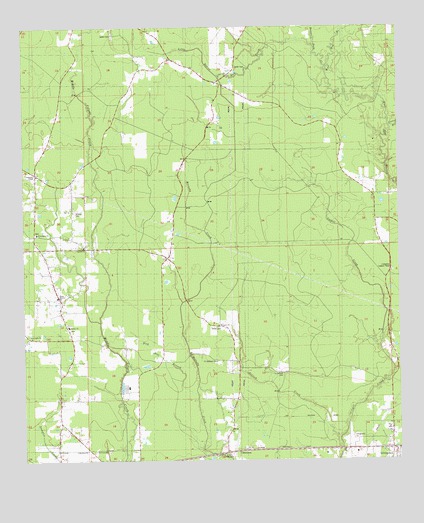
Satsuma, LA USGS Topographic Map
Click on map above to begin viewing in our Map Viewer.

This topographic map contains these locations and features:
Feature Name Type Latitude Longitude GNIS ID View Map
Antioch CreekStreamN30.5060°W90.7704°532194View Map
Beaver Dam CreekStreamN30.6127°W90.7740°560124View Map
Beech Ridge Baptist ChurchChurchN30.6011°W90.7886°2600577View Map
Carroll Baptist ChurchChurchN30.5619°W90.8551°556688View Map
Community ChapelChurchN30.5824°W90.8707°542167View Map
Cutrer BranchStreamN30.5963°W90.7526°534330View Map
Dick Hill BranchStreamN30.5196°W90.8179°542168View Map
FriendshipPopulated PlaceN30.5827°W90.8709°552020View Map
Friendship United Methodist ChurchChurchN30.5657°W90.8707°554483View Map
H Stafford CemeteryCemeteryN30.5257°W90.7898°554635View Map
Holiness TabernacleChurchN30.5019°W90.8073°556689View Map
Judson Baptist ChurchChurchN30.5388°W90.8601°554904View Map
Judson Baptist ChurchChurchN30.5390°W90.8602°2602106View Map
Judson CemeteryCemeteryN30.5380°W90.8601°552030View Map
Kids' Corner Child Development CenterSchoolN30.5160°W90.8626°2600091View Map
Lanier CemeteryCemeteryN30.6132°W90.8034°542169View Map
Lanier School (historical)SchoolN30.6130°W90.8182°552032View Map
Levi Milton Elementary SchoolSchoolN30.5243°W90.8618°2434796View Map
Little Beaver Dam CreekStreamN30.6194°W90.7779°536495View Map
Livingston Lookout TowerTowerN30.5544°W90.7523°542170View Map
Livingston Parish Fire Protection District 4BuildingN30.5823°W90.8715°2691757View Map
Mangum Chapel United Methodist ChurchChurchN30.5391°W90.8101°555227View Map
North Corbin Elementary SchoolSchoolN30.5408°W90.8305°2434832View Map
North Corbin Junior High SchoolSchoolN30.5419°W90.8303°2434833View Map
Parish Governing Authority District 1CivilN30.5677°W90.7533°1929745View Map
Rebel FieldAirportN30.5812°W90.8615°2676744View Map
S Stafford CemeteryCemeteryN30.5288°W90.8156°555870View Map
Saint Marys Baptist ChurchChurchN30.5104°W90.7534°2602711View Map
Salem CemeteryCemeteryN30.6235°W90.8448°539091View Map
SatsumaPopulated PlaceN30.5027°W90.8004°555982View Map
Shady Bowery ChurchChurchN30.5471°W90.8640°556690View Map
Sibley CemeteryCemeteryN30.5385°W90.8101°542171View Map
True Light ChurchChurchN30.5357°W90.8729°542172View Map
Vickers CemeteryCemeteryN30.5724°W90.8579°540155View Map
Ward OneCivilN30.5382°W90.8693°545117View Map

Note: Coordinates in the location and feature list above are referenced to NAD83 datum.


Copyright (C) 2008-2024 Ryan Niemi / Sunset Dynamics ... All Rights Reserved