TopoQuest Logo
Do you find TopoQuest useful?
Help keep TopoQuest running and adding new maps/features by donating!
Bitcoin:  19c7KJd3qBynnjoSw5npx9KScwjBe4ifkT
Litecoin:  LXs6TkuXGGXo1vDsWCkWVdjQX94eUKd6ui
Home View Maps Find Maps Find Places Resources & Links


Priest Tank, New Mexico Topographic Map

USGS Map Title: Priest Tank, NM
USGS Map MRC: 33107C4
DRG (GeoTIFF) Download: o33107c4.tif


Neighboring USGS Topographic Map Quads:


  Jaralosa Mountain, NM  
33107D5
 

  Monticello, NM  
33107D4
 

  Sierra Fijardo, NM  
33107D3
 

  Chise, NM  
33107C5
 

  Priest Tank, NM  
33107C4
 

  Huerfano Hill, NM  
33107C3
 

  Thumb Tank Peak, NM  
33107B5
 

  Williamsburg NW, NM  
33107B4
 

  Cuchillo, NM  
33107B3


Map MRC Location:

N34°
W108°
N34°
W107°
H8 H7 H6 H5 H4 H3 H2 H1
G8 G7 G6 G5 G4 G3 G2 G1
F8 F7 F6 F5 F4 F3 F2 F1
E8 E7 E6 E5 E4 E3 E2 E1
D8 D7 D6 D5 D4 D3 D2 D1
C8 C7 C6 C5 C4 C3 C2 C1
B8 B7 B6 B5 B4 B3 B2 B1
A8 A7 A6 A5 A4 A3 A2 A1
N33°
W108°
N33°
W107°

Priest Tank, NM USGS 1:24K Topographic Map Preview:
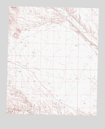
Priest Tank, NM USGS Topographic Map
Click on map above to begin viewing in our Map Viewer.

This topographic map contains these locations and features:
Feature Name Type Latitude Longitude GNIS ID View Map
Aden Torres WindmillLocaleN33.3556°W107.4564°885564View Map
Bernal Chavez CanyonValleyN33.3587°W107.4481°903758View Map
Caņada de la CruzStreamN33.3620°W107.4214°933058View Map
Caņada de la CruzArroyoN33.3659°W107.4145°933059View Map
Dennison TankReservoirN33.2989°W107.4844°888322View Map
Frank TankReservoirN33.3212°W107.4626°889218View Map
Garcia TankReservoirN33.2642°W107.3939°889336View Map
Garrison TankReservoirN33.2728°W107.4956°889368View Map
Hok CanyonValleyN33.2801°W107.4992°890060View Map
Ignacio Pares TankReservoirN33.3293°W107.4746°890288View Map
Little Joe TankReservoirN33.2883°W107.4642°891149View Map
Lopez CanyonValleyN33.2551°W107.4589°891329View Map
Lopez WindmillLocaleN33.2856°W107.4975°891333View Map
O W TankReservoirN33.2861°W107.4429°892779View Map
Old Mill CanyonValleyN33.2573°W107.4695°892876View Map
Priest TankReservoirN33.3309°W107.4044°893487View Map
RG 32555 Water WellWellN33.3306°W107.4745°925751View Map
Roque Ramos CanyonValleyN33.3587°W107.4484°910426View Map
Roque Ramos PeakSummitN33.3734°W107.4925°897460View Map
S S CanyonValleyN33.3556°W107.4020°894233View Map
Samora TankReservoirN33.2674°W107.4250°894387View Map
Water Well 1WellN33.3262°W107.4736°921989View Map
Water Well 2WellN33.2934°W107.4025°921987View Map

Note: Coordinates in the location and feature list above are referenced to NAD83 datum.


Copyright (C) 2008-2025 Ryan Niemi / Sunset Dynamics ... All Rights Reserved