TopoQuest Logo
Do you find TopoQuest useful?
Help keep TopoQuest running and adding new maps/features by donating!
Bitcoin:  19c7KJd3qBynnjoSw5npx9KScwjBe4ifkT
Litecoin:  LXs6TkuXGGXo1vDsWCkWVdjQX94eUKd6ui
Home View Maps Find Maps Find Places Resources & Links


Thumb Tank Peak, New Mexico Topographic Map

USGS Map Title: Thumb Tank Peak, NM
USGS Map MRC: 33107B5
DRG (GeoTIFF) Download: o33107b5.tif


Neighboring USGS Topographic Map Quads:


  Winston, NM  
33107C6
 

  Chise, NM  
33107C5
 

  Priest Tank, NM  
33107C4
 

  Sugarloaf Peak, NM  
33107B6
 

  Thumb Tank Peak, NM  
33107B5
 

  Williamsburg NW, NM  
33107B4
 

  Apache Peak, NM  
33107A6
 

  Bell Mountain, NM  
33107A5
 

  Saladone Tank, NM  
33107A4


Map MRC Location:

N34°
W108°
N34°
W107°
H8 H7 H6 H5 H4 H3 H2 H1
G8 G7 G6 G5 G4 G3 G2 G1
F8 F7 F6 F5 F4 F3 F2 F1
E8 E7 E6 E5 E4 E3 E2 E1
D8 D7 D6 D5 D4 D3 D2 D1
C8 C7 C6 C5 C4 C3 C2 C1
B8 B7 B6 B5 B4 B3 B2 B1
A8 A7 A6 A5 A4 A3 A2 A1
N33°
W108°
N33°
W107°

Thumb Tank Peak, NM USGS 1:24K Topographic Map Preview:
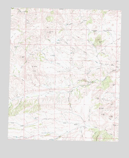
Thumb Tank Peak, NM USGS Topographic Map
Click on map above to begin viewing in our Map Viewer.

This topographic map contains these locations and features:
Feature Name Type Latitude Longitude GNIS ID View Map
Antelope CanyonValleyN33.1303°W107.5656°903181View Map
Apodaca SpringSpringN33.2128°W107.6178°885851View Map
Aragon SpringSpringN33.2012°W107.5056°885864View Map
Avilas CampLocaleN33.1648°W107.6161°885957View Map
Avilas CanyonValleyN33.1392°W107.5420°903467View Map
Bear CanyonValleyN33.1609°W107.6242°903633View Map
Buck CanyonValleyN33.2159°W107.5600°886824View Map
Bulldozer SpringSpringN33.2306°W107.5164°886910View Map
Cactus FlatFlatN33.2237°W107.6217°904293View Map
Camp Water TankReservoirN33.2298°W107.5287°887106View Map
Chris TankReservoirN33.2348°W107.5624°887567View Map
Clay Tank CanyonValleyN33.1392°W107.5334°887660View Map
Cross O CanyonValleyN33.1923°W107.5089°888092View Map
Cross O PeakSummitN33.2031°W107.6125°888093View Map
Cross O SpringSpringN33.2062°W107.6028°888094View Map
Cross O WellWellN33.1995°W107.5767°888095View Map
Deadman CanyonValleyN33.1712°W107.5575°888239View Map
Deep TankReservoirN33.2054°W107.5755°888266View Map
Double S PeaksSummitN33.2215°W107.5261°888475View Map
Dry TankReservoirN33.2082°W107.5567°888546View Map
East Avilas TankReservoirN33.1453°W107.5958°888635View Map
Evans RanchLocaleN33.1651°W107.6161°898308View Map
Fox CanyonValleyN33.1353°W107.5223°889203View Map
Gallina SpringSpringN33.1815°W107.5320°889299View Map
Garcia PeaksRangeN33.1587°W107.5170°920599View Map
Goat Camp CanyonValleyN33.1390°W107.5328°889438View Map
Grandview MesaBenchN33.1923°W107.5531°889542View Map
Granite PeakSummitN33.1792°W107.5089°899654View Map
High Trail PeakSummitN33.1403°W107.5034°889968View Map
Joe TankReservoirN33.2394°W107.5429°890472View Map
Kelly PeakSummitN33.1656°W107.5259°890652View Map
Kelly TankReservoirN33.1656°W107.5204°890654View Map
Lard TankReservoirN33.1253°W107.5747°890936View Map
Lee WindmillLocaleN33.1448°W107.5820°891030View Map
Lobo CampLocaleN33.1276°W107.6109°891230View Map
Lobo TankReservoirN33.1273°W107.6155°891239View Map
Marshall GapGapN33.1606°W107.5106°891623View Map
Martin TankReservoirN33.1319°W107.5827°891642View Map
Nation WellWellN33.1773°W107.5842°892377View Map
No Mans LandAreaN33.1928°W107.5970°892547View Map
North Fork Palomas CreekStreamN33.1792°W107.5339°909149View Map
Oak WellWellN33.2356°W107.6064°892802View Map
Panther PeakSummitN33.1565°W107.5211°893064View Map
Pinatosa WellWellN33.2462°W107.6100°893272View Map
Polo TankReservoirN33.1710°W107.5759°893391View Map
Quail CanyonValleyN33.1901°W107.5136°909911View Map
Reno WindmillLocaleN33.2428°W107.5453°893864View Map
Salado WellWellN33.1384°W107.5411°894313View Map
Salado Wind Mill Water WellWellN33.1387°W107.5414°922972View Map
Sophio SpringSpringN33.2495°W107.5650°895002View Map
South Fork Palomas CreekStreamN33.1792°W107.5339°911240View Map
Spring CanyonValleyN33.1848°W107.6142°895248View Map
Spur PeakSummitN33.1509°W107.5192°895280View Map
Thumb TankReservoirN33.2203°W107.5715°895663View Map
Thumb Tank CanyonValleyN33.2026°W107.5342°895664View Map
Thumb Tank PeakSummitN33.2276°W107.5814°895665View Map
Trap PeakSummitN33.1490°W107.5098°895802View Map
Yellow MountainSummitN33.1978°W107.5114°900004View Map
Yellow SpringSpringN33.1959°W107.5056°896817View Map

Note: Coordinates in the location and feature list above are referenced to NAD83 datum.


Copyright (C) 2008-2025 Ryan Niemi / Sunset Dynamics ... All Rights Reserved