TopoQuest Logo
Do you find TopoQuest useful?
Help keep TopoQuest running and adding new maps/features by donating!
Bitcoin:  19c7KJd3qBynnjoSw5npx9KScwjBe4ifkT
Litecoin:  LXs6TkuXGGXo1vDsWCkWVdjQX94eUKd6ui
Home View Maps Find Maps Find Places Resources & Links


Big Black, Mississippi Topographic Map

USGS Map Title: Big Black, MS
USGS Map MRC: 32090B7
DRG (GeoTIFF) Download: o32090b7.tif


Neighboring USGS Topographic Map Quads:


  Vicksburg West, MS  
32090C8
 

  Vicksburg East, MS  
32090C7
 

  Bovina, MS  
32090C6
 

  Yokena, MS  
32090B8
 

  Big Black, MS  
32090B7
 

  Cayuga, MS  
32090B6
 

  Willows, MS  
32090A8
 

  Carlisle, MS  
32090A7
 

  Utica West, MS  
32090A6


Map MRC Location:

N33°
W91°
N33°
W90°
H8 H7 H6 H5 H4 H3 H2 H1
G8 G7 G6 G5 G4 G3 G2 G1
F8 F7 F6 F5 F4 F3 F2 F1
E8 E7 E6 E5 E4 E3 E2 E1
D8 D7 D6 D5 D4 D3 D2 D1
C8 C7 C6 C5 C4 C3 C2 C1
B8 B7 B6 B5 B4 B3 B2 B1
A8 A7 A6 A5 A4 A3 A2 A1
N32°
W91°
N32°
W90°

Big Black, MS USGS 1:24K Topographic Map Preview:
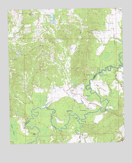
Big Black, MS USGS Topographic Map
Click on map above to begin viewing in our Map Viewer.

This topographic map contains these locations and features:
Feature Name Type Latitude Longitude GNIS ID View Map
AntiochPopulated PlaceN32.2465°W90.8490°707634View Map
Antioch ChurchChurchN32.2463°W90.8493°666309View Map
Asberry Church (historical)ChurchN32.2471°W90.8076°686291View Map
Baker LakeLakeN32.1554°W90.8102°666474View Map
Beaver PondLakeN32.1338°W90.8472°666717View Map
Ben SloughGutN32.1571°W90.7895°666816View Map
Big BlackPopulated PlaceN32.2157°W90.8398°691703View Map
Big Sand CreekStreamN32.1468°W90.7982°667141View Map
Campbell SwampSwampN32.1382°W90.8720°668003View Map
Cane LakeLakeN32.1481°W90.8034°668028View Map
Commissioners CreekStreamN32.1935°W90.7554°668726View Map
Congo LakeLakeN32.1684°W90.7893°668766View Map
E E Wallis Pond DamDamN32.1602°W90.8651°681033View Map
Fisher Ferry Volunteer Fire DepartmentBuildingN32.2477°W90.8484°2667967View Map
Fishers BridgeBridgeN32.1552°W90.7693°669996View Map
Goodrum ChurchChurchN32.2454°W90.8473°670501View Map
Halls Ferry (historical)CrossingN32.1924°W90.7729°707654View Map
Hamer BayouStreamN32.1521°W90.8087°670856View Map
Horners Ferry (historical)CrossingN32.1552°W90.7695°707656View Map
Horseshoe LakeLakeN32.1550°W90.7916°671489View Map
Ivanhoe Bridge (historical)BridgeN32.1585°W90.8357°686784View Map
Jim BayouStreamN32.1568°W90.8493°671880View Map
Lake ParkPopulated PlaceN32.2363°W90.8223°686347View Map
Leroy George Lake DamDamN32.2252°W90.8384°681100View Map
Little Sand CreekStreamN32.1352°W90.7976°672682View Map
McKee CreekStreamN32.1979°W90.7507°673381View Map
Mount Pilgrim School (historical)SchoolN32.1288°W90.8170°686799View Map
New Lake Park DamDamN32.2385°W90.8334°681109View Map
Old Lake Park DamDamN32.2368°W90.8284°681107View Map
Pear Orchard Plantation (historical)LocaleN32.1293°W90.7668°708090View Map
Pleasant Hill ChurchChurchN32.2288°W90.7857°676065View Map
Price CreekStreamN32.1629°W90.8498°676335View Map
Providence ChurchChurchN32.2149°W90.8401°686368View Map
Ragsdall CreekStreamN32.1265°W90.8498°676454View Map
Range Line School (historical)SchoolN32.1802°W90.7565°686811View Map
Regan IslandLakeN32.1749°W90.7734°676593View Map
Regan LakeLakeN32.1878°W90.7739°676594View Map
Rose Hill ChurchChurchN32.1735°W90.8048°676859View Map
Saint Paul Baptist ChurchChurchN32.1802°W90.7551°677188View Map
Second Union ChurchChurchN32.1349°W90.7565°677494View Map
Second Union School (historical)SchoolN32.1357°W90.7570°686822View Map
Sherwood ForestPopulated PlaceN32.2451°W90.8593°686378View Map
Spring Plains (historical)Populated PlaceN32.1418°W90.8043°708104View Map
TimberlanePopulated PlaceN32.2474°W90.8237°686388View Map
Twin Halls Plantation (historical)LocaleN32.1460°W90.7723°708108View Map
W R Farris Lake DamDamN32.1802°W90.8034°681061View Map
W R Farris Pond DamDamN32.1702°W90.8168°681050View Map
Wayside ChurchChurchN32.2040°W90.8690°679403View Map
West Carter LakeLakeN32.1885°W90.7830°679476View Map
WQMV-FM (Vicksburg)TowerN32.2363°W90.8445°680213View Map

Note: Coordinates in the location and feature list above are referenced to NAD83 datum.


Copyright (C) 2008-2024 Ryan Niemi / Sunset Dynamics ... All Rights Reserved