TopoQuest Logo
Do you find TopoQuest useful?
Help keep TopoQuest running and adding new maps/features by donating!
Bitcoin:  19c7KJd3qBynnjoSw5npx9KScwjBe4ifkT
Litecoin:  LXs6TkuXGGXo1vDsWCkWVdjQX94eUKd6ui
Home View Maps Find Maps Find Places Resources & Links


Carlisle, Mississippi Topographic Map

USGS Map Title: Carlisle, MS
USGS Map MRC: 32090A7
DRG (GeoTIFF) Download: o32090a7.tif


Neighboring USGS Topographic Map Quads:


  Yokena, MS  
32090B8
 

  Big Black, MS  
32090B7
 

  Cayuga, MS  
32090B6
 

  Willows, MS  
32090A8
 

  Carlisle, MS  
32090A7
 

  Utica West, MS  
32090A6
 

  Port Gibson, MS  
31090H8
 

  Hermanville, MS  
31090H7
 

  Dentville NW, MS  
31090H6


Map MRC Location:

N33°
W91°
N33°
W90°
H8 H7 H6 H5 H4 H3 H2 H1
G8 G7 G6 G5 G4 G3 G2 G1
F8 F7 F6 F5 F4 F3 F2 F1
E8 E7 E6 E5 E4 E3 E2 E1
D8 D7 D6 D5 D4 D3 D2 D1
C8 C7 C6 C5 C4 C3 C2 C1
B8 B7 B6 B5 B4 B3 B2 B1
A8 A7 A6 A5 A4 A3 A2 A1
N32°
W91°
N32°
W90°

Carlisle, MS USGS 1:24K Topographic Map Preview:
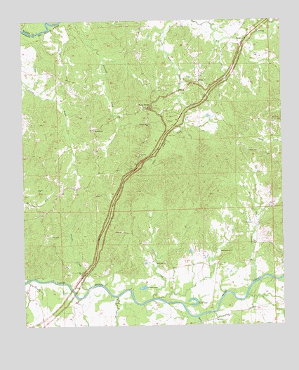
Carlisle, MS USGS Topographic Map
Click on map above to begin viewing in our Map Viewer.

This topographic map contains these locations and features:
Feature Name Type Latitude Longitude GNIS ID View Map
Belvidere Plantation (historical)LocaleN32.0127°W90.7848°708068View Map
Bethel Green ChurchChurchN32.0302°W90.7751°666963View Map
Booths CreekStreamN32.0121°W90.8304°667444View Map
Borenfield School (historical)SchoolN32.0532°W90.7576°686748View Map
CarlislePopulated PlaceN32.0027°W90.7845°691750View Map
Claiborne County Fire Department Station 3BuildingN32.0891°W90.8154°2668062View Map
Clarks CreekStreamN32.0113°W90.8137°668522View Map
Clarks LakeLakeN32.0157°W90.8178°668523View Map
Clarks Lake DamDamN32.0152°W90.8184°680983View Map
Flowers CemeteryCemeteryN32.0418°W90.7645°670055View Map
Flowers CreekStreamN32.0171°W90.7651°670058View Map
Gees CreekStreamN32.1157°W90.7795°670348View Map
Harper CemeteryCemeteryN32.0643°W90.8215°670953View Map
Hermitage Plantation (historical)LocaleN32.0043°W90.8640°708087View Map
Hopewell Plantation (historical)LocaleN32.0071°W90.7904°708088View Map
HumphreysPopulated PlaceN32.0804°W90.8409°691950View Map
Jones LakeLakeN32.0084°W90.7928°672002View Map
Lake School (historical)SchoolN32.0313°W90.7751°686787View Map
Midway ChurchChurchN32.1007°W90.7895°673546View Map
Midway School (historical)SchoolN32.1024°W90.7884°686793View Map
Norris CreekStreamN32.0152°W90.8448°674934View Map
Pleasant Hill ChurchChurchN32.0824°W90.8145°676064View Map
Rocky SpringsPopulated PlaceN32.0888°W90.8151°692184View Map
Rocky Springs CemeteryCemeteryN32.0901°W90.8134°708095View Map
Rocky Springs Methodist ChurchChurchN32.0899°W90.8140°708096View Map
Rose Arbor Plantation (historical)LocaleN32.1043°W90.8154°708098View Map
Ross School (historical)SchoolN32.0838°W90.7579°686815View Map
Saint Luke School (historical)SchoolN32.0352°W90.8193°686818View Map
Saint Lukes ChurchChurchN32.0257°W90.8115°677115View Map
Scutchillo HillsRidgeN32.0599°W90.8168°686821View Map
Storm CreekStreamN32.0032°W90.7932°678320View Map
Supervisor District 3CivilN32.0701°W90.8419°711810View Map
Templeton CemeteryCemeteryN32.0715°W90.7618°678621View Map
Valley of the Moon AirportAirportN32.0040°W90.8402°2676403View Map
Vernalia Plantation (historical)LocaleN32.1002°W90.8362°708109View Map

Note: Coordinates in the location and feature list above are referenced to NAD83 datum.


Copyright (C) 2008-2025 Ryan Niemi / Sunset Dynamics ... All Rights Reserved