TopoQuest Logo
Do you find TopoQuest useful?
Help keep TopoQuest running and adding new maps/features by donating!
Bitcoin:  19c7KJd3qBynnjoSw5npx9KScwjBe4ifkT
Litecoin:  LXs6TkuXGGXo1vDsWCkWVdjQX94eUKd6ui
Home View Maps Find Maps Find Places Resources & Links


Willows, Mississippi Topographic Map

USGS Map Title: Willows, MS
USGS Map MRC: 32090A8
DRG (GeoTIFF) Download: o32090a8.tif


Neighboring USGS Topographic Map Quads:


  Bedford, LA  
32091B1
 

  Yokena, MS  
32090B8
 

  Big Black, MS  
32090B7
 

  Grand Gulf, MS  
32091A1
 

  Willows, MS  
32090A8
 

  Carlisle, MS  
32090A7
 

  Widows Creek, MS  
31091H1
 

  Port Gibson, MS  
31090H8
 

  Hermanville, MS  
31090H7


Map MRC Location:

N33°
W91°
N33°
W90°
H8 H7 H6 H5 H4 H3 H2 H1
G8 G7 G6 G5 G4 G3 G2 G1
F8 F7 F6 F5 F4 F3 F2 F1
E8 E7 E6 E5 E4 E3 E2 E1
D8 D7 D6 D5 D4 D3 D2 D1
C8 C7 C6 C5 C4 C3 C2 C1
B8 B7 B6 B5 B4 B3 B2 B1
A8 A7 A6 A5 A4 A3 A2 A1
N32°
W91°
N32°
W90°

Willows, MS USGS 1:24K Topographic Map Preview:
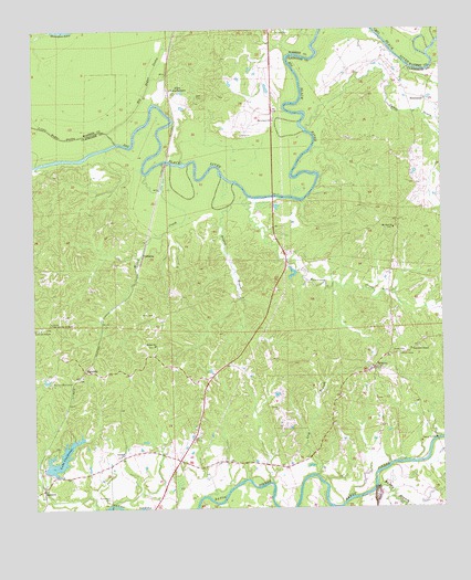
Willows, MS USGS Topographic Map
Click on map above to begin viewing in our Map Viewer.

This topographic map contains these locations and features:
Feature Name Type Latitude Longitude GNIS ID View Map
AllenPopulated PlaceN32.1079°W90.9582°691664View Map
Allen CemeteryCemeteryN32.1076°W90.9473°666206View Map
Ashland Baptist ChurchChurchN32.0138°W90.9745°666396View Map
Ashland Plantation (historical)LocaleN32.0127°W90.9709°708066View Map
Ashland School (historical)SchoolN32.0143°W90.9723°686742View Map
Big Bogue DeshaStreamN32.0957°W90.9746°667080View Map
Blackman BayouStreamN32.1204°W90.9598°686304View Map
Burnstand ChurchChurchN32.1013°W90.9262°667826View Map
Campbell ChapelChurchN32.0415°W90.8845°667996View Map
Drakes BayouStreamN32.0849°W90.9384°669380View Map
Fairview BranchStreamN32.0013°W90.9451°669879View Map
Fairview Plantation (historical)LocaleN32.0029°W90.9362°708075View Map
GallowayPopulated PlaceN32.0665°W90.9668°691877View Map
Grindstone FordCrossingN32.0057°W90.8959°708081View Map
Gunns BayouStreamN32.0990°W90.9157°670807View Map
HankinsonPopulated PlaceN32.1065°W90.8795°691918View Map
Hankinson Bridge (historical)BridgeN32.1202°W90.8904°686772View Map
Hankinsons Ferry (historical)CrossingN32.1202°W90.8904°708083View Map
Hard Scrabble School (historical)SchoolN32.0740°W90.8893°686773View Map
Humphreys CemeteryCemeteryN32.0029°W90.9779°671581View Map
InglesidePopulated PlaceN32.0357°W90.9829°691958View Map
Ingleside School (historical)SchoolN32.0396°W90.9934°686782View Map
Kennison CreekStreamN32.0815°W90.9345°672105View Map
Kings Landing (historical)LocaleN32.0988°W90.9248°686343View Map
Lake ClaiborneReservoirN32.0134°W90.9920°668498View Map
Lake Claiborne DamDamN32.0085°W90.9968°680982View Map
Lick BranchStreamN32.0088°W90.9137°672475View Map
Little Bogue DeshaStreamN32.0982°W90.9768°672552View Map
Little Come and See ChurchChurchN32.0471°W90.9984°672570View Map
Little Come and See Church Number 2ChurchN32.0488°W90.9948°672571View Map
Mount Zion ChurchChurchN32.0735°W90.8898°674349View Map
OaklawnPopulated PlaceN32.0052°W90.9979°692120View Map
Old Savoy CemeteryCemeteryN32.1238°W90.9248°675249View Map
Shiloh Baptist ChurchChurchN32.0429°W90.9634°677681View Map
Shiloh CemeteryCemeteryN32.0427°W90.9634°708103View Map
Thompsons Ferry (historical)CrossingN32.1040°W90.9598°707685View Map
Warner YMCA CampLocaleN32.0329°W90.9951°679348View Map
Whisky BranchStreamN32.0052°W90.8962°679563View Map
Willis CemeteryCemeteryN32.0507°W90.9640°679731View Map
Willis CreekStreamN32.0877°W90.9651°679732View Map
Willow Springs Methodist ChurchChurchN32.0360°W90.8962°708112View Map
WillowsPopulated PlaceN32.0363°W90.8962°692326View Map
Willows School (historical)SchoolN32.0402°W90.8854°686833View Map
Woodlawn Plantation (historical)LocaleN32.0113°W90.9320°708113View Map
Woodlawn School (historical)SchoolN32.0121°W90.9309°686835View Map
Wrights CreekStreamN32.1215°W90.9137°686409View Map

Note: Coordinates in the location and feature list above are referenced to NAD83 datum.


Copyright (C) 2008-2024 Ryan Niemi / Sunset Dynamics ... All Rights Reserved