TopoQuest Logo
Do you find TopoQuest useful?
Help keep TopoQuest running and adding new maps/features by donating!
Bitcoin:  19c7KJd3qBynnjoSw5npx9KScwjBe4ifkT
Litecoin:  LXs6TkuXGGXo1vDsWCkWVdjQX94eUKd6ui
Home View Maps Find Maps Find Places Resources & Links


Pungoteague, Virginia Topographic Map

USGS Map Title: Pungoteague, VA
USGS Map MRC: 37075F7
DRG (GeoTIFF) Download: o37075f7.tif


Neighboring USGS Topographic Map Quads:


  Tangier Island, VA  
37075G8
 

  Chesconessex, VA  
37075G7
 

  Parksley, VA  
37075G6
 

  Nandua Creek, VA  
37075F8
 

  Pungoteague, VA  
37075F7
 

  Accomac, VA  
37075F6
 

  Jamesville, VA  
37075E8
 

  Exmore, VA  
37075E7


Map MRC Location:

N38°
W76°
N38°
W75°
H8 H7 H6 H5 H4 H3 H2 H1
G8 G7 G6 G5 G4 G3 G2 G1
F8 F7 F6 F5 F4 F3 F2 F1
E8 E7 E6 E5 E4 E3 E2 E1
D8 D7 D6 D5 D4 D3 D2 D1
C8 C7 C6 C5 C4 C3 C2 C1
B8 B7 B6 B5 B4 B3 B2 B1
A8 A7 A6 A5 A4 A3 A2 A1
N37°
W76°
N37°
W75°

Pungoteague, VA USGS 1:24K Topographic Map Preview:
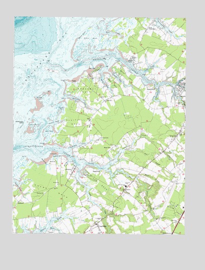
Pungoteague, VA USGS Topographic Map
Click on map above to begin viewing in our Map Viewer.

This topographic map contains these locations and features:
Feature Name Type Latitude Longitude GNIS ID View Map
Accomack County AirportAirportN37.6432°W75.7611°1498745View Map
Accomack County Bobtown Southern LandfillLocaleN37.6464°W75.7919°2518619View Map
Addison Plot CemeteryCemeteryN37.6837°W75.8114°2780403View Map
Ames - Hacks Neck CemeteryCemeteryN37.6372°W75.8392°2780405View Map
Andrew ChapelChurchN37.6907°W75.8191°1462468View Map
Arlington CemeteryCemeteryN37.6787°W75.7852°2780431View Map
Back CreekStreamN37.7479°W75.8072°1462648View Map
Badger - Savage CemeteryCemeteryN37.6609°W75.7729°2780436View Map
Bailey NeckCapeN37.7162°W75.7924°1462685View Map
Bailey PointCapeN37.7246°W75.7974°1462687View Map
Bluff PointCapeN37.6687°W75.8680°1463604View Map
BobtownPopulated PlaceN37.6510°W75.7933°1477127View Map
Bobtown Census Designated PlaceCensusN37.6492°W75.7999°2584809View Map
Bobtown NurseryBuildingN37.6506°W75.7986°2677673View Map
Boggs WharfLocaleN37.6615°W75.8113°1480085View Map
Broadway ChurchChurchN37.7037°W75.8113°1463861View Map
Broadway LandingLocaleN37.7124°W75.8308°1499162View Map
Broadway NeckCapeN37.7076°W75.8227°1463862View Map
Buckland GutGutN37.6693°W75.8427°1464014View Map
Bull BranchStreamN37.6737°W75.7905°1464059View Map
CashvillePopulated PlaceN37.7021°W75.8083°1477187View Map
Cedar CreekStreamN37.7190°W75.7797°1464594View Map
Central Branch Onancock CreekStreamN37.7115°W75.7560°1464682View Map
Chandler MarshSwampN37.6985°W75.8399°1464730View Map
Coffin PointCapeN37.7074°W75.8502°1465055View Map
CoocheyvillePopulated PlaceN37.6476°W75.8522°1499296View Map
Crockett TownPopulated PlaceN37.6804°W75.8119°1499304View Map
Dahl SwampSwampN37.6940°W75.7955°1478017View Map
Dinglers MillLocaleN37.6837°W75.7824°1779643View Map
East PointPopulated PlaceN37.7201°W75.8147°1499372View Map
Eastern Shore Community CollegeSchoolN37.6405°W75.7508°2519581View Map
Eastern Shore Community College Police DepartmentBuildingN37.6404°W75.7507°2767091View Map
Eastern Shore Regional Fire Training CenterBuildingN37.6409°W75.7716°2331836View Map
Eastern Shore Yacht and Country ClubLocaleN37.6552°W75.8190°1491140View Map
Evans WharfLocaleN37.6660°W75.8199°1466357View Map
Evergreen ChurchChurchN37.6537°W75.8413°1466364View Map
Finneys CreekStreamN37.7193°W75.8060°1466568View Map
Finneys IslandIslandN37.6865°W75.8605°1466569View Map
Finneys NeckCapeN37.7118°W75.8033°1466570View Map
Finneys WharfLocaleN37.7090°W75.7724°1466571View Map
Gaskin ChapelChurchN37.6832°W75.7538°1467014View Map
Gospel Temple ChurchChurchN37.6321°W75.7558°1467285View Map
Hacks NeckCapeN37.6499°W75.8472°1467629View Map
HacksneckPopulated PlaceN37.6432°W75.8705°1499514View Map
Hancock GutGutN37.6649°W75.8499°1467700View Map
HarbortonPopulated PlaceN37.6618°W75.8305°1499526View Map
Harborton Census Designated PlaceCensusN37.6596°W75.8332°2584855View Map
Harborton Post OfficePost OfficeN37.6607°W75.8319°2519616View Map
Harborton Solid Waste Receiving FacilityLocaleN37.6665°W75.8305°2518608View Map
Hollies ChurchChurchN37.6343°W75.7713°1468139View Map
Hollies Church BranchStreamN37.6576°W75.7849°1468140View Map
Horse Hole CreekStreamN37.6665°W75.8335°1468262View Map
Indian PointCapeN37.7029°W75.8366°1468478View Map
Klondike PointCapeN37.6771°W75.8516°1469065View Map
Kusian CoveBayN37.6276°W75.8433°1469083View Map
Leatherberry CreekStreamN37.7107°W75.7702°1469228View Map
Little HellPopulated PlaceN37.6657°W75.7766°1779654View Map
LocksvillePopulated PlaceN37.6721°W75.7674°1779655View Map
Matchotank CreekStreamN37.7040°W75.8374°1470180View Map
Moore BranchStreamN37.6576°W75.7847°1470702View Map
Mount NeboPopulated PlaceN37.6746°W75.8030°1499774View Map
Mount Olive ChurchChurchN37.6512°W75.8449°1470974View Map
North Branch Onancock CreekStreamN37.7110°W75.7585°1471582View Map
Onancock CemeteryCemeteryN37.6996°W75.7533°1471922View Map
Onancock CreekStreamN37.7201°W75.8349°1471923View Map
Onancock Post OfficePost OfficeN37.7123°W75.7501°1779666View Map
Onley PointCapeN37.7165°W75.7794°1471926View Map
Pakers CreekStreamN37.7179°W75.8110°1472022View Map
Parkers IslandIslandN37.7046°W75.8544°1472068View Map
Parkers MarshSwampN37.7379°W75.8197°1472070View Map
Peace and Plenty Farm AirportAirportN37.7237°W75.7866°1498766View Map
Pine Ridge Mobile Home ParkPopulated PlaceN37.6684°W75.7619°2519931View Map
Poplar CoveBayN37.7246°W75.7899°1472640View Map
Poplar CoveLocaleN37.7276°W75.7897°1472641View Map
Poplar Cove WharfLocaleN37.7246°W75.7916°1779672View Map
Poplar Cove WharfLocaleN37.7249°W75.7916°1478016View Map
PungoteaguePopulated PlaceN37.6304°W75.8135°1472867View Map
Pungoteague Census Designated PlaceCensusN37.6290°W75.8172°2584905View Map
Pungoteague CreekStreamN37.6762°W75.8627°1472868View Map
Pungoteague Elementary SchoolSchoolN37.6529°W75.7926°1474830View Map
Pungoteague Post OfficePost OfficeN37.6305°W75.8143°1779673View Map
Saint Georges ChurchChurchN37.6337°W75.8108°1473721View Map
SavagevillePopulated PlaceN37.6810°W75.7569°1500031View Map
Savageville Census Designated PlaceCensusN37.6825°W75.7592°2584915View Map
Scarborough IslandIslandN37.6865°W75.8691°1474091View Map
Scott StoreLocaleN37.6893°W75.8188°1779679View Map
Sluitkill NeckCapeN37.6893°W75.8297°1474704View Map
SmithvillePopulated PlaceN37.6671°W75.8435°1500127View Map
Sound BeachBeachN37.7399°W75.8260°1474827View Map
South Branch Onancock CreekStreamN37.7110°W75.7585°1474283View Map
South ChesconessexPopulated PlaceN37.7432°W75.7785°1474844View Map
Southside Chesconessex Census Designated PlaceCensusN37.7440°W75.7787°2584923View Map
Tankard DamDamN37.6568°W75.7863°1488977View Map
Tankard PondReservoirN37.6568°W75.7863°1488978View Map
Tarkill CreekStreamN37.6885°W75.8505°1475479View Map
Taylor CreekStreamN37.6621°W75.8260°1475505View Map
Thicket CreekStreamN37.7182°W75.8202°1475624View Map
Thicket PointCapeN37.7135°W75.8377°1475625View Map
Titlow CreekStreamN37.7032°W75.7530°1475741View Map
Underhill CreekStreamN37.6737°W75.8335°1476019View Map
Ware PointCapeN37.7251°W75.8299°1476327View Map
Warehouse PointCapeN37.6707°W75.8447°1476333View Map
Warehouse ProngStreamN37.6621°W75.8072°1476335View Map
West PointCapeN37.6837°W75.8524°1476498View Map
Yeo NeckCapeN37.6537°W75.8116°1474341View Map

Note: Coordinates in the location and feature list above are referenced to NAD83 datum.


Copyright (C) 2008-2024 Ryan Niemi / Sunset Dynamics ... All Rights Reserved