TopoQuest Logo
Do you find TopoQuest useful?
Help keep TopoQuest running and adding new maps/features by donating!
Bitcoin:  19c7KJd3qBynnjoSw5npx9KScwjBe4ifkT
Litecoin:  LXs6TkuXGGXo1vDsWCkWVdjQX94eUKd6ui
Home View Maps Find Maps Find Places Resources & Links


Chesconessex, Virginia Topographic Map

USGS Map Title: Chesconessex, VA
USGS Map MRC: 37075G7
DRG (GeoTIFF) Download: o37075g7.tif


Neighboring USGS Topographic Map Quads:


  Great Fox Island, VA  
37075H8
 

  Crisfield, MD  
37075H7
 

  Saxis, VA  
37075H6
 

  Tangier Island, VA  
37075G8
 

  Chesconessex, VA  
37075G7
 

  Parksley, VA  
37075G6
 

  Nandua Creek, VA  
37075F8
 

  Pungoteague, VA  
37075F7
 

  Accomac, VA  
37075F6


Map MRC Location:

N38°
W76°
N38°
W75°
H8 H7 H6 H5 H4 H3 H2 H1
G8 G7 G6 G5 G4 G3 G2 G1
F8 F7 F6 F5 F4 F3 F2 F1
E8 E7 E6 E5 E4 E3 E2 E1
D8 D7 D6 D5 D4 D3 D2 D1
C8 C7 C6 C5 C4 C3 C2 C1
B8 B7 B6 B5 B4 B3 B2 B1
A8 A7 A6 A5 A4 A3 A2 A1
N37°
W76°
N37°
W75°

Chesconessex, VA USGS 1:24K Topographic Map Preview:
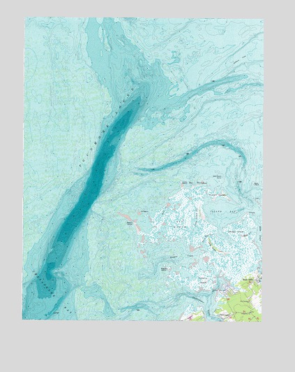
Chesconessex, VA USGS Topographic Map
Click on map above to begin viewing in our Map Viewer.

This topographic map contains these locations and features:
Feature Name Type Latitude Longitude GNIS ID View Map
Accomack CountyCivilN37.7649°W75.7566°1480091View Map
Back CreekStreamN37.7999°W75.7980°1462649View Map
Back Way GutGutN37.7846°W75.7788°1462661View Map
Beach IslandIslandN37.7893°W75.8158°1462854View Map
Big MarshSwampN37.7899°W75.7927°1463380View Map
Camp IslandIslandN37.8074°W75.7922°1464335View Map
Camp Island GutGutN37.7929°W75.7849°1464336View Map
ChesconessexPopulated PlaceN37.7521°W75.7663°1492753View Map
Chesconessex CreekStreamN37.7599°W75.7869°1464797View Map
Deep CreekPopulated PlaceN37.7674°W75.7527°1492852View Map
Deep CreekStreamN37.7946°W75.7516°1465702View Map
Deep Creek Census Designated PlaceCensusN37.7630°W75.7550°2584835View Map
Factory PointCapeN37.7629°W75.7724°1466385View Map
Guilford FlatsFlatN37.8587°W75.7619°1467588View Map
Island BayBayN37.7951°W75.7694°1468528View Map
Leatherbury ChurchChurchN37.7537°W75.7558°1469229View Map
Long RidgeRidgeN37.7812°W75.7755°1469840View Map
New Testament ChurchChurchN37.7582°W75.7560°1471500View Map
Old BeachIslandN37.7954°W75.8141°1471822View Map
Pocomoke SoundBayN37.8610°W75.8010°586619View Map
Pompco CreekStreamN37.7743°W75.8049°1472591View Map
Rainy PointCapeN37.7949°W75.7569°1472948View Map
Rock GutGutN37.7860°W75.7572°1473368View Map
Rogue IslandIslandN37.7718°W75.7985°1473509View Map
Russell IslandIslandN37.8029°W75.7738°1477931View Map
Savage IslandIslandN37.7879°W75.7635°1474065View Map
Schooner Bay Census Designated PlaceCensusN37.7625°W75.7670°2584916View Map
Scott IslandIslandN37.8068°W75.7552°1474108View Map
The ThorofareChannelN37.8074°W75.7847°1475618View Map
Tobacco IslandIslandN37.7668°W75.7805°1475746View Map
West Marsh TumpIslandN37.8099°W75.7708°1476497View Map

Note: Coordinates in the location and feature list above are referenced to NAD83 datum.


Copyright (C) 2008-2024 Ryan Niemi / Sunset Dynamics ... All Rights Reserved