TopoQuest Logo
Do you find TopoQuest useful?
Help keep TopoQuest running and adding new maps/features by donating!
Bitcoin:  19c7KJd3qBynnjoSw5npx9KScwjBe4ifkT
Litecoin:  LXs6TkuXGGXo1vDsWCkWVdjQX94eUKd6ui
Home View Maps Find Maps Find Places Resources & Links


Quemado, New Mexico Topographic Map

USGS Map Title: Quemado, NM
USGS Map MRC: 34108C4
DRG (GeoTIFF) Download: o34108c4.tif


Neighboring USGS Topographic Map Quads:


  Tejana Mesa, NM  
34108D5
 

  Mariano Springs, NM  
34108D4
 

  Adams Diggings, NM  
34108D3
 

  Armstrong Canyon, NM  
34108C5
 

  Quemado, NM  
34108C4
 

  Omega, NM  
34108C3
 

  Largo Mesa, NM  
34108B5
 

  Escondido Mountain, NM  
34108B4
 

  Mangas, NM  
34108B3


Map MRC Location:

N35°
W109°
N35°
W108°
H8 H7 H6 H5 H4 H3 H2 H1
G8 G7 G6 G5 G4 G3 G2 G1
F8 F7 F6 F5 F4 F3 F2 F1
E8 E7 E6 E5 E4 E3 E2 E1
D8 D7 D6 D5 D4 D3 D2 D1
C8 C7 C6 C5 C4 C3 C2 C1
B8 B7 B6 B5 B4 B3 B2 B1
A8 A7 A6 A5 A4 A3 A2 A1
N34°
W109°
N34°
W108°

Quemado, NM USGS 1:24K Topographic Map Preview:
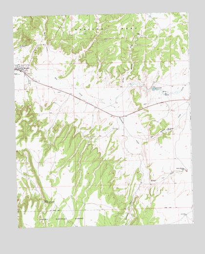
Quemado, NM USGS Topographic Map
Click on map above to begin viewing in our Map Viewer.

This topographic map contains these locations and features:
Feature Name Type Latitude Longitude GNIS ID View Map
Baca ArroyoValleyN34.3439°W108.4773°903481View Map
Catron County Ambulance Service QuemadoBuildingN34.3459°W108.4979°2657573View Map
Escondido CreekStreamN34.3223°W108.4362°906187View Map
First Baptist ChurchChurchN34.3439°W108.4956°921152View Map
Mangas CreekStreamN34.2884°W108.4098°908386View Map
North WellWellN34.2556°W108.3806°2038593View Map
Nutria SpringSpringN34.2826°W108.3806°909225View Map
QuemadoPopulated PlaceN34.3439°W108.4956°923654View Map
Quemado Community CemeteryCemeteryN34.3573°W108.4948°909930View Map
Quemado District Ranger OfficeLocaleN34.3617°W108.4923°936707View Map
Quemado Elementary SchoolSchoolN34.3398°W108.4918°933891View Map
Quemado Fire DepartmentBuildingN34.3459°W108.4977°2658169View Map
Quemado High SchoolSchoolN34.3402°W108.4920°901747View Map
Quemado Post OfficePost OfficeN34.3423°W108.4945°937907View Map
Quemado Weather StationLocaleN34.3439°W108.4956°931851View Map
Rito SpringSpringN34.3270°W108.3931°910321View Map
San Ignacio CreekStreamN34.3187°W108.4284°910625View Map
San Ignacio SpringSpringN34.3059°W108.3920°910626View Map
Spring Tanque de CaballosSpringN34.2653°W108.4815°911343View Map
StevensonLocaleN34.3489°W108.3756°929231View Map
Sweazea DrawValleyN34.3381°W108.3756°895454View Map
Sweazea LakeReservoirN34.3301°W108.4003°923698View Map
Wadley WellWellN34.3623°W108.4098°912127View Map
Wilbur Wadley DrawValleyN34.3242°W108.4415°912363View Map

Note: Coordinates in the location and feature list above are referenced to NAD83 datum.


Copyright (C) 2008-2024 Ryan Niemi / Sunset Dynamics ... All Rights Reserved