TopoQuest Logo
Do you find TopoQuest useful?
Help keep TopoQuest running and adding new maps/features by donating!
Bitcoin:  19c7KJd3qBynnjoSw5npx9KScwjBe4ifkT
Litecoin:  LXs6TkuXGGXo1vDsWCkWVdjQX94eUKd6ui
Home View Maps Find Maps Find Places Resources & Links


Mangas, New Mexico Topographic Map

USGS Map Title: Mangas, NM
USGS Map MRC: 34108B3
DRG (GeoTIFF) Download: o34108b3.tif


Neighboring USGS Topographic Map Quads:


  Quemado, NM  
34108C4
 

  Omega, NM  
34108C3
 

  Pie Town, NM  
34108C2
 

  Escondido Mountain, NM  
34108B4
 

  Mangas, NM  
34108B3
 

  Alegres Mountain, NM  
34108B2
 

  Slaughter Mesa, NM  
34108A4
 

  Mangas Mountain, NM  
34108A3
 

  Wallace Mesa, NM  
34108A2


Map MRC Location:

N35°
W109°
N35°
W108°
H8 H7 H6 H5 H4 H3 H2 H1
G8 G7 G6 G5 G4 G3 G2 G1
F8 F7 F6 F5 F4 F3 F2 F1
E8 E7 E6 E5 E4 E3 E2 E1
D8 D7 D6 D5 D4 D3 D2 D1
C8 C7 C6 C5 C4 C3 C2 C1
B8 B7 B6 B5 B4 B3 B2 B1
A8 A7 A6 A5 A4 A3 A2 A1
N34°
W109°
N34°
W108°

Mangas, NM USGS 1:24K Topographic Map Preview:
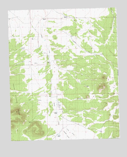
Mangas, NM USGS Topographic Map
Click on map above to begin viewing in our Map Viewer.

This topographic map contains these locations and features:
Feature Name Type Latitude Longitude GNIS ID View Map
BacaLocaleN34.1559°W108.3234°929182View Map
Baca CanyonValleyN34.1670°W108.3270°1877574View Map
Canon del MachoValleyN34.2028°W108.3284°1923045View Map
Chief WellWellN34.2056°W108.2695°1877580View Map
Club WellWellN34.2217°W108.3487°1877587View Map
Cottonwood DrawValleyN34.1712°W108.3270°1877583View Map
Descalso CanyonValleyN34.1334°W108.3176°1854066View Map
East Mangas WellWellN34.2426°W108.3103°1877578View Map
Erman WellWellN34.1426°W108.3523°1877575View Map
Hubble DrawValleyN34.2348°W108.3342°1877579View Map
Killion CanyonValleyN34.1392°W108.3223°1854068View Map
LeybaLocaleN34.1528°W108.3184°929545View Map
MangasLocaleN34.1989°W108.3276°929589View Map
MangasPopulated PlaceN34.1570°W108.3192°923624View Map
Mangas CemeteryCemeteryN34.1587°W108.3189°931282View Map
Mangas Post Office (historical)Post OfficeN34.1587°W108.3190°937514View Map
Mangas RanchLocaleN34.1992°W108.3284°1877577View Map
Mangas SpringsSpringN34.1509°W108.3212°1877576View Map
Mangas WellWellN34.2412°W108.3351°1877588View Map
Martin CanyonValleyN34.1278°W108.2815°1854067View Map
Mitchell WellWellN34.1753°W108.2867°1877581View Map
New WellWellN34.2131°W108.3606°1877586View Map
ReidLocaleN34.2059°W108.3356°929604View Map
San Jose SpringSpringN34.1292°W108.3217°1877582View Map
SmithLocaleN34.1489°W108.3126°929640View Map

Note: Coordinates in the location and feature list above are referenced to NAD83 datum.


Copyright (C) 2008-2025 Ryan Niemi / Sunset Dynamics ... All Rights Reserved