TopoQuest Logo
Do you find TopoQuest useful?
Help keep TopoQuest running and adding new maps/features by donating!
Bitcoin:  19c7KJd3qBynnjoSw5npx9KScwjBe4ifkT
Litecoin:  LXs6TkuXGGXo1vDsWCkWVdjQX94eUKd6ui
Home View Maps Find Maps Find Places Resources & Links


Largo Mesa, New Mexico Topographic Map

USGS Map Title: Largo Mesa, NM
USGS Map MRC: 34108B5
DRG (GeoTIFF) Download: o34108b5.tif


Neighboring USGS Topographic Map Quads:


  Tejana Mesa SW, NM  
34108C6
 

  Armstrong Canyon, NM  
34108C5
 

  Quemado, NM  
34108C4
 

  Ponderosa Tank, NM  
34108B6
 

  Largo Mesa, NM  
34108B5
 

  Escondido Mountain, NM  
34108B4
 

  Gallo Mountains West, NM  
34108A6
 

  Gallo Mountains East, NM  
34108A5
 

  Slaughter Mesa, NM  
34108A4


Map MRC Location:

N35°
W109°
N35°
W108°
H8 H7 H6 H5 H4 H3 H2 H1
G8 G7 G6 G5 G4 G3 G2 G1
F8 F7 F6 F5 F4 F3 F2 F1
E8 E7 E6 E5 E4 E3 E2 E1
D8 D7 D6 D5 D4 D3 D2 D1
C8 C7 C6 C5 C4 C3 C2 C1
B8 B7 B6 B5 B4 B3 B2 B1
A8 A7 A6 A5 A4 A3 A2 A1
N34°
W109°
N34°
W108°

Largo Mesa, NM USGS 1:24K Topographic Map Preview:
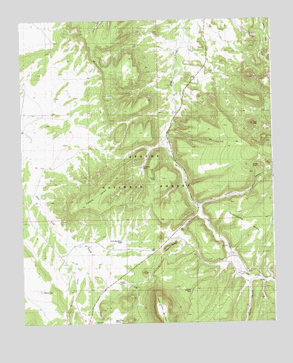
Largo Mesa, NM USGS Topographic Map
Click on map above to begin viewing in our Map Viewer.

This topographic map contains these locations and features:
Feature Name Type Latitude Longitude GNIS ID View Map
Agua Fria MountainSummitN34.1326°W108.5584°1923406View Map
Agua Fria SpringSpringN34.1262°W108.5801°1923266View Map
Agua Fria TankReservoirN34.1278°W108.5373°936548View Map
Armijo TankReservoirN34.1418°W108.5745°936547View Map
Bobcat TankReservoirN34.1889°W108.5103°1923272View Map
Castle RockSummitN34.1556°W108.5537°1923267View Map
Chavez LakeReservoirN34.1386°W108.6163°1934596View Map
Division TankReservoirN34.1384°W108.5417°1923274View Map
Escondido MesaSummitN34.1659°W108.5145°2038781View Map
Escondido MountainSummitN34.1667°W108.5159°1923273View Map
Harris CanyonValleyN34.1512°W108.5978°906852View Map
Harris CreekStreamN34.1326°W108.5584°1923378View Map
Largo MesaSummitN34.1781°W108.5867°1934598View Map
Leon TankReservoirN34.1995°W108.5284°1923270View Map
North Boundary TankReservoirN34.1589°W108.5765°2038589View Map
Paradise CanyonValleyN34.1720°W108.5367°898507View Map
Picture TankReservoirN34.1845°W108.5648°1923269View Map
Quemado Lake Fire DepartmentBuildingN34.1464°W108.5095°2657885View Map
Sawmill CanyonValleyN34.1406°W108.5128°910842View Map
Telephone TankReservoirN34.1892°W108.5587°1923268View Map
The HubSummitN34.2070°W108.5095°1923271View Map
William TankReservoirN34.2415°W108.6076°936546View Map
Williams Pit - ID Number 2901685MineN34.2373°W108.5467°939924View Map

Note: Coordinates in the location and feature list above are referenced to NAD83 datum.


Copyright (C) 2008-2025 Ryan Niemi / Sunset Dynamics ... All Rights Reserved