TopoQuest Logo
Do you find TopoQuest useful?
Help keep TopoQuest running and adding new maps/features by donating!
Bitcoin:  19c7KJd3qBynnjoSw5npx9KScwjBe4ifkT
Litecoin:  LXs6TkuXGGXo1vDsWCkWVdjQX94eUKd6ui
Home View Maps Find Maps Find Places Resources & Links


Big Cove Tannery, Pennsylvania Topographic Map

USGS Map Title: Big Cove Tannery, PA
USGS Map MRC: 39078G1
DRG (GeoTIFF) Download: o39078g1.tif


Neighboring USGS Topographic Map Quads:


  Breezewood, PA  
39078H2
 

  Meadow Grounds, PA  
39078H1
 

  McConnellsburg, PA  
39077H8
 

  Needmore, PA  
39078G2
 

  Big Cove Tannery, PA  
39078G1
 

  Mercersburg, PA  
39077G8
 

  Hancock, MD  
39078F2
 

  Cherry Run, WV  
39078F1
 

  Clear Spring, MD  
39077F8


Map MRC Location:

N40°
W79°
N40°
W78°
H8 H7 H6 H5 H4 H3 H2 H1
G8 G7 G6 G5 G4 G3 G2 G1
F8 F7 F6 F5 F4 F3 F2 F1
E8 E7 E6 E5 E4 E3 E2 E1
D8 D7 D6 D5 D4 D3 D2 D1
C8 C7 C6 C5 C4 C3 C2 C1
B8 B7 B6 B5 B4 B3 B2 B1
A8 A7 A6 A5 A4 A3 A2 A1
N39°
W79°
N39°
W78°

Big Cove Tannery, PA USGS 1:24K Topographic Map Preview:
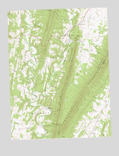
Big Cove Tannery, PA USGS Topographic Map
Click on map above to begin viewing in our Map Viewer.

This topographic map contains these locations and features:
Feature Name Type Latitude Longitude GNIS ID View Map
Anthony FordLocaleN39.7559°W78.0822°1211010View Map
Antioch ChurchChurchN39.8173°W78.1172°1168338View Map
Bald Eagle SchoolSchoolN39.7898°W78.0808°1211013View Map
Big Cove CreekStreamN39.7934°W78.0956°1169491View Map
Big Cove TanneryPopulated PlaceN39.8490°W78.0494°1169492View Map
Big HollowValleyN39.8605°W78.0919°1169517View Map
Big SpringSpringN39.8434°W78.0344°1202301View Map
Boardyard SchoolSchoolN39.7651°W78.0994°1211014View Map
Cave RunStreamN39.7581°W78.0133°1171353View Map
Center SchoolSchoolN39.7693°W78.0150°1211428View Map
Center SchoolSchoolN39.7729°W78.1228°1211429View Map
Chestnut FlatRidgeN39.8745°W78.0681°1171704View Map
Connor SchoolSchoolN39.8501°W78.0536°1211011View Map
Damascus ChurchChurchN39.7615°W78.1039°1172913View Map
Dickeys MountainPopulated PlaceN39.7798°W78.0775°1203415View Map
Dickeys MountainRidgeN39.8029°W78.0542°1192358View Map
Esther RunStreamN39.8395°W78.0478°1174330View Map
Indian ChairSummitN39.8465°W78.0389°1177738View Map
Laurel Ridge ChurchChurchN39.8281°W78.0667°1178966View Map
Lockings HollowValleyN39.7625°W78.0843°1179760View Map
Lowery KnobSummitN39.8487°W78.0383°1180042View Map
Mount Zion ChurchChurchN39.7656°W78.0169°1181908View Map
Plum RunPopulated PlaceN39.7656°W78.1178°1184117View Map
Redbud Valley Nature CenterParkN39.8368°W78.0514°1206738View Map
Rehobeth ChurchChurchN39.7506°W78.1222°1184863View Map
Roaring RunStreamN39.8659°W78.0408°1185179View Map
Saint Pauls ChurchChurchN39.8498°W78.0522°1186569View Map
SharpePopulated PlaceN39.8165°W78.1183°1204627View Map
Sowers HollowValleyN39.8390°W78.0195°1188139View Map
Spring RunStreamN39.8548°W78.0442°1188269View Map
State Game Lands Number 124ParkN39.7962°W78.0222°1193434View Map
SylvanPopulated PlaceN39.7534°W78.0217°1189212View Map
The CornerValleyN39.8416°W78.0345°1189395View Map
The LockingsCliffN39.7651°W78.0631°1189420View Map
Timber RidgeRidgeN39.8295°W78.1139°1189573View Map
Township of ThompsonCivilN39.7730°W78.1144°1216481View Map
Township of WarrenCivilN39.7802°W78.0127°1216472View Map
Websters MillPopulated PlaceN39.8601°W78.0350°1190765View Map

Note: Coordinates in the location and feature list above are referenced to NAD83 datum.


Copyright (C) 2008-2024 Ryan Niemi / Sunset Dynamics ... All Rights Reserved