TopoQuest Logo
Do you find TopoQuest useful?
Help keep TopoQuest running and adding new maps/features by donating!
Bitcoin:  19c7KJd3qBynnjoSw5npx9KScwjBe4ifkT
Litecoin:  LXs6TkuXGGXo1vDsWCkWVdjQX94eUKd6ui
Home View Maps Find Maps Find Places Resources & Links


Quincy, Missouri Topographic Map

USGS Map Title: Quincy, MO
USGS Map MRC: 38093A4
DRG (GeoTIFF) Download: o38093a4.tif


Neighboring USGS Topographic Map Quads:


  Ninnescah Park, MO  
38093B5
 

  Warsaw West, MO  
38093B4
 

  Warsaw East, MO  
38093B3
 

  Iconium, MO  
38093A5
 

  Quincy, MO  
38093A4
 

  Fristoe, MO  
38093A3
 

  Weaubleau, MO  
37093H5
 

  Wheatland, MO  
37093H4
 

  Hermitage, MO  
37093H3


Map MRC Location:

N39°
W94°
N39°
W93°
H8 H7 H6 H5 H4 H3 H2 H1
G8 G7 G6 G5 G4 G3 G2 G1
F8 F7 F6 F5 F4 F3 F2 F1
E8 E7 E6 E5 E4 E3 E2 E1
D8 D7 D6 D5 D4 D3 D2 D1
C8 C7 C6 C5 C4 C3 C2 C1
B8 B7 B6 B5 B4 B3 B2 B1
A8 A7 A6 A5 A4 A3 A2 A1
N38°
W94°
N38°
W93°

Quincy, MO USGS 1:24K Topographic Map Preview:
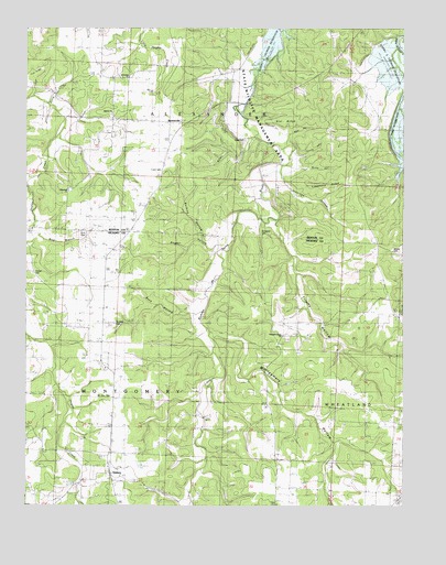
Quincy, MO USGS Topographic Map
Click on map above to begin viewing in our Map Viewer.

This topographic map contains these locations and features:
Feature Name Type Latitude Longitude GNIS ID View Map
BentonvillePopulated PlaceN38.1006°W93.4491°740671View Map
Beyers CemeteryCemeteryN38.0667°W93.3777°729990View Map
Bird CemeteryCemeteryN38.0717°W93.4821°741941View Map
Bird HollowValleyN38.0723°W93.4980°714262View Map
Bird School (historical)SchoolN38.1049°W93.3905°714263View Map
Blackwell CemeteryCemeteryN38.0703°W93.4213°714340View Map
Buck HollowValleyN38.0500°W93.4449°714968View Map
Burbick HollowValleyN38.0673°W93.4363°715060View Map
Button HollowValleyN38.0959°W93.4244°715137View Map
Cobb CemeteryCemeteryN38.0875°W93.4555°716051View Map
Cover BranchStreamN38.0689°W93.4983°716399View Map
Cross Lane SchoolSchoolN38.0436°W93.4733°716527View Map
Franks HollowValleyN38.0923°W93.4116°718179View Map
Freedom ChurchChurchN38.1123°W93.4666°741943View Map
Gist RidgeRidgeN38.1042°W93.4199°718472View Map
Gover BranchStreamN38.0689°W93.4980°737942View Map
Harper CemeteryCemeteryN38.0609°W93.4983°719130View Map
Hopewell ChurchChurchN38.0820°W93.4860°719805View Map
Jennings HollowValleyN38.0861°W93.4152°720302View Map
Limestone RidgeRidgeN38.0836°W93.4027°721073View Map
Mize HollowValleyN38.0953°W93.4141°722502View Map
Montgomery HollowValleyN38.0448°W93.4380°722542View Map
Mount Zion CemeteryCemeteryN38.0281°W93.4713°722930View Map
Muddy HollowValleyN38.0889°W93.4108°723044View Map
Myers School (historical)SchoolN38.0039°W93.4166°723102View Map
Pleasant Grove ChurchChurchN38.0445°W93.4152°730012View Map
Pleasant Hill School (historical)SchoolN38.0561°W93.4227°724546View Map
Pleasant Hill School (historical)SchoolN38.0436°W93.4169°745333View Map
Powell HollowValleyN38.0689°W93.4430°724814View Map
QuincyPopulated PlaceN38.0084°W93.4724°729807View Map
Quincy Post OfficePost OfficeN38.0089°W93.4723°2783224View Map
Shiloh CemeteryCemeteryN38.1021°W93.4718°2681314View Map
Shiloh ChurchChurchN38.1028°W93.4721°741942View Map
Shiloh School (historical)SchoolN38.1017°W93.4719°726378View Map
Tick RidgeRidgeN38.1181°W93.4946°727644View Map
Township of MontgomeryCivilN38.0076°W93.4673°766756View Map
Trinity HollowValleyN38.0742°W93.4169°727790View Map
Turnip Top HollowValleyN38.1059°W93.4921°727911View Map
Union ChurchChurchN38.0959°W93.4263°730019View Map
Union SchoolSchoolN38.0709°W93.4780°728038View Map

Note: Coordinates in the location and feature list above are referenced to NAD83 datum.


Copyright (C) 2008-2024 Ryan Niemi / Sunset Dynamics ... All Rights Reserved