TopoQuest Logo
Do you find TopoQuest useful?
Help keep TopoQuest running and adding new maps/features by donating!
Bitcoin:  19c7KJd3qBynnjoSw5npx9KScwjBe4ifkT
Litecoin:  LXs6TkuXGGXo1vDsWCkWVdjQX94eUKd6ui
Home View Maps Find Maps Find Places Resources & Links


Ragsdale Butte, Oregon Topographic Map

USGS Map Title: Ragsdale Butte, OR
USGS Map MRC: 42122G7
DRG (GeoTIFF) Download: o42122g7.tif


Neighboring USGS Topographic Map Quads:


  Tiller, OR  
42122H8
 

  Pickett Butte, OR  
42122H7
 

  Butler Butte, OR  
42122H6
 

  Richter Mountain, OR  
42122G8
 

  Ragsdale Butte, OR  
42122G7
 

  Sugarpine Creek, OR  
42122G6
 

  Cleveland Ridge, OR  
42122F8
 

  Trail, OR  
42122F7
 

  McLeod, OR  
42122F6


Map MRC Location:

N43°
W123°
N43°
W122°
H8 H7 H6 H5 H4 H3 H2 H1
G8 G7 G6 G5 G4 G3 G2 G1
F8 F7 F6 F5 F4 F3 F2 F1
E8 E7 E6 E5 E4 E3 E2 E1
D8 D7 D6 D5 D4 D3 D2 D1
C8 C7 C6 C5 C4 C3 C2 C1
B8 B7 B6 B5 B4 B3 B2 B1
A8 A7 A6 A5 A4 A3 A2 A1
N42°
W123°
N42°
W122°

Ragsdale Butte, OR USGS 1:24K Topographic Map Preview:
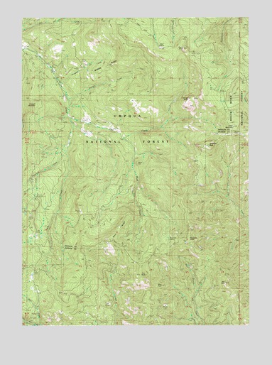
Ragsdale Butte, OR USGS Topographic Map
Click on map above to begin viewing in our Map Viewer.

This topographic map contains these locations and features:
Feature Name Type Latitude Longitude GNIS ID View Map
Alco RockPillarN42.7671°W122.7644°1137053View Map
Alco TrailTrailN42.7657°W122.7620°1137054View Map
Blue RockPillarN42.7661°W122.7993°1138332View Map
Cowbell MountainSummitN42.8395°W122.8686°1140292View Map
Dead Horse CreekStreamN42.7501°W122.8656°1140694View Map
Devils KnobSummitN42.8624°W122.7870°1157047View Map
Devils Knob CampLocaleN42.8621°W122.7914°1156457View Map
Devils Knob LookoutLocaleN42.8629°W122.7864°1140961View Map
Diamond CreekStreamN42.8201°W122.8514°1140993View Map
Divide Guard StationLocaleN42.7723°W122.8684°1141067View Map
East Fork Elk CreekStreamN42.8318°W122.8484°1156840View Map
Finger RockSummitN42.7657°W122.7569°1159021View Map
Flat CreekStreamN42.8335°W122.8481°1142227View Map
Flats RanchLocaleN42.8393°W122.8123°1142248View Map
Growey CreekStreamN42.8193°W122.8150°1154514View Map
Hawk MountainSummitN42.8307°W122.7595°1143375View Map
Jacques CreekStreamN42.8479°W122.8539°1158298View Map
Middle RidgeRidgeN42.8540°W122.8331°1146178View Map
Mitchell CreekStreamN42.8112°W122.8664°1146373View Map
Mule HillSummitN42.8156°W122.8122°1146637View Map
Old Johnson Mill (historical)LocaleN42.7957°W122.8737°1147197View Map
Oliver SpringSpringN42.7570°W122.8085°1147216View Map
Pilot RockSummitN42.7705°W122.8105°1147671View Map
Ragsdale ButteSummitN42.7848°W122.7838°1148139View Map
Ragsdale LookoutLocaleN42.7890°W122.7820°1148140View Map
Ragsdale SpringSpringN42.7848°W122.7949°1148141View Map
Rattlesnake TrailTrailN42.8615°W122.7537°1148248View Map
Rogue-Umpqua Divide TrailTrailN42.8151°W122.7775°1148701View Map
Savage BluffsCliffN42.8412°W122.7845°1149082View Map
Section CreekStreamN42.8423°W122.8495°1149215View Map
Shangri-La Mill (historical)LocaleN42.7848°W122.8684°1149288View Map
Shed CampLocaleN42.7760°W122.8103°1149305View Map
Shed CreekStreamN42.8262°W122.8178°1149306View Map
Summit CabinLocaleN42.8282°W122.7581°1150606View Map
Threehorn Recreation SiteLocaleN42.8026°W122.8667°1156458View Map
Timber CabinLocaleN42.8293°W122.7787°1151235View Map
Timbered RockPillarN42.8232°W122.7731°1151246View Map
Tison School (historical)SchoolN42.8429°W122.8428°1151285View Map
Tison TrailTrailN42.8065°W122.8228°1158523View Map
Warren Tison RanchLocaleN42.8296°W122.8237°1151914View Map
Wolf PrairieAreaN42.8637°W122.7992°1157046View Map
Wolf RidgeRidgeN42.7896°W122.8220°1152599View Map

Note: Coordinates in the location and feature list above are referenced to NAD83 datum.


Copyright (C) 2008-2024 Ryan Niemi / Sunset Dynamics ... All Rights Reserved