TopoQuest Logo
Do you find TopoQuest useful?
Help keep TopoQuest running and adding new maps/features by donating!
Bitcoin:  19c7KJd3qBynnjoSw5npx9KScwjBe4ifkT
Litecoin:  LXs6TkuXGGXo1vDsWCkWVdjQX94eUKd6ui
Home View Maps Find Maps Find Places Resources & Links


Tiller, Oregon Topographic Map

USGS Map Title: Tiller, OR
USGS Map MRC: 42122H8
DRG (GeoTIFF) Download: o42122h8.tif


Neighboring USGS Topographic Map Quads:


  White Rock, OR  
43123A1
 

  Deadman Mountain, OR  
43122A8
 

  Dumont Creek, OR  
43122A7
 

  Milo, OR  
42123H1
 

  Tiller, OR  
42122H8
 

  Pickett Butte, OR  
42122H7
 

  Cedar Springs Mountain, OR  
42123G1
 

  Richter Mountain, OR  
42122G8
 

  Ragsdale Butte, OR  
42122G7


Map MRC Location:

N43°
W123°
N43°
W122°
H8 H7 H6 H5 H4 H3 H2 H1
G8 G7 G6 G5 G4 G3 G2 G1
F8 F7 F6 F5 F4 F3 F2 F1
E8 E7 E6 E5 E4 E3 E2 E1
D8 D7 D6 D5 D4 D3 D2 D1
C8 C7 C6 C5 C4 C3 C2 C1
B8 B7 B6 B5 B4 B3 B2 B1
A8 A7 A6 A5 A4 A3 A2 A1
N42°
W123°
N42°
W122°

Tiller, OR USGS 1:24K Topographic Map Preview:
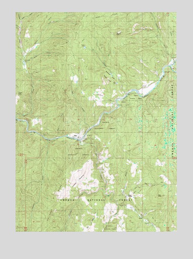
Tiller, OR USGS Topographic Map
Click on map above to begin viewing in our Map Viewer.

This topographic map contains these locations and features:
Feature Name Type Latitude Longitude GNIS ID View Map
Brown RanchLocaleN42.9051°W122.8820°1138677View Map
Callahan CreekStreamN42.8968°W122.9317°1139165View Map
Callahan LookoutLocaleN42.9032°W122.9634°1139166View Map
Callahan MeadowsFlatN42.9040°W122.9526°1157122View Map
Callahan RidgeRidgeN42.8943°W122.9664°1157125View Map
Camp CreekStreamN42.8773°W122.8931°1139221View Map
Cathedral CreekStreamN42.9665°W122.8859°1154507View Map
Coffee Creek CemeteryCemeteryN42.9715°W122.9939°1157131View Map
Cole CreekStreamN42.9290°W122.9595°1154511View Map
Cook CreekStreamN42.8790°W122.8970°1154512View Map
Cow CreekStreamN42.9193°W122.8762°1155027View Map
Deadhorse CreekStreamN42.9491°W122.9233°1154510View Map
Deadman CreekStreamN42.9715°W122.8762°1140735View Map
Deer ButteSummitN42.8962°W122.8862°1140814View Map
Dixon CreekStreamN42.8896°W122.9170°1141087View Map
Dompier CreekStreamN42.9521°W122.9148°1141167View Map
Dompier Creek Slide AreaSlopeN42.9637°W122.9789°1157130View Map
DrewPopulated PlaceN42.8818°W122.8995°1141234View Map
Drew CreekStreamN42.8896°W122.9212°1141236View Map
Drew Post Office (historical)Post OfficeN42.8818°W122.8995°1165178View Map
Drew School (historical)SchoolN42.8943°W122.9131°1141239View Map
Elk CreekStreamN42.9273°W122.9514°1141751View Map
Golden GulchValleyN42.8923°W122.9203°1142836View Map
Graham GulchValleyN42.9907°W122.9970°1157560View Map
Granite CreekStreamN42.9748°W122.9942°1142919View Map
Hatchet CreekStreamN42.9276°W122.9764°1143361View Map
Heart LakeLakeN42.9593°W122.9226°1154509View Map
Jackson CreekStreamN42.9698°W122.8795°1144199View Map
Joseph Reed DamDamN42.9598°W122.9539°1157129View Map
Joseph Reed ReservoirReservoirN42.9601°W122.9538°1157128View Map
Lake CreekStreamN42.9582°W122.9187°1157127View Map
Lucas RanchLocaleN42.8757°W122.9170°1145648View Map
Marshall Place (historical)LocaleN42.9885°W122.9531°1145830View Map
Neet Post Office (historical)Post OfficeN42.8846°W122.9239°1164546View Map
O'Neill ButteSummitN42.9531°W122.9998°1147106View Map
Rainville CemeteryCemeteryN42.9137°W122.9333°1157121View Map
Rondeau ButteSummitN42.9874°W122.9230°1126270View Map
Rondeau CemeteryCemeteryN42.9570°W122.9012°1154508View Map
Ruby CreekStreamN42.9710°W122.9945°1148824View Map
Salt CreekStreamN42.9343°W122.9428°1148992View Map
Slate CreekStreamN42.9290°W122.9673°1149660View Map
South Umpqua DivisionCivilN42.9428°W122.9854°1938128View Map
Texas GulchValleyN42.9962°W122.9959°1150993View Map
Three C Rock Campground Boat LaunchLocaleN42.9600°W122.8905°2668354View Map
Three C Rock Recreation SiteLocaleN42.9657°W122.8876°1157126View Map
TillerPopulated PlaceN42.9285°W122.9512°1151223View Map
Tiller Elementary SchoolSchoolN42.9290°W122.9566°2417830View Map
Tiller Post OfficePost OfficeN42.9288°W122.9559°1166047View Map
Tiller Ranger StationBuildingN42.9271°W122.9498°1157123View Map
Tiller Rural Fire Protection District HeadquartersBuildingN42.9285°W122.9536°2576716View Map
Tinhat PondLakeN42.9797°W122.9476°1157124View Map
United States Forest Service Tiller Ranger DistrictBuildingN42.9265°W122.9500°2576658View Map

Note: Coordinates in the location and feature list above are referenced to NAD83 datum.


Copyright (C) 2008-2025 Ryan Niemi / Sunset Dynamics ... All Rights Reserved