TopoQuest Logo
Do you find TopoQuest useful?
Help keep TopoQuest running and adding new maps/features by donating!
Bitcoin:  19c7KJd3qBynnjoSw5npx9KScwjBe4ifkT
Litecoin:  LXs6TkuXGGXo1vDsWCkWVdjQX94eUKd6ui
Home View Maps Find Maps Find Places Resources & Links


Richter Mountain, Oregon Topographic Map

USGS Map Title: Richter Mountain, OR
USGS Map MRC: 42122G8
DRG (GeoTIFF) Download: o42122g8.tif


Neighboring USGS Topographic Map Quads:


  Milo, OR  
42123H1
 

  Tiller, OR  
42122H8
 

  Pickett Butte, OR  
42122H7
 

  Cedar Springs Mountain, OR  
42123G1
 

  Richter Mountain, OR  
42122G8
 

  Ragsdale Butte, OR  
42122G7
 

  Skeleton Mountain, OR  
42123F1
 

  Cleveland Ridge, OR  
42122F8
 

  Trail, OR  
42122F7


Map MRC Location:

N43°
W123°
N43°
W122°
H8 H7 H6 H5 H4 H3 H2 H1
G8 G7 G6 G5 G4 G3 G2 G1
F8 F7 F6 F5 F4 F3 F2 F1
E8 E7 E6 E5 E4 E3 E2 E1
D8 D7 D6 D5 D4 D3 D2 D1
C8 C7 C6 C5 C4 C3 C2 C1
B8 B7 B6 B5 B4 B3 B2 B1
A8 A7 A6 A5 A4 A3 A2 A1
N42°
W123°
N42°
W122°

Richter Mountain, OR USGS 1:24K Topographic Map Preview:
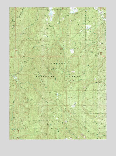
Richter Mountain, OR USGS Topographic Map
Click on map above to begin viewing in our Map Viewer.

This topographic map contains these locations and features:
Feature Name Type Latitude Longitude GNIS ID View Map
Anderson CreekStreamN42.8507°W122.8759°1137199View Map
Bainfield MineMineN42.8360°W122.9289°1137421View Map
Beaver CreekStreamN42.8093°W122.9951°1137800View Map
Brownie CreekStreamN42.8632°W122.8751°1138682View Map
Brownie Creek TrailTrailN42.8296°W122.8862°1138684View Map
Buzzard RockLocaleN42.8198°W122.8976°1139082View Map
Chicago TrailTrailN42.7573°W122.9364°1139626View Map
Diamond RockSummitN42.8058°W122.9199°1157120View Map
Diamond Rock LookoutLocaleN42.8048°W122.9192°1141008View Map
Drew LakeLakeN42.7923°W122.9391°1141238View Map
East Fork Cow CreekStreamN42.8018°W122.9906°1141550View Map
East Fork Drew CreekStreamN42.8429°W122.9373°1154513View Map
Granite CreekStreamN42.8371°W122.9476°1142918View Map
Hall RanchLocaleN42.8337°W122.9173°1143224View Map
Joe Hall CreekStreamN42.8676°W122.8820°1144295View Map
Long PrairieFlatN42.7826°W122.9159°1145430View Map
Mammoth Lode MineMineN42.7623°W122.9512°1145780View Map
Neuman GapGapN42.8237°W122.9714°1146796View Map
Peavine CampLocaleN42.7704°W122.9234°1147538View Map
Red Cloud MineMineN42.7771°W122.9456°1148283View Map
Richter CabinLocaleN42.7676°W122.9512°1148424View Map
Richter MountainSummitN42.7641°W122.9495°1148425View Map
Rowley MineMineN42.8157°W122.9439°1148815View Map
South Fork Cow CreekStreamN42.8026°W122.9917°1155363View Map
Stauch RanchLocaleN42.8346°W122.9189°1167432View Map
The DrewRidgeN42.8665°W122.9470°1151009View Map
Threehorn MountainSummitN42.7815°W122.9067°1151185View Map
Tiller Rural Fire Protection District Drew StationBuildingN42.8649°W122.8798°2577126View Map
Tom CreekStreamN42.8507°W122.8778°1151310View Map
Tombstone GapGapN42.7543°W122.9523°1151322View Map
White CreekStreamN42.7804°W122.9959°1152229View Map
Wildcat RidgeRidgeN42.8079°W122.9620°1152350View Map

Note: Coordinates in the location and feature list above are referenced to NAD83 datum.


Copyright (C) 2008-2025 Ryan Niemi / Sunset Dynamics ... All Rights Reserved