TopoQuest Logo
Do you find TopoQuest useful?
Help keep TopoQuest running and adding new maps/features by donating!
Bitcoin:  19c7KJd3qBynnjoSw5npx9KScwjBe4ifkT
Litecoin:  LXs6TkuXGGXo1vDsWCkWVdjQX94eUKd6ui
Home View Maps Find Maps Find Places Resources & Links


Rams Horn Ridge, Idaho Topographic Map

USGS Map Title: Rams Horn Ridge, ID
USGS Map MRC: 42114C2
DRG (GeoTIFF) Download: o42114c2.tif


Neighboring USGS Topographic Map Quads:


  Stricker Butte, ID  
42114D3
 

  Murtaugh, ID  
42114D2
 

  Milner Butte, ID  
42114D1
 

  Grand View Peak, ID  
42114C3
 

  Rams Horn Ridge, ID  
42114C2
 

  Buckhorn Canyon, ID  
42114C1
 

  Pike Mountain, ID  
42114B3
 

  Trapper Peak, ID  
42114B2
 

  Severe Spring, ID  
42114B1


Map MRC Location:

N43°
W115°
N43°
W114°
H8 H7 H6 H5 H4 H3 H2 H1
G8 G7 G6 G5 G4 G3 G2 G1
F8 F7 F6 F5 F4 F3 F2 F1
E8 E7 E6 E5 E4 E3 E2 E1
D8 D7 D6 D5 D4 D3 D2 D1
C8 C7 C6 C5 C4 C3 C2 C1
B8 B7 B6 B5 B4 B3 B2 B1
A8 A7 A6 A5 A4 A3 A2 A1
N42°
W115°
N42°
W114°

Rams Horn Ridge, ID USGS 1:24K Topographic Map Preview:
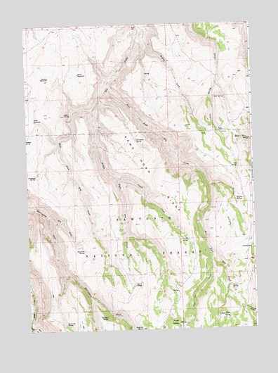
Rams Horn Ridge, ID USGS Topographic Map
Click on map above to begin viewing in our Map Viewer.

This topographic map contains these locations and features:
Feature Name Type Latitude Longitude GNIS ID View Map
Antelope SpringSpringN42.3130°W114.2453°376661View Map
Basin Patch SpringSpringN42.2549°W114.1400°377014View Map
Bowers SpringSpringN42.3038°W114.1342°399806View Map
Coal Pit ButteSummitN42.2505°W114.1884°397559View Map
Coal Pit CreekStreamN42.2802°W114.1484°379471View Map
Cold SpringSpringN42.3165°W114.1339°379523View Map
Cold SpringSpringN42.2513°W114.2275°393903View Map
Coyote CreekStreamN42.3113°W114.2006°379990View Map
Coyote SpringSpringN42.2866°W114.1622°380005View Map
Deadeye ReservoirReservoirN42.3535°W114.2369°380311View Map
Dry ForkStreamN42.2966°W114.2397°380845View Map
Dry Fork SpringSpringN42.2828°W114.2192°380856View Map
East Fork Dry CreekStreamN42.3499°W114.2039°381086View Map
East Line SpringSpringN42.2522°W114.2298°381208View Map
Franks SpringSpringN42.2832°W114.1272°382022View Map
Fuller ReservoirReservoirN42.3548°W114.2208°382128View Map
Horse HollowValleyN42.2527°W114.1700°383389View Map
Indian SpringSpringN42.2694°W114.1920°383715View Map
Jeffs SpringSpringN42.3385°W114.2292°383876View Map
Keith ReservoirReservoirN42.3359°W114.2456°384124View Map
Lost Hat SpringSpringN42.2541°W114.2080°395859View Map
Medley CreekStreamN42.3741°W114.1892°386732View Map
Middle Fork Dry CreekStreamN42.3399°W114.2134°386809View Map
Mikes CabinLocaleN42.3307°W114.1436°386892View Map
Mud SpringSpringN42.3449°W114.1400°387346View Map
Oliver SpringSpringN42.2680°W114.1383°387951View Map
Porcupine SpringSpringN42.3274°W114.1897°388770View Map
Rams Horn RidgeRidgeN42.3160°W114.1861°389074View Map
Stump HollowValleyN42.3088°W114.1489°391567View Map
Third Fork Rock CreekStreamN42.2544°W114.2497°392005View Map
Wahlstrom HollowValleyN42.2513°W114.2472°392772View Map
West Fork Dry CreekStreamN42.3402°W114.2134°393090View Map

Note: Coordinates in the location and feature list above are referenced to NAD83 datum.


Copyright (C) 2008-2025 Ryan Niemi / Sunset Dynamics ... All Rights Reserved