TopoQuest Logo
Do you find TopoQuest useful?
Help keep TopoQuest running and adding new maps/features by donating!
Bitcoin:  19c7KJd3qBynnjoSw5npx9KScwjBe4ifkT
Litecoin:  LXs6TkuXGGXo1vDsWCkWVdjQX94eUKd6ui
Home View Maps Find Maps Find Places Resources & Links


Grand View Peak, Idaho Topographic Map

USGS Map Title: Grand View Peak, ID
USGS Map MRC: 42114C3
DRG (GeoTIFF) Download: o42114c3.tif


Neighboring USGS Topographic Map Quads:


  Hub Butte, ID  
42114D4
 

  Stricker Butte, ID  
42114D3
 

  Murtaugh, ID  
42114D2
 

  McMullen Basin, ID  
42114C4
 

  Grand View Peak, ID  
42114C3
 

  Rams Horn Ridge, ID  
42114C2
 

  Hopper Gulch, ID  
42114B4
 

  Pike Mountain, ID  
42114B3
 

  Trapper Peak, ID  
42114B2


Map MRC Location:

N43°
W115°
N43°
W114°
H8 H7 H6 H5 H4 H3 H2 H1
G8 G7 G6 G5 G4 G3 G2 G1
F8 F7 F6 F5 F4 F3 F2 F1
E8 E7 E6 E5 E4 E3 E2 E1
D8 D7 D6 D5 D4 D3 D2 D1
C8 C7 C6 C5 C4 C3 C2 C1
B8 B7 B6 B5 B4 B3 B2 B1
A8 A7 A6 A5 A4 A3 A2 A1
N42°
W115°
N42°
W114°

Grand View Peak, ID USGS 1:24K Topographic Map Preview:
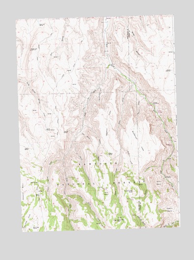
Grand View Peak, ID USGS Topographic Map
Click on map above to begin viewing in our Map Viewer.

This topographic map contains these locations and features:
Feature Name Type Latitude Longitude GNIS ID View Map
330 SpringSpringN42.3132°W114.2623°395803View Map
Big Bluff Picnic Ground (historical)LocaleN42.3110°W114.2600°395829View Map
Birch Glen Picnic GroundLocaleN42.3177°W114.2656°377670View Map
Bluff CreekStreamN42.2982°W114.2945°377962View Map
Buckbrush FlatsFlatN42.3005°W114.2811°378399View Map
Coyote SpringSpringN42.2986°W114.3678°380006View Map
Crockett SpringSpringN42.3079°W114.3402°380068View Map
Deadeye SpringSpringN42.3279°W114.2506°380312View Map
Deer CreekStreamN42.3282°W114.2759°380410View Map
Donahue BasinBasinN42.2741°W114.3700°380712View Map
Doodlelink CreekStreamN42.3346°W114.3111°380722View Map
Fifth Fork Rock CreekStreamN42.3471°W114.3017°381683View Map
Fourth Fork Rock CreekStreamN42.2544°W114.2500°381977View Map
Grand View PeakSummitN42.2552°W114.2997°396576View Map
Harrington ForkStreamN42.3010°W114.2542°395850View Map
Harrington Fork Picnic AreaLocaleN42.2985°W114.2534°395821View Map
Indian SpringSpringN42.2716°W114.3600°383716View Map
Indian Spring CreekStreamN42.2921°W114.3409°383719View Map
Jones Fork CreekStreamN42.2707°W114.3392°384016View Map
Juniper Spring Campground (historical)LocaleN42.2885°W114.2609°395855View Map
Lincoln ReservoirReservoirN42.3423°W114.2531°384683View Map
Little CreekStreamN42.3349°W114.2828°384788View Map
Lucky GulchValleyN42.3121°W114.3234°386269View Map
Magpie BasinBasinN42.2602°W114.2581°386357View Map
Mud SpringSpringN42.2791°W114.3614°387345View Map
North Willow SpringsSpringN42.3096°W114.3535°387859View Map
Pine BasinBasinN42.2710°W114.3073°388471View Map
Pine Basin SpringSpringN42.2745°W114.3061°388472View Map
Pole Camp SpringSpringN42.2524°W114.3661°388669View Map
Sagehen FlatsFlatN42.3144°W114.3048°389812View Map
Sagehen SpringSpringN42.2941°W114.3053°389813View Map
Schipper CampgroundLocaleN42.3227°W114.2681°390014View Map
Secret CreekStreamN42.3038°W114.3306°390088View Map
Steer BasinBasinN42.2763°W114.2653°391422View Map
Steer Basin CampgroundLocaleN42.2796°W114.2603°391423View Map
SugarloafSummitN42.3566°W114.3617°397222View Map
Sugarloaf SpringSpringN42.3713°W114.3561°391590View Map
Three Hundred Thirty Spring Picnic Ground (historical)LocaleN42.3135°W114.2620°395882View Map
Trail GulchValleyN42.3074°W114.3267°392319View Map
Wooden Shoe ButteSummitN42.2721°W114.2861°397317View Map
Wooden Shoe CreekStreamN42.2863°W114.2628°393666View Map
Wooden Shoe SpringSpringN42.2685°W114.2856°393667View Map

Note: Coordinates in the location and feature list above are referenced to NAD83 datum.


Copyright (C) 2008-2024 Ryan Niemi / Sunset Dynamics ... All Rights Reserved