TopoQuest Logo
Do you find TopoQuest useful?
Help keep TopoQuest running and adding new maps/features by donating!
Bitcoin:  19c7KJd3qBynnjoSw5npx9KScwjBe4ifkT
Litecoin:  LXs6TkuXGGXo1vDsWCkWVdjQX94eUKd6ui
Home View Maps Find Maps Find Places Resources & Links


Rand, Colorado Topographic Map

USGS Map Title: Rand, CO
USGS Map MRC: 40106D2
DRG (GeoTIFF) Download: o40106d2.tif


Neighboring USGS Topographic Map Quads:


  MacFarlane Reservoir, CO  
40106E3
 

  Owl Ridge, CO  
40106E2
 

  Gould, CO  
40106E1
 

  Buffalo Peak, CO  
40106D3
 

  Rand, CO  
40106D2
 

  Jack Creek Ranch, CO  
40106D1
 

  Hyannis Peak, CO  
40106C3
 

  Parkview Mountain, CO  
40106C2
 

  Radial Mountain, CO  
40106C1


Map MRC Location:

N41°
W107°
N41°
W106°
H8 H7 H6 H5 H4 H3 H2 H1
G8 G7 G6 G5 G4 G3 G2 G1
F8 F7 F6 F5 F4 F3 F2 F1
E8 E7 E6 E5 E4 E3 E2 E1
D8 D7 D6 D5 D4 D3 D2 D1
C8 C7 C6 C5 C4 C3 C2 C1
B8 B7 B6 B5 B4 B3 B2 B1
A8 A7 A6 A5 A4 A3 A2 A1
N40°
W107°
N40°
W106°

Rand, CO USGS 1:24K Topographic Map Preview:
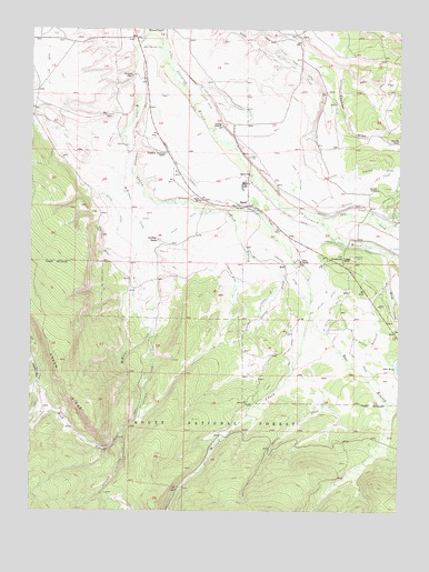
Rand, CO USGS Topographic Map
Click on map above to begin viewing in our Map Viewer.

This topographic map contains these locations and features:
Feature Name Type Latitude Longitude GNIS ID View Map
Arnold DitchCanalN40.4539°W106.1422°202120View Map
Badgero CreekStreamN40.4419°W106.1275°172896View Map
Big Willow DitchCanalN40.4211°W106.1506°172890View Map
Brown RanchLocaleN40.4589°W106.1334°172870View Map
Darcy DitchCanalN40.4083°W106.2481°202113View Map
Donelson DitchCanalN40.4361°W106.1825°172888View Map
Donelson RanchLocaleN40.4453°W106.2075°172868View Map
East Branch Willow CreekStreamN40.4258°W106.1553°172899View Map
Faulkner DrawValleyN40.4904°W106.1475°172903View Map
Fuqua RanchLocaleN40.4750°W106.1867°172873View Map
Green RidgeRidgeN40.4139°W106.2406°202111View Map
Hanover DitchCanalN40.4361°W106.1636°172889View Map
Haystack TrailTrailN40.3833°W106.2231°172878View Map
Hills RanchLocaleN40.4400°W106.1595°172867View Map
Howard PlaceLocaleN40.4878°W106.2170°172874View Map
Howd CreekStreamN40.4341°W106.1295°172901View Map
Ish DitchCanalN40.4180°W106.1617°172892View Map
J W Sutton DitchCanalN40.4166°W106.1361°172894View Map
J W Sutton Ditch Number 2CanalN40.4250°W106.1486°172893View Map
Jack CreekStreamN40.4508°W106.1528°172900View Map
John S Sutton DitchCanalN40.4555°W106.1367°202118View Map
Last Chance DitchCanalN40.4534°W106.1990°2723245View Map
Little Chief DitchCanalN40.4972°W106.1667°202094View Map
Lost DitchCanalN40.4841°W106.2464°202116View Map
Mac Farlane ExtensionCanalN40.4955°W106.2103°172880View Map
McKinnon CreekStreamN40.4639°W106.2184°172897View Map
Monroe DitchCanalN40.4833°W106.1942°172879View Map
Old HomesteadPopulated PlaceN40.4403°W106.1436°172875View Map
Ottawa DitchCanalN40.4969°W106.2056°202095View Map
Owl Ridge HeliportAirportN40.4497°W106.2011°204613View Map
Peabody DitchCanalN40.4522°W106.1728°172883View Map
RandPopulated PlaceN40.4539°W106.1814°172876View Map
Rand CemeteryCemeteryN40.4669°W106.1767°172871View Map
Rand Post OfficePost OfficeN40.4536°W106.1729°2043353View Map
Rand SchoolSchoolN40.4555°W106.1936°172869View Map
Rock CreekStreamN40.4522°W106.1845°172835View Map
Rock Creek TrailTrailN40.3916°W106.2228°172877View Map
Salem DitchCanalN40.4380°W106.2089°172887View Map
Shearer CreekStreamN40.4425°W106.1775°172895View Map
Shearer DitchCanalN40.4250°W106.1736°172891View Map
Slew DitchCanalN40.4897°W106.2067°2724264View Map
Spring CreekStreamN40.4108°W106.1614°172898View Map
Stella DitchCanalN40.4444°W106.1459°172885View Map
Stephens Brothers RanchLocaleN40.4678°W106.2050°172872View Map
Stevenson Ditch Number 2CanalN40.4722°W106.2161°172881View Map
Stevenson Ditch Number 4CanalN40.4555°W106.2123°2724278View Map
Victor DitchCanalN40.4131°W106.1448°2724383View Map
Welch and Peabody DitchCanalN40.4611°W106.1978°172882View Map
Welch DitchCanalN40.4500°W106.1589°172884View Map
Westfield DitchCanalN40.4250°W106.2128°172886View Map
Windy PointSummitN40.4344°W106.1514°171351View Map
Zelma Darcy DitchCanalN40.4119°W106.1594°2724519View Map

Note: Coordinates in the location and feature list above are referenced to NAD83 datum.


Copyright (C) 2008-2025 Ryan Niemi / Sunset Dynamics ... All Rights Reserved