TopoQuest Logo
Do you find TopoQuest useful?
Help keep TopoQuest running and adding new maps/features by donating!
Bitcoin:  19c7KJd3qBynnjoSw5npx9KScwjBe4ifkT
Litecoin:  LXs6TkuXGGXo1vDsWCkWVdjQX94eUKd6ui
Home View Maps Find Maps Find Places Resources & Links


Gould, Colorado Topographic Map

USGS Map Title: Gould, CO
USGS Map MRC: 40106E1
DRG (GeoTIFF) Download: o40106e1.tif


Neighboring USGS Topographic Map Quads:


  Gould NW, CO  
40106F2
 

  Johnny Moore Mountain, CO  
40106F1
 

  Rawah Lakes, CO  
40105F8
 

  Owl Ridge, CO  
40106E2
 

  Gould, CO  
40106E1
 

  Clark Peak, CO  
40105E8
 

  Rand, CO  
40106D2
 

  Jack Creek Ranch, CO  
40106D1
 

  Mount Richthofen, CO  
40105D8


Map MRC Location:

N41°
W107°
N41°
W106°
H8 H7 H6 H5 H4 H3 H2 H1
G8 G7 G6 G5 G4 G3 G2 G1
F8 F7 F6 F5 F4 F3 F2 F1
E8 E7 E6 E5 E4 E3 E2 E1
D8 D7 D6 D5 D4 D3 D2 D1
C8 C7 C6 C5 C4 C3 C2 C1
B8 B7 B6 B5 B4 B3 B2 B1
A8 A7 A6 A5 A4 A3 A2 A1
N40°
W107°
N40°
W106°

Gould, CO USGS 1:24K Topographic Map Preview:
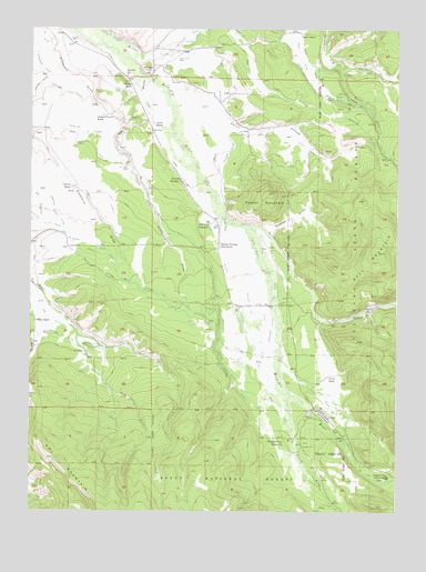
Gould, CO USGS Topographic Map
Click on map above to begin viewing in our Map Viewer.

This topographic map contains these locations and features:
Feature Name Type Latitude Longitude GNIS ID View Map
Aspen CampgroundLocaleN40.5172°W106.0325°172698View Map
Bradfield DitchCanalN40.6028°W106.0506°202070View Map
Bull MountainSummitN40.5672°W106.0064°202102View Map
Cameron Pass 4-H Club CampLocaleN40.5091°W106.0036°172697View Map
Custer DrawValleyN40.5728°W106.0455°172715View Map
Custer MountainSummitN40.5825°W106.0445°172716View Map
Domestic Supply DitchCanalN40.5769°W106.1178°172714View Map
Dry Fork Owl CreekStreamN40.5455°W106.1092°172686View Map
Endomile DitchCanalN40.5428°W106.0631°172708View Map
Fox DitchCanalN40.6166°W106.0367°202071View Map
Georgia DitchCanalN40.5789°W106.1034°172722View Map
Gibbs DitchCanalN40.5844°W106.0728°172700View Map
GouldPopulated PlaceN40.5264°W106.0267°172696View Map
Gould DitchCanalN40.5261°W106.0200°172694View Map
Gould RanchLocaleN40.5350°W106.0247°172695View Map
Haworth SchoolSchoolN40.6128°W106.0934°172726View Map
Hoover RoundupLocaleN40.5855°W106.0750°172719View Map
Johnson RanchLocaleN40.6103°W106.0909°172725View Map
Kermode DitchCanalN40.6214°W106.0245°202072View Map
Last Treasure and Georgia DitchCanalN40.5428°W106.0628°172710View Map
Lobau RanchLocaleN40.6000°W106.0834°172724View Map
Longhorn DitchCanalN40.5480°W106.0425°172704View Map
Lost Treasure DitchCanalN40.5614°W106.1006°172713View Map
Lynch DitchCanalN40.5569°W106.0411°172705View Map
Mason DitchCanalN40.5653°W106.0978°172712View Map
Michigan HillSummitN40.6144°W106.0870°172727View Map
Michigan River Ranger StationLocaleN40.5183°W106.0389°172699View Map
Mill CreekStreamN40.5153°W106.0350°172689View Map
No Name CreekStreamN40.5130°W106.0350°172688View Map
North Fork Canadian RiverStreamN40.6155°W106.0206°172693View Map
North Michigan Creek DamDamN40.5530°W106.0111°199988View Map
North Michigan Creek ReservoirReservoirN40.5530°W106.0111°169399View Map
Orb DitchCanalN40.5444°W106.1145°172709View Map
Overland DitchCanalN40.5666°W106.0672°202065View Map
Overton RanchLocaleN40.5844°W106.1122°172720View Map
Owl DitchCanalN40.5528°W106.1228°202098View Map
Owl Mountain and Domestic Supply and Mason DitchCanalN40.5466°W106.0617°172711View Map
Peterson CreekStreamN40.6130°W106.0881°172721View Map
Poverty Flat Ditch Number 1CanalN40.5536°W106.0509°172703View Map
Poverty Flat Ditch Number 2CanalN40.5455°W106.0517°172702View Map
Ravine DitchCanalN40.6105°W106.1220°202066View Map
Riley Extension DitchCanalN40.5391°W106.0547°172701View Map
Riley RanchLocaleN40.5491°W106.1231°172707View Map
Sales CreekStreamN40.6078°W106.0784°172685View Map
Sales Ditch Number 2CanalN40.5936°W106.0311°172683View Map
Smith RanchLocaleN40.6241°W106.0345°172682View Map
South Fork Canadian RiverStreamN40.6155°W106.0206°172692View Map
South Fork Michigan RiverStreamN40.5300°W106.0367°172690View Map
Squibob DitchCanalN40.5883°W106.0620°172684View Map
Stelbars Connor RanchLocaleN40.6022°W106.1014°172723View Map
Stelbars LindlandPopulated PlaceN40.5744°W106.0647°172718View Map
Stelbars Michigan River RanchLocaleN40.5691°W106.0611°172717View Map
Stemmer DitchCanalN40.6125°W106.0645°172728View Map
Wagon Wheel DitchCanalN40.5683°W106.0492°172706View Map

Note: Coordinates in the location and feature list above are referenced to NAD83 datum.


Copyright (C) 2008-2024 Ryan Niemi / Sunset Dynamics ... All Rights Reserved