TopoQuest Logo
Do you find TopoQuest useful?
Help keep TopoQuest running and adding new maps/features by donating!
Bitcoin:  19c7KJd3qBynnjoSw5npx9KScwjBe4ifkT
Litecoin:  LXs6TkuXGGXo1vDsWCkWVdjQX94eUKd6ui
Home View Maps Find Maps Find Places Resources & Links


Randville, Michigan Topographic Map

USGS Map Title: Randville, MI
USGS Map MRC: 45088H1
DRG (GeoTIFF) Download: o45088h1.tif


Neighboring USGS Topographic Map Quads:


  Lake Mary, MI  
46088A2
 

  Sagola, MI  
46088A1
 

  Ralph SW, MI  
46087A8
 

  Florence East, WI  
45088H2
 

  Randville, MI  
45088H1
 

  Carney Lake, MI  
45087H8
 

  Iron Mountain SW, WI  
45088G2
 

  Iron Mountain, MI  
45088G1
 

  Norway, MI  
45087G8


Map MRC Location:

N46°
W89°
N46°
W88°
H8 H7 H6 H5 H4 H3 H2 H1
G8 G7 G6 G5 G4 G3 G2 G1
F8 F7 F6 F5 F4 F3 F2 F1
E8 E7 E6 E5 E4 E3 E2 E1
D8 D7 D6 D5 D4 D3 D2 D1
C8 C7 C6 C5 C4 C3 C2 C1
B8 B7 B6 B5 B4 B3 B2 B1
A8 A7 A6 A5 A4 A3 A2 A1
N45°
W89°
N45°
W88°

Randville, MI USGS 1:24K Topographic Map Preview:
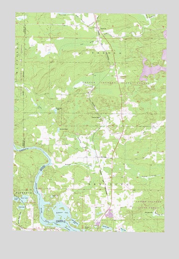
Randville, MI USGS Topographic Map
Click on map above to begin viewing in our Map Viewer.

This topographic map contains these locations and features:
Feature Name Type Latitude Longitude GNIS ID View Map
Badwater CreekStreamN45.9136°W88.0921°620431View Map
Badwater LakeLakeN45.8852°W88.0818°620432View Map
Bradford LakeLakeN45.9329°W88.0884°621844View Map
Breitung Township Fire Department Station 3BuildingN45.8761°W88.0556°2627092View Map
Browning CreekStreamN45.9236°W88.0618°622102View Map
Browning LakeLakeN45.9436°W88.0910°622104View Map
Deer LakeLakeN45.8761°W88.0343°624491View Map
Dyer LakeLakeN45.8947°W88.0931°625060View Map
East LakeLakeN45.8930°W88.1157°1564346View Map
Gestner BranchStreamN45.9991°W88.0779°626766View Map
Granite BluffPopulated PlaceN45.9394°W88.0537°1617594View Map
Granite Bluff Post Office (historical)Post OfficeN45.9394°W88.0536°2128847View Map
Granite Bluff StationLocaleN45.9389°W88.0500°2128846View Map
Harding LakeLakeN45.8863°W88.0093°627770View Map
Lilienthal AirportAirportN45.9343°W88.0991°1623979View Map
Little Badwater LakeLakeN45.8801°W88.0742°630543View Map
MerrimanPopulated PlaceN45.9175°W88.0557°1617717View Map
Merriman StationLocaleN45.9175°W88.0558°2128586View Map
RandvillePopulated PlaceN45.9916°W88.0571°1617810View Map
Randville Bible ChurchChurchN45.9894°W88.0536°2128579View Map
Randville Post Office (historical)Post OfficeN45.9917°W88.0569°2128837View Map
Randville StationLocaleN45.9917°W88.0581°2128836View Map
Sonnies PondLakeN45.8753°W88.0668°638247View Map
South LakeLakeN45.8883°W88.1176°1574463View Map
Spring LakeLakeN45.8774°W88.0477°638591View Map
Summer Breeze CampgroundsLocaleN45.8814°W88.0583°2127778View Map
Tom Kings CreekStreamN45.9969°W88.0149°1614935View Map
Vagabond CabinsLocaleN45.8758°W88.0887°1845399View Map

Note: Coordinates in the location and feature list above are referenced to NAD83 datum.


Copyright (C) 2008-2025 Ryan Niemi / Sunset Dynamics ... All Rights Reserved