TopoQuest Logo
Do you find TopoQuest useful?
Help keep TopoQuest running and adding new maps/features by donating!
Bitcoin:  19c7KJd3qBynnjoSw5npx9KScwjBe4ifkT
Litecoin:  LXs6TkuXGGXo1vDsWCkWVdjQX94eUKd6ui
Home View Maps Find Maps Find Places Resources & Links


Florence East, Wisconsin Topographic Map

USGS Map Title: Florence East, WI
USGS Map MRC: 45088H2
DRG (GeoTIFF) Download: o45088h2.tif


Neighboring USGS Topographic Map Quads:


  Crystal Falls, MI  
46088A3
 

  Lake Mary, MI  
46088A2
 

  Sagola, MI  
46088A1
 

  Florence West, WI  
45088H3
 

  Florence East, WI  
45088H2
 

  Randville, MI  
45088H1
 

  Florence SE, WI  
45088G3
 

  Iron Mountain SW, WI  
45088G2
 

  Iron Mountain, MI  
45088G1


Map MRC Location:

N46°
W89°
N46°
W88°
H8 H7 H6 H5 H4 H3 H2 H1
G8 G7 G6 G5 G4 G3 G2 G1
F8 F7 F6 F5 F4 F3 F2 F1
E8 E7 E6 E5 E4 E3 E2 E1
D8 D7 D6 D5 D4 D3 D2 D1
C8 C7 C6 C5 C4 C3 C2 C1
B8 B7 B6 B5 B4 B3 B2 B1
A8 A7 A6 A5 A4 A3 A2 A1
N45°
W89°
N45°
W88°

Florence East, WI USGS 1:24K Topographic Map Preview:
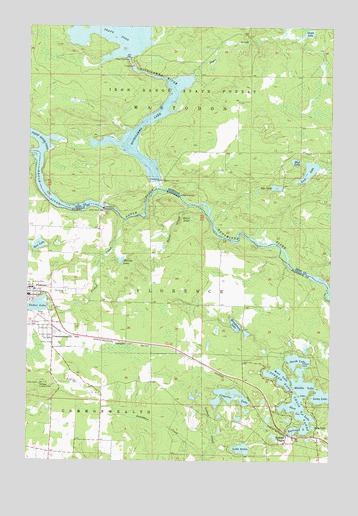
Florence East, WI USGS Topographic Map
Click on map above to begin viewing in our Map Viewer.

This topographic map contains these locations and features:
Feature Name Type Latitude Longitude GNIS ID View Map
Alpha - Mastodon Township Volunteer Fire Department Station 2BuildingN45.9711°W88.1636°2626923View Map
Baird CreekStreamN45.9486°W88.1843°1561095View Map
Baird LakeLakeN45.9446°W88.1825°1561097View Map
Bass IslandIslandN45.8894°W88.1376°1561226View Map
Bass LakeLakeN45.8883°W88.1365°1561265View Map
Bethlehem Lutheran ChurchChurchN45.9244°W88.2474°1845368View Map
Brule Island DamDamN45.9477°W88.2196°1562291View Map
Brule Island DamDamN45.9477°W88.2193°622131View Map
Brule Island Power PlantBuildingN45.9475°W88.2190°1845371View Map
Brule RiverStreamN45.9533°W88.1962°1619340View Map
Brule RiverStreamN45.9533°W88.1962°1578866View Map
Brule River FlowageReservoirN45.9473°W88.2193°2784007View Map
Buckeye Lookout TowerTowerN45.8969°W88.2454°1581185View Map
CommonwealthPopulated PlaceN45.9136°W88.2401°1563294View Map
Cosgrove LakeLakeN45.8939°W88.1653°1572032View Map
Deadman CreekStreamN45.8761°W88.1776°1563778View Map
Eagle IslandIslandN45.8938°W88.1379°1564241View Map
First CreekStreamN45.9291°W88.1332°626006View Map
First Presbyterian ChurchChurchN45.9213°W88.2479°1845378View Map
Fisher CreekStreamN45.9441°W88.2107°1565012View Map
Fisher LakeLakeN45.9195°W88.2458°1565015View Map
Florence County CourthouseBuildingN45.9211°W88.2490°1845380View Map
Florence County Sheriff's OfficeBuildingN45.9212°W88.2487°2759476View Map
Florence Elementary SchoolSchoolN45.9246°W88.2493°1845381View Map
Florence High SchoolSchoolN45.9248°W88.2485°1845382View Map
Florence Middle SchoolSchoolN45.9248°W88.2486°2713356View Map
Gages CreekStreamN45.9866°W88.1815°626590View Map
Gages LakeLakeN45.9987°W88.1352°626591View Map
HematitePopulated PlaceN45.9091°W88.2096°1577636View Map
Jule LakeLakeN45.9538°W88.1477°629418View Map
Lake AnnaLakeN45.8786°W88.1611°1560879View Map
Lilly LakeLakeN45.8850°W88.1318°1568040View Map
Long LakeLakeN45.8938°W88.1279°1568576View Map
Lost LakeLakeN45.9585°W88.1345°631101View Map
Marlow LakeLakeN45.9326°W88.2117°1569060View Map
Michigamme Falls DamDamN45.9555°W88.1957°632195View Map
Michigamme LakeReservoirN45.9558°W88.1957°632196View Map
Michigamme RiverStreamN45.9533°W88.1954°632200View Map
Middle LakeLakeN45.8966°W88.1351°1569426View Map
Montgomery LakeLakeN45.9141°W88.1641°1569680View Map
Mud LakeLakeN45.9613°W88.1400°633029View Map
Mud LakeLakeN45.9369°W88.2458°1569972View Map
North LakeLakeN45.9044°W88.1382°1570453View Map
Paint RiverStreamN45.9638°W88.2451°634300View Map
Peavy Falls DamDamN45.9908°W88.2085°634541View Map
Pershing School (historical)SchoolN45.8772°W88.2401°1845388View Map
Railroad LakeLakeN45.8844°W88.1379°1845392View Map
Robbins IslandIslandN45.9027°W88.1385°1572400View Map
Saint Johns Lutheran ChurchChurchN45.9244°W88.2499°1845394View Map
Saint Marys Catholic ChurchChurchN45.9241°W88.2471°1845395View Map
Saint Marys CemeteryCemeteryN45.9144°W88.2496°1573311View Map
Spread EaglePopulated PlaceN45.8819°W88.1399°1574582View Map
Spread Eagle Chain of LakesLakeN45.8938°W88.1323°1574583View Map
West LakeLakeN45.8993°W88.1459°1576526View Map
Woodlawn CemeteryCemeteryN45.9236°W88.2346°1577007View Map

Note: Coordinates in the location and feature list above are referenced to NAD83 datum.


Copyright (C) 2008-2024 Ryan Niemi / Sunset Dynamics ... All Rights Reserved