TopoQuest Logo
Do you find TopoQuest useful?
Help keep TopoQuest running and adding new maps/features by donating!
Bitcoin:  19c7KJd3qBynnjoSw5npx9KScwjBe4ifkT
Litecoin:  LXs6TkuXGGXo1vDsWCkWVdjQX94eUKd6ui
Home View Maps Find Maps Find Places Resources & Links


Rattlesnake Butte, Montana Topographic Map

USGS Map Title: Rattlesnake Butte, MT
USGS Map MRC: 45108H4
DRG (GeoTIFF) Download: o45108h4.tif


Neighboring USGS Topographic Map Quads:


  North Fork Crooked Creek West, MT  
46108A5
 

  North Fork Crooked Creek East, MT  
46108A4
 

  Cotton Creek, MT  
46108A3
 

  Hickson Ranch, MT  
45108H5
 

  Rattlesnake Butte, MT  
45108H4
 

  Huntley, MT  
45108H3
 

  Billings West, MT  
45108G5
 

  Billings East, MT  
45108G4
 

  Cottonwood Creek, MT  
45108G3


Map MRC Location:

N46°
W109°
N46°
W108°
H8 H7 H6 H5 H4 H3 H2 H1
G8 G7 G6 G5 G4 G3 G2 G1
F8 F7 F6 F5 F4 F3 F2 F1
E8 E7 E6 E5 E4 E3 E2 E1
D8 D7 D6 D5 D4 D3 D2 D1
C8 C7 C6 C5 C4 C3 C2 C1
B8 B7 B6 B5 B4 B3 B2 B1
A8 A7 A6 A5 A4 A3 A2 A1
N45°
W109°
N45°
W108°

Rattlesnake Butte, MT USGS 1:24K Topographic Map Preview:
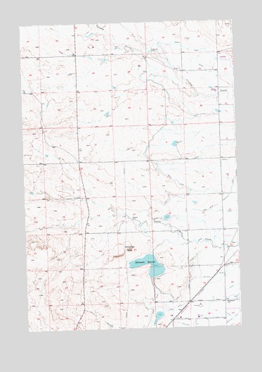
Rattlesnake Butte, MT USGS Topographic Map
Click on map above to begin viewing in our Map Viewer.

This topographic map contains these locations and features:
Feature Name Type Latitude Longitude GNIS ID View Map
02N26E22DDCB01 WellWellN45.8844°W108.4724°813066View Map
02N26E23C___01 WellWellN45.9036°W108.4618°813230View Map
02N26E26BCBC01 WellWellN45.8861°W108.4668°813087View Map
02N27E16CBBC01 WellWellN45.9205°W108.3837°813363View Map
02N27E20ABBC01 WellWellN45.9136°W108.3943°813333View Map
02N27E28BBBA01 WellWellN45.9000°W108.3824°813205View Map
02N27E30BCCB01 WellWellN45.8944°W108.4249°813168View Map
02N27E30DAAB01 WellWellN45.8927°W108.4068°813147View Map
02N27E31ABBC01 WellWellN45.8844°W108.4140°813065View Map
02N27E32AABB01 WellWellN45.8852°W108.3890°813077View Map
03N27E32ADAA01 WellWellN45.9683°W108.3849°813625View Map
Charter Number 1 DamDamN45.9800°W108.4724°797217View Map
ClinePopulated PlaceN45.8822°W108.4090°769938View Map
Crooked Creek SiphonCanalN45.9886°W108.4226°770323View Map
Progressive SchoolSchoolN45.8852°W108.3829°775466View Map
Rattlesnake ButteSummitN45.9077°W108.4382°775570View Map
Rattlesnake ReservoirReservoirN45.9032°W108.4297°775593View Map
Rattlesnake Reservoir DamDamN45.9000°W108.4224°797522View Map
Retriever Number 1 DamDamN45.8800°W108.4224°797521View Map
Twelvemile SiphonCanalN45.9197°W108.4365°777828View Map

Note: Coordinates in the location and feature list above are referenced to NAD83 datum.


Copyright (C) 2008-2024 Ryan Niemi / Sunset Dynamics ... All Rights Reserved