TopoQuest Logo
Do you find TopoQuest useful?
Help keep TopoQuest running and adding new maps/features by donating!
Bitcoin:  19c7KJd3qBynnjoSw5npx9KScwjBe4ifkT
Litecoin:  LXs6TkuXGGXo1vDsWCkWVdjQX94eUKd6ui
Home View Maps Find Maps Find Places Resources & Links


Billings East, Montana Topographic Map

USGS Map Title: Billings East, MT
USGS Map MRC: 45108G4
DRG (GeoTIFF) Download: o45108g4.tif


Neighboring USGS Topographic Map Quads:


  Hickson Ranch, MT  
45108H5
 

  Rattlesnake Butte, MT  
45108H4
 

  Huntley, MT  
45108H3
 

  Billings West, MT  
45108G5
 

  Billings East, MT  
45108G4
 

  Cottonwood Creek, MT  
45108G3
 

  Yegen, MT  
45108F5
 

  Soda Springs NW, MT  
45108F4
 

  Badbaby Coulee, MT  
45108F3


Map MRC Location:

N46°
W109°
N46°
W108°
H8 H7 H6 H5 H4 H3 H2 H1
G8 G7 G6 G5 G4 G3 G2 G1
F8 F7 F6 F5 F4 F3 F2 F1
E8 E7 E6 E5 E4 E3 E2 E1
D8 D7 D6 D5 D4 D3 D2 D1
C8 C7 C6 C5 C4 C3 C2 C1
B8 B7 B6 B5 B4 B3 B2 B1
A8 A7 A6 A5 A4 A3 A2 A1
N45°
W109°
N45°
W108°

Billings East, MT USGS 1:24K Topographic Map Preview:
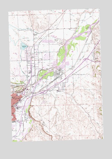
Billings East, MT USGS Topographic Map
Click on map above to begin viewing in our Map Viewer.

This topographic map contains these locations and features:
Feature Name Type Latitude Longitude GNIS ID View Map
01N26E01ABCC01 WellWellN45.8625°W108.4393°812855View Map
01N26E01BCCC01 WellWellN45.8644°W108.4451°812872View Map
01N26E02DCBD01 WellWellN45.8588°W108.4537°812805View Map
01N26E10ABBA01 WellWellN45.8561°W108.4679°812785View Map
01N26E12BCBB01 WellWellN45.8525°W108.4440°812762View Map
01N26E13BABB01 WellWellN45.8416°W108.4390°812657View Map
01N26E15A___01 WellWellN45.8375°W108.4924°812616View Map
01N26E22DCBD01 WellWellN45.8152°W108.4746°812359View Map
01N26E23ACDB01 WellWellN45.8216°W108.4521°812446View Map
01N26E23ADCD01 WellWellN45.8202°W108.4482°812430View Map
01N26E23B___01 WellWellN45.8230°W108.4821°812468View Map
01N26E23BAAB01 WellWellN45.8272°W108.4579°812521View Map
01N26E25CA__01 WellWellN45.8030°W108.4590°812189View Map
01N26E36B___01 WellWellN45.7941°W108.4615°812100View Map
01N27E05AADC01 WellWellN45.8677°W108.3860°812902View Map
01N27E06CDDD01 WellWellN45.8569°W108.4151°812789View Map
01N27E17CABA01 WellWellN45.8338°W108.3965°812582View Map
01N27E18ADDB01 WellWellN45.8355°W108.4051°812598View Map
01N27E19DBCB01 WellWellN45.8177°W108.4129°812398View Map
01N27E20CAAD01 WellWellN45.8175°W108.3932°812392View Map
01N27E31AACD01 WellWellN45.7950°W108.4082°812106View Map
01N27E32BCCC01 WellWellN45.7913°W108.3874°812071View Map
01N27E33BACB01 WellWellN45.7952°W108.3774°812109View Map
01S26E02BADC01 WellWellN45.7811°W108.4851°811960View Map
01S26E02BC__01 WellWellN45.7769°W108.4904°811920View Map
01S27E04ACCC01 WellWellN45.7761°W108.3968°811914View Map
02N27E31CDAC01 WellWellN45.8733°W108.4162°812960View Map
Alkali CreekStreamN45.8044°W108.4671°768181View Map
Alkali SiphonCanalN45.8052°W108.4901°768197View Map
American Medical Response Station 1 HeadquartersBuildingN45.7971°W108.4833°2637843View Map
American Medical Response Station Central StationBuildingN45.7876°W108.4924°2637845View Map
Billings BenchBenchN45.8336°W108.4560°768853View Map
Billings Bench SchoolSchoolN45.8155°W108.4737°768854View Map
Billings Bench Water Association CanalCanalN45.8555°W108.4657°768855View Map
Billings Fire Department Station 2BuildingN45.7761°W108.4994°2546568View Map
Billings Fire Department Station 6BuildingN45.8279°W108.4863°2546565View Map
Billings HeightsPopulated PlaceN45.8333°W108.4590°768010View Map
Billings Post OfficePost OfficeN45.7746°W108.4932°2738308View Map
Bitter CreekStreamN45.7661°W108.4704°768907View Map
Boothill CemeteryCemeteryN45.8024°W108.4807°769105View Map
Cherry IslandIslandN45.8166°W108.4482°769794View Map
Clarks CrossingCrossingN45.7503°W108.4983°2761959View Map
Conoco Phillips Emergency Response TeamBuildingN45.7798°W108.4939°2546564View Map
Coulson DitchCanalN45.8186°W108.4201°770203View Map
Dovers IslandIslandN45.8566°W108.3921°770734View Map
Dry CreekStreamN45.8175°W108.4290°770787View Map
East Bridge Fishing Access SiteLocaleN45.7972°W108.4674°1744476View Map
Elmo Lake DamDamN45.8133°W108.4890°796188View Map
ExxonMobil Emergency Response TeamBuildingN45.8127°W108.4332°2546563View Map
Five Mile CreekStreamN45.8436°W108.4224°771411View Map
Halverson Number 1 DamDamN45.7883°W108.3757°797211View Map
Hawthorn ChurchChurchN45.8305°W108.4699°772221View Map
Hawthorn SchoolSchoolN45.8283°W108.4551°772222View Map
HirschPopulated PlaceN45.8177°W108.4137°802118View Map
Independent Elementary SchoolSchoolN45.8516°W108.4657°772673View Map
Josephine ParkParkN45.7711°W108.4774°772913View Map
KCTR-FM (Billings)TowerN45.7663°W108.4560°806653View Map
KIDX-FM (Billings)TowerN45.7641°W108.4557°806652View Map
KOHZ-FM (Billings)TowerN45.7666°W108.4582°806649View Map
KPQD-TV (Billings)TowerN45.7677°W108.4582°806723View Map
KTVQ-TV (Billings)TowerN45.7666°W108.4582°806722View Map
KULR-TV (Billings)TowerN45.7597°W108.4546°806721View Map
KURL-AM (Billings)TowerN45.7580°W108.4987°806575View Map
KVME-TV (Billings)TowerN45.7666°W108.4582°806720View Map
KYYA-FM (Billings)TowerN45.7602°W108.4532°806654View Map
KZLS-FM (Billings)TowerN45.7641°W108.4557°806650View Map
Lake ElmoLakeN45.8410°W108.4802°771210View Map
LockwoodPopulated PlaceN45.8191°W108.4149°1867340View Map
Lockwood AmbulanceBuildingN45.8180°W108.4004°2738271View Map
Lockwood Census Designated PlaceCensusN45.8199°W108.4072°2408626View Map
Lockwood DitchCanalN45.8047°W108.4235°773528View Map
Lockwood Rural Fire District 8BuildingN45.8180°W108.4004°2546663View Map
Lockwood SchoolsSchoolN45.7975°W108.4357°773529View Map
Lockwood Sheriff's OfficeBuildingN45.8180°W108.4003°2548980View Map
MetraParkLocaleN45.7972°W108.4807°778736View Map
Miller and McGirl DitchCanalN45.8722°W108.3837°774231View Map
Montana Highway Patrol District IV OfficeBuildingN45.7756°W108.4970°2548931View Map
Montana Narcotics Bureau Division of Criminal InvestigationBuildingN45.7755°W108.4969°2548923View Map
Montana Women's PrisonBuildingN45.7751°W108.4954°2735594View Map
North Park SchoolSchoolN45.7922°W108.4990°774843View Map
Pine Hill SchoolSchoolN45.8269°W108.3824°775245View Map
Pioneer SchoolSchoolN45.8563°W108.4151°775265View Map
Place Where the White Horse Went Down Historical MarkerParkN45.7986°W108.4757°1813134View Map
Riverside CemeteryCemeteryN45.8220°W108.4458°775790View Map
Ronald Reagan Post OfficePost OfficeN45.8269°W108.4679°2738312View Map
Sacrifice CliffCliffN45.7755°W108.4740°776063View Map
Sevenmile CreekStreamN45.8711°W108.3929°776362View Map
Skeleton CliffCliffN45.7994°W108.4843°776606View Map
South ParkParkN45.7736°W108.4996°776902View Map
Taft SchoolSchoolN45.7772°W108.4965°777403View Map
Yegen DrainCanalN45.7744°W108.4904°778729View Map

Note: Coordinates in the location and feature list above are referenced to NAD83 datum.


Copyright (C) 2008-2024 Ryan Niemi / Sunset Dynamics ... All Rights Reserved