TopoQuest Logo
Do you find TopoQuest useful?
Help keep TopoQuest running and adding new maps/features by donating!
Bitcoin:  19c7KJd3qBynnjoSw5npx9KScwjBe4ifkT
Litecoin:  LXs6TkuXGGXo1vDsWCkWVdjQX94eUKd6ui
Home View Maps Find Maps Find Places Resources & Links


Raynesford, Montana Topographic Map

USGS Map Title: Raynesford, MT
USGS Map MRC: 47110C6
DRG (GeoTIFF) Download: o47110c6.tif


Neighboring USGS Topographic Map Quads:


  Belt NE, MT  
47110D7
 

  Highwood Baldy, MT  
47110D6
 

  Arrow Peak, MT  
47110D5
 

  Blythe, MT  
47110C7
 

  Raynesford, MT  
47110C6
 

  Byrne Creek, MT  
47110C5
 

  Monarch NE, MT  
47110B7
 

  Limestone Butte, MT  
47110B6
 

  The Arch, MT  
47110B5


Map MRC Location:

N48°
W111°
N48°
W110°
H8 H7 H6 H5 H4 H3 H2 H1
G8 G7 G6 G5 G4 G3 G2 G1
F8 F7 F6 F5 F4 F3 F2 F1
E8 E7 E6 E5 E4 E3 E2 E1
D8 D7 D6 D5 D4 D3 D2 D1
C8 C7 C6 C5 C4 C3 C2 C1
B8 B7 B6 B5 B4 B3 B2 B1
A8 A7 A6 A5 A4 A3 A2 A1
N47°
W111°
N47°
W110°

Raynesford, MT USGS 1:24K Topographic Map Preview:
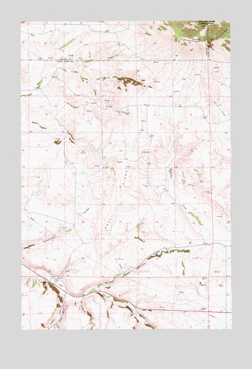
Raynesford, MT USGS Topographic Map
Click on map above to begin viewing in our Map Viewer.

This topographic map contains these locations and features:
Feature Name Type Latitude Longitude GNIS ID View Map
17N08E03A___01 WellWellN47.2677°W110.6883°821826View Map
18N08E10C___01 WellWellN47.3333°W110.6980°822276View Map
18N08E12BBCC01 WellWellN47.3411°W110.6588°822313View Map
18N08E13A___01 WellWellN47.3258°W110.6438°822224View Map
18N08E20____01 WellWellN47.3077°W110.7361°822100View Map
18N08E24A___01 WellWellN47.3114°W110.6438°822124View Map
18N08E28____01 WellWellN47.2930°W110.7144°821999View Map
18N08E29____01 WellWellN47.2930°W110.7361°822000View Map
Cache CouleeValleyN47.2525°W110.7305°780758View Map
Dry CouleeValleyN47.2733°W110.6899°782556View Map
Judith Basin Rural Fire District RaynesfordBuildingN47.2699°W110.7307°1750685View Map
Kibbey CanyonValleyN47.2636°W110.7249°785712View Map
Little Otter CreekStreamN47.2636°W110.7249°786336View Map
Mann (historical)Populated PlaceN47.2636°W110.7252°1750737View Map
Mann Post Office (historical)Post OfficeN47.2636°W110.7252°1750606View Map
Otter Post Office (historical)Post OfficeN47.2636°W110.7252°1750602View Map
RaynesfordLocaleN47.2700°W110.7299°1750734View Map
RaynesfordPopulated PlaceN47.2700°W110.7299°789423View Map
Raynesford Elementary SchoolSchoolN47.2700°W110.7286°1750684View Map
Raynesford Post OfficePost OfficeN47.2697°W110.7304°1750601View Map
Ridley CouleeValleyN47.2625°W110.7152°789586View Map
Rocky RidgeRidgeN47.3044°W110.6916°789738View Map
South PeakSummitN47.3725°W110.6397°791108View Map
Williams CreekStreamN47.2658°W110.7066°793318View Map

Note: Coordinates in the location and feature list above are referenced to NAD83 datum.


Copyright (C) 2008-2025 Ryan Niemi / Sunset Dynamics ... All Rights Reserved