TopoQuest Logo
Do you find TopoQuest useful?
Help keep TopoQuest running and adding new maps/features by donating!
Bitcoin:  19c7KJd3qBynnjoSw5npx9KScwjBe4ifkT
Litecoin:  LXs6TkuXGGXo1vDsWCkWVdjQX94eUKd6ui
Home View Maps Find Maps Find Places Resources & Links


Blythe, Montana Topographic Map

USGS Map Title: Blythe, MT
USGS Map MRC: 47110C7
DRG (GeoTIFF) Download: o47110c7.tif


Neighboring USGS Topographic Map Quads:


  Belt, MT  
47110D8
 

  Belt NE, MT  
47110D7
 

  Highwood Baldy, MT  
47110D6
 

  Armington, MT  
47110C8
 

  Blythe, MT  
47110C7
 

  Raynesford, MT  
47110C6
 

  Riceville, MT  
47110B8
 

  Monarch NE, MT  
47110B7
 

  Limestone Butte, MT  
47110B6


Map MRC Location:

N48°
W111°
N48°
W110°
H8 H7 H6 H5 H4 H3 H2 H1
G8 G7 G6 G5 G4 G3 G2 G1
F8 F7 F6 F5 F4 F3 F2 F1
E8 E7 E6 E5 E4 E3 E2 E1
D8 D7 D6 D5 D4 D3 D2 D1
C8 C7 C6 C5 C4 C3 C2 C1
B8 B7 B6 B5 B4 B3 B2 B1
A8 A7 A6 A5 A4 A3 A2 A1
N47°
W111°
N47°
W110°

Blythe, MT USGS 1:24K Topographic Map Preview:
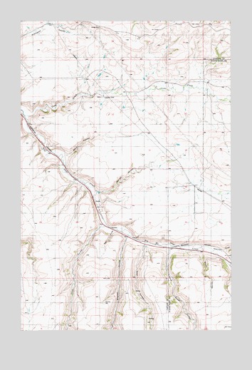
Blythe, MT USGS Topographic Map
Click on map above to begin viewing in our Map Viewer.

This topographic map contains these locations and features:
Feature Name Type Latitude Longitude GNIS ID View Map
18N07E05____01 WellWellN47.3519°W110.8636°822385View Map
18N07E05A___01 WellWellN47.3555°W110.8583°822419View Map
18N07E11____01 WellWellN47.3372°W110.7997°822292View Map
18N07E11____02 WellWellN47.3372°W110.7997°822293View Map
Baker CouleeValleyN47.3202°W110.8494°768456View Map
Blyth School (historical)SchoolN47.3014°W110.8286°1761840View Map
BlythePopulated PlaceN47.3014°W110.8286°802047View Map
Brigman CouleeValleyN47.2866°W110.8127°780413View Map
Brigman Coulee School (historical)SchoolN47.2897°W110.8227°800499View Map
Brush CouleeValleyN47.2816°W110.7677°805820View Map
Burlingame School (historical)SchoolN47.3744°W110.7502°1761894View Map
Cora (historical)LocaleN47.3450°W110.8091°1762395View Map
Cora CreekStreamN47.3366°W110.8744°781664View Map
Cora Post Office (historical)Post OfficeN47.3450°W110.8091°1762439View Map
Dawson Ranch Number 1 DamDamN47.3533°W110.8324°798360View Map
Ford CouleeValleyN47.2916°W110.8283°783591View Map
Government CouleeValleyN47.2816°W110.7552°784137View Map
Marion CouleeValleyN47.3061°W110.8305°773883View Map
Never Sweat CouleeValleyN47.2844°W110.7841°800331View Map
Swan CouleeValleyN47.2844°W110.8030°791781View Map

Note: Coordinates in the location and feature list above are referenced to NAD83 datum.


Copyright (C) 2008-2025 Ryan Niemi / Sunset Dynamics ... All Rights Reserved